
Escambia County Property Records Lookup
Find property appraiser records across Escambia County with an owner name, parcel number, street address, city, or
ZIP code. Refine your search with the available filters to locate the record you want.
Total Parcels
163,843
Data Source
Property Appraiser
Last update
2026 November
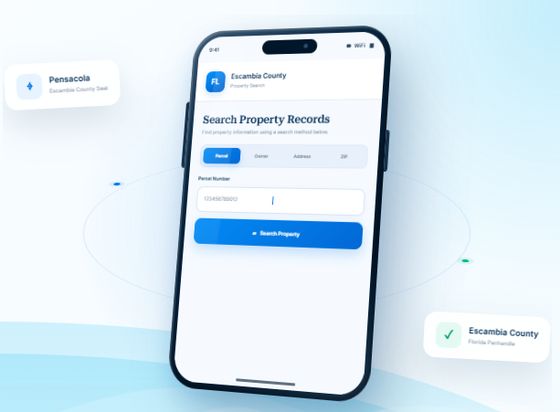
Explore Helpful Property Tools in Escambia County
Escambia County includes Pensacola, coastal communities, established neighborhoods, and inland areas near the Alabama border. FL Parcel Point provides practical resources for understanding property taxes, estimating
transfer-related costs, exploring parcel maps, and learning about real estate record
Property Taxes
Learn about property tax assessments, find payment guidance, and review key timing information that may help local property owners.
Doc Stamp Tax
Estimate documentary stamp taxes related to a Florida property transfer and understand how transaction details can affect costs.
Property Guide
Read practical guides to property records, real estate terminology, and common questions about property ownership and transactions.
Escambia County Property Search Tool Features
Whether your search begins with a property address or a parcel identifier, the record can provide several layers of information. FL Parcel Point brings together 120+ property data fields for Escambia County and sorts them into practical categories. Review ownership, land and building details, assessment figures, and sales information where those entries are available.
- Explore publicly available property appraiser and parcel information.
- Use the property search tool free of charge.
- Search without signing up or creating an account.
Ownership Records
Explore the ownership section for names and associated address details recorded for the parcel. It offers a useful starting point when you need to confirm how a property is listed in public records.
Parcel Details
Use parcel identifiers, recorded acreage, lot size, and other land measurements to distinguish the selected property. These details describe the parcel itself rather than the buildings that may sit on it.
Property Address
Find the recorded location for the property, then check whether a separate mailing address is also listed. Address information can be useful when matching a search result to a particular parcel.
Legal Records
Use the legal record details to understand how the parcel is described in official property information. The section may show subdivision information, lot numbers, and other recorded identifiers.
Building Characteristics
Review the characteristics recorded for structures on the parcel. Depending on the available record, these may include construction type, year built, living area, bedroom and bathroom counts, and related building details.
Assessment
Review the property's available assessment values and note how just value, assessed value, and taxable value are presented. These figures help explain the valuation information recorded for the parcel.
Property Codes
Explore the designations attached to the parcel, including available property-use codes and land classifications. They help explain the category under which the property is recorded.
Property Sale History
Look through available transaction entries for recorded sale dates, reported prices, and transfer details. Historical information can provide context about previous sales associated with the selected parcel.
GIS Map
Use the map view to see where the selected parcel sits and how its boundaries relate to surrounding properties. The geographic display adds a visual reference to the written record details.
Explore Escambia County Cities and Western Panhandle Communities
Escambia County includes Pensacola, the county seat, as well as communities such as Century and areas along Pensacola Bay and the Gulf Coast. Municipality details help users distinguish city limits from nearby unincorporated places when identifying a property’s location and the local government responsible for it.
Counties Near Escambia County, Florida
If your search in Escambia County has not found the right fit, nearby Panhandle counties can offer additional
places to explore. FL Parcel Point provides convenient access to property records across surrounding Florida
communities, helping you compare options beyond Escambia County
Escambia County Property Appraiser’s Office
The Escambia County Property Appraiser’s Office is an independently elected constitutional office responsible for carrying out duties established under Florida property tax law. The current Property Appraiser is Gary “Bubba” Peters, CFA, whose elected term runs through January 2029. The office operates separately from the Escambia County Board of County Commissioners and is accountable for performing its statutory responsibilities fairly and consistently.
Office Locations and Contact Information
The Property Appraiser provides in-person assistance at its main Pensacola office and its Molino branch. Both locations handle public inquiries and applications within the office’s responsibilities.
Office | Address | Telephone | Published Hours |
Main Office | 221 Palafox Place, Suite 300, Pensacola, FL 32502-5836 | (850) 434-2735 | Monday–Friday, 8:00 a.m.–5:00 p.m. |
Molino Branch | 6440 Highway 95A North, Suite B, Molino, FL 32577-9308 | (850) 434-2735 | Monday–Friday, 8:00 a.m.–4:30 p.m. |
The office’s general email address is pidept@escpa.org. The main office fax number is (850) 435-9526. Office hours may change for holidays or special closures.
Main Responsibilities and Public Assistance
Beyond its assessment-related duties, the Property Appraiser’s Office administers several programs that require applications, supporting documents, and compliance with Florida law.
- Property tax exemption administration: The office reviews applications for qualifying exemptions, including homestead-related benefits and exemptions available to eligible veterans, surviving spouses, seniors, and other qualifying applicants.
- Agricultural classification: The office reviews applications for land used for bona fide agricultural purposes. Applicants must provide information showing that the land is being used for a qualifying agricultural operation under Florida law.
- Tangible personal property administration: Businesses may receive assistance with filing requirements for qualifying equipment, furniture, fixtures, and other taxable business assets.
- Portability administration: Eligible homeowners may apply to transfer a qualifying Save Our Homes assessment benefit from a former Florida homestead to a new Florida homestead, subject to statutory requirements and filing deadlines.
- Taxpayer assistance: Staff can explain application requirements, documentation, exemption eligibility, agricultural classification procedures, and applicable filing deadlines.
- State reporting and compliance: The office prepares required assessment documentation and works with the Florida Department of Revenue on statutory reporting, review, and certification procedures.
An exemption or classification is not automatic merely because a person or property appears to qualify. Applicants must meet the applicable legal requirements and submit the required documentation within the relevant filing period.
Escambia County History, Government, and Local Institutions
Establishment and Historical Development
Escambia County was established on July 21, 1821, by an ordinance issued by Andrew Jackson while he served as provisional governor of Florida. It is one of the two original counties created after the United States acquired Florida from Spain. Its original territory was much larger than the present county, and later boundary changes created additional counties and reduced its geographic extent.
The county’s name is associated with the Escambia River, which flows through the region. The precise linguistic origin of the word has not been conclusively established. Historical accounts have proposed connections to Indigenous languages and to early descriptions of trade along the river, but these explanations should be treated as historical theories rather than a confirmed translation.
The area has a long history of Indigenous settlement, Spanish colonization, British rule, and American territorial development. Spanish expeditions reached Pensacola Bay in the sixteenth century. A lasting Spanish settlement was established in 1698, and control of the region changed between European powers before Florida became a U.S. territory. Pensacola later developed as an important naval location because of the bay’s deep-water harbor.
The establishment of the Pensacola Navy Yard in the nineteenth century strengthened the area’s military and maritime importance. Coastal fortifications were constructed to protect the harbor and naval facilities. During the Civil War, Pensacola became a strategic military location, and Fort Pickens remained under Union control while other nearby defenses changed hands.
Historic Places and Cultural Institutions
Escambia County’s historic resources reflect its Spanish colonial past, military development, maritime activity, and cultural history.
- Fort Pickens: Built between 1829 and 1834 on Santa Rosa Island, the fort was designed to defend Pensacola Bay and the U.S. Navy facilities. It remained under Union control during the Civil War and is now part of Gulf Islands National Seashore.
- Fort Barrancas: Located within Naval Air Station Pensacola, this historic fort developed through several periods of coastal defense. Its present structure was built over earlier Spanish fortifications and became part of Gulf Islands National Seashore in 1971.
- Pensacola Lighthouse and Maritime Museum: The lighthouse began operating in 1859 and served as a navigational aid for ships entering Pensacola Bay. Its history is closely connected to the development of the local harbor and naval facilities.
- Historic Pensacola Village: This collection of historic buildings and cultural facilities preserves parts of the area’s colonial, commercial, and residential heritage.
- T. T. Wentworth Jr. Florida State Museum: Located in the historic former City Hall building, the museum presents exhibits connected to Northwest Florida history and regional culture.
These locations are important educational and cultural resources for residents, students, and visitors interested in the development of the western Florida Panhandle.
Board of County Commissioners
Escambia County is governed by a five-member Board of County Commissioners (BCC). Each commissioner represents one district and serves a four-year term. The board is the county’s principal legislative and policy-setting body under Florida law. Its responsibilities include adopting ordinances, approving the county budget, establishing local policies, authorizing major expenditures, and overseeing county services.
The current commissioners listed by the county are:
District | Commissioner | Listed Term Expiration |
District 1 | Steve Stroberger | November 2028 |
District 2 | Mike Kohler | November 2026 |
District 3 | Lumon May | November 2028 |
District 4 | Ashlee Hofberger | November 2026 |
District 5 | Steven Barry | November 2028 |
The commission elects its leadership and conducts public meetings to consider policy matters, budgets, development issues, contracts, and other county business. Residents may participate through public-comment procedures and scheduled public hearings.
County Administrator and Administrative Structure
Wes Moreno serves as Escambia County Administrator. The Board of County Commissioners appoints the administrator, who serves at the board’s pleasure. The administrator oversees day-to-day county operations, coordinates departments, implements commission policies, and recommends annual operating and capital improvement budgets.
The county’s administrative structure includes departments responsible for public safety, development, infrastructure, environmental management, community services, and internal operations.
Department or Office | Main Government Function |
County Attorney | Provides legal advice and representation for county government. |
Office of Management and Budget | Coordinates budget development, financial planning, and performance oversight. |
Human Resources | Manages recruitment, employee relations, benefits, and workforce administration. |
Development Services | Administers planning, zoning, development review, and related land-use procedures. |
Building Services | Handles construction permitting, plan review, inspections, and contractor licensing. |
Engineering | Oversees engineering design, construction projects, traffic planning, and related technical work. |
Public Works | Manages road infrastructure, maintenance, fleet-related operations, and public works services. |
Public Safety | Coordinates emergency management, emergency medical services, fire rescue, and emergency communications. |
Natural Resources Management | Oversees environmental code enforcement, marine resources, mosquito control, conservation, and water-quality programs. |
Neighborhood and Human Services | Supports community redevelopment, neighborhood programs, human assistance, and community centers. |
Parks and Recreation | Maintains county recreation facilities, parks, and organized recreational programs. |
Waste Services | Manages waste operations, landfill services, recycling programs, and related environmental functions. |
Library Services | Provides public library programs, educational resources, and community learning services. |
Veterans Services | Helps eligible veterans and their dependents access benefits and related assistance. |
The County Administrator coordinates these departments, while constitutional officers such as the Property Appraiser, Sheriff, Tax Collector, Clerk, and Supervisor of Elections retain their separate legal responsibilities.
Economic Sectors and Major Employers
The local economy includes financial services, healthcare, higher education, manufacturing, hospitality, military operations, and tourism. The county’s adopted FY 2026–2027 budget identifies several major private employers and provides an indication of the scale of these industries.
Employer | Industry |
Navy Federal Credit Union | Financial services |
Baptist Health Care | Healthcare |
Sacred Heart Health Systems | Healthcare |
University of West Florida | Higher education |
Pensacola Christian College | Higher education |
Ascend Performance Materials | Chemical and materials manufacturing |
West Florida Healthcare | Healthcare |
LifeView Group | Health and human services |
Innisfree Hotels | Hospitality |
GE Vernova | Energy technology and manufacturing |
The military also has a significant role in the regional economy. Naval Air Station Pensacola supports aviation training, military education, and defense-related employment. The Port of Pensacola contributes to maritime commerce and industrial activity, while the area’s colleges and universities support workforce development and professional training.
Community Redevelopment Areas
Escambia County operates a Community Redevelopment Agency (CRA), established by the Board of County Commissioners in 1995 under Part III of Chapter 163, Florida Statutes. The agency administers redevelopment plans for nine designated areas in unincorporated Escambia County.
The nine redevelopment areas are:
- Atwood
- Barrancas
- Brownsville
- Cantonment
- Englewood
- Ensley
- Oakfield
- Palafox
- Warrington
The CRA supports neighborhood improvement through redevelopment planning, commercial and residential assistance programs, infrastructure projects, business incentives, and reinvestment initiatives. Its work is funded through tax increment financing, a mechanism that uses increases in property values within designated redevelopment areas to support approved redevelopment activities.
Other Public and Special-Purpose Institutions
Several public institutions serve specific community needs beyond the regular county departments.
- Escambia Children’s Trust: Supports programs and services intended to improve outcomes for children and families.
- Escambia County Housing Finance Authority: Supports housing finance initiatives and programs designed to expand access to affordable housing.
- Escambia County Law Library: Provides legal reference resources for the public and legal professionals.
- Escambia Soil and Water Conservation District: Supports conservation education and responsible management of soil and water resources.
- Escambia Health Facilities Authority: Provides a public financing framework for qualifying health-related facilities and projects.
These institutions have separate legal purposes and governance arrangements. Their responsibilities should not be confused with those of the Board of County Commissioners or county operating departments.
Escambia County Zoning Codes and Land Development Classifications
Escambia County regulates land development through Part III of its Code of Ordinances, known as the Land Development Code (LDC). Chapter 3 contains the zoning regulations and establishes the district classifications used for residential, commercial, industrial, agricultural, recreational, conservation, and public purposes. The chapter includes separate district systems for mainland Escambia County, Perdido Key, and Pensacola Beach.
Mainland Zoning Districts
Article 2 of Chapter 3 establishes the mainland zoning districts. These classifications apply in the county-regulated mainland areas, subject to the separate district systems and jurisdictional boundaries described below.
Code | Official Classification | Purpose and Typical Uses |
Agr | Agricultural | Supports agricultural operations, crop production, livestock, nursery activities, and other uses allowed under agricultural standards. |
RR | Rural Residential | Provides for low-intensity rural living, including detached homes, qualifying agricultural activities, and certain rural services. |
RMU | Rural Mixed-use | Allows a planned combination of rural housing, limited commercial services, agricultural activities, and compatible community uses. |
LDR | Low Density Residential | Primarily supports detached single-family homes in suburban residential neighborhoods. |
LDMU | Low Density Mixed-use | Combines lower-density housing with small-scale retail, professional services, restaurants, and compatible neighborhood uses. |
MDR | Medium Density Residential | Accommodates a greater range and density of residential development than the low-density residential district. |
HDR | High Density Residential | Supports higher-density housing, including attached, two-family, and multifamily residential forms. |
HDMU | High Density Mixed-use | Provides for higher-intensity combinations of residential and compatible nonresidential uses. |
Com | Commercial | Accommodates retail sales, business services, offices, restaurants, and other commercial activities allowed by the district. |
HC/LI | Heavy Commercial and Light Industrial | Provides for more intensive commercial operations and selected light industrial activities. |
Ind | Industrial | Supports industrial and manufacturing operations and related uses. |
Rec | Recreation | Provides for recreational facilities and activities, subject to applicable development standards. |
Con | Conservation | Protects designated resources and limits development to uses compatible with conservation purposes. |
Pub | Public | Accommodates qualifying public facilities and government-related uses. |
The districts have different density limits, building standards, and permitted-use lists. For example, the LDR district generally focuses on detached single-family housing and does not allow ordinary retail sales or retail services. Its code sets a maximum density of four dwelling units per acre. The HDR district allows a broader range of residential building types and has a maximum density of 18 dwelling units per acre.
Rural and Mixed-Use District Considerations
The rural and mixed-use districts allow more variation than strictly residential classifications, but they do not provide unrestricted permission for commercial or industrial activity.
- Agricultural (Agr): Intended for bona fide agricultural and related rural uses. The applicable rules determine which farming, livestock, and supporting activities are permitted.
- Rural Residential (RR): Allows rural housing alongside certain agricultural, recreational, and community uses. Some activities have minimum acreage or other site requirements.
- Rural Mixed-use (RMU): Allows specified residential uses and limited services, retail, agricultural activities, and community facilities. Certain uses require conditional approval.
- Low Density Mixed-use (LDMU): Allows several residential building forms and selected neighborhood-scale commercial uses. The code includes limits on retail and service floor areas and distinguishes permitted uses from conditional uses.
- High Density Mixed-use (HDMU): Supports a more intensive mix of housing and compatible commercial or service uses, subject to the district’s use and development standards.
The county’s conditional-use process is important where a proposed activity is not permitted automatically but may be considered after a formal review. Approval can include conditions intended to protect compatibility with nearby uses.
Perdido Key Zoning Districts
Article 4 of Chapter 3 establishes a separate set of zoning districts for Perdido Key. These classifications reflect the island’s adopted planning framework and its combination of residential, visitor-serving, commercial, resort, and recreational uses.
Code | Official Classification | Purpose and Typical Uses |
LDR-PK | Low Density Residential – Perdido Key | Provides for lower-density residential development. |
MDR-PK | Medium Density Residential – Perdido Key | Allows residential development at a medium density. |
HDR-PK | High Density Residential – Perdido Key | Accommodates higher-density residential development. |
Com-PK | Commercial – Perdido Key | Provides for designated commercial and service activities. |
CC-PK | Commercial Core – Perdido Key | Concentrates commercial uses in designated core areas. |
CG-PK | Commercial Gateway – Perdido Key | Supports commercial development in designated gateway locations. |
PR-PK | Planned Resort – Perdido Key | Provides for planned resort-oriented development under specific standards. |
Rec-PK | Recreation – Perdido Key | Accommodates qualifying recreational uses and facilities. |
The district-specific use lists and standards control what may be built or operated. A resort or commercial proposal may require additional review even when its general purpose appears consistent with the district name.
Pensacola Beach Zoning Districts
Article 5 of Chapter 3 provides a distinct zoning system for Pensacola Beach. The classifications address residential development, retail activity, lodging, preservation, conservation, recreation, and public facilities.
Code | Official Classification | Purpose and Typical Uses |
LDR-PB | Low Density Residential – Pensacola Beach | Supports lower-density residential development. |
MDR-PB | Medium Density Residential – Pensacola Beach | Allows medium-density residential uses. |
MDR/C-PB | Medium Density Residential and Commercial – Pensacola Beach | Combines medium-density housing with designated commercial uses. |
HDR-PB | High Density Residential – Pensacola Beach | Provides for higher-density residential development. |
HDR/C-PB | High Density Residential and Commercial – Pensacola Beach | Combines higher-density housing with permitted commercial activity. |
GR-PB | General Retail – Pensacola Beach | Accommodates general retail and related commercial services. |
Rec/R-PB | Recreation Retail – Pensacola Beach | Supports retail activities connected with recreation and visitor services. |
CH-PB | Commercial Hotel – Pensacola Beach | Provides for hotel and lodging-oriented development. |
PR-PB | Preservation – Pensacola Beach | Protects designated areas through preservation-focused requirements. |
Con/Rec-PB | Conservation and Recreation – Pensacola Beach | Allows conservation and compatible recreational activities. |
G/C-PB | Government and Civic – Pensacola Beach | Provides for government, civic, and public-service facilities. |
Pensacola Beach development also involves the applicable island planning and administrative framework. Projects should be reviewed under the district regulations and the relevant review authority rather than assuming that mainland zoning standards apply.
Overlay Districts
Overlay districts add requirements to an underlying zoning district in areas where the county has identified special planning, redevelopment, historic, scenic, or resource-protection concerns. An overlay does not simply replace the underlying zoning; it adds supplemental rules that may affect allowed uses, site design, building standards, or other development requirements.
Code | Official Classification | General Purpose |
Barr-OL | Barrancas Overlay | Adds development requirements for the designated Barrancas area. |
Brn-OL | Brownsville Overlay | Provides additional standards for the Brownsville area. |
Eng-OL | Englewood Overlay | Applies supplemental requirements in the Englewood area. |
Pfox-OL | Palafox Overlay | Establishes additional standards for the designated Palafox area. |
SH-OL | Scenic Highway Overlay | Protects the character and development quality of the Scenic Highway corridor. |
Warr-OL | Warrington Overlay | Adds location-specific requirements in Warrington. |
PK-OL | Perdido Key Towncenter Overlay | Provides additional planning standards for the Perdido Key Town Center. |
The overlay provisions are especially relevant to redevelopment areas and designated corridors, where building design, streetscape, access, and compatibility may be subject to additional standards.
Planned Unit Developments and Conditional Uses
A Planned Unit Development (PUD) is a coordinated development review option under Chapter 2 of the Land Development Code. It allows a project to be evaluated as an integrated plan rather than treating each component as an unrelated development proposal. The review can address site layout, uses, circulation, open space, compatibility, and other project-specific details.
A conditional use is different from a PUD. A conditional use is a use identified in a zoning district as potentially acceptable after discretionary review and may be approved subject to conditions. The county evaluates whether the proposal can operate compatibly with surrounding uses and meet applicable LDC requirements. Neither process guarantees approval.
Zoning Districts and Future Land Use Are Not the Same
Escambia County maintains both an official zoning map and a Future Land Use (FLU) map. Zoning districts provide detailed rules for the types of activities and development allowed at a location. Future Land Use categories establish broader planning policies under the county’s Comprehensive Plan.
The LDC identifies future land-use categories such as Agriculture (AG), Rural Community (RC), Mixed-use Suburban (MU-S), Mixed-use Urban (MU-U), Commercial (C), Industrial (I), Public (P), Recreation (REC), Conservation (CON), Mixed-use Perdido Key (MU-PK), and Mixed-use Pensacola Beach (MU-PB). These are plan designations, not zoning district codes.
Where zoning and Future Land Use requirements conflict, the applicable Future Land Use provisions generally prevail, subject to any established vested rights. A use must also satisfy all other relevant LDC requirements and receive the approvals required for the proposed activity.
County and Municipal Zoning Jurisdiction
The Escambia County Land Development Code applies within the county’s regulatory jurisdiction. The City of Pensacola and the Town of Century have their own municipal governments and administer their respective local land-use and development regulations. A county zoning district should therefore not be assumed to apply to a site inside either municipality.
Perdido Key and Pensacola Beach also have distinct zoning articles within the county LDC. Applicants should confirm the applicable jurisdiction and district rules before relying on a zoning classification for a proposed project.
Escambia County ZIP Codes
Escambia County is served by standard geographic ZIP Codes, PO Box ZIP Codes, and unique-use ZIP Codes assigned to specific institutions or organizations. These categories serve different mailing purposes and should not be treated as interchangeable.
The standard ZIP Codes below are associated with geographic delivery areas in Escambia County. Postal city names identify mailing locations and do not necessarily match municipal boundaries.
Standard Geographic ZIP Codes
ZIP Code | USPS City or Mailing Name | General Geographic Association |
32501 | Pensacola | Central Pensacola delivery area |
32502 | Pensacola | Pensacola business and central mailing area |
32503 | Pensacola | Pensacola residential and commercial areas |
32504 | Pensacola | Northeastern Pensacola delivery area |
32505 | Pensacola | Western Pensacola delivery area |
32506 | Pensacola | Southwestern Pensacola delivery area |
32507 | Pensacola | Western Pensacola and coastal delivery areas |
32508 | Pensacola | Pensacola-area geographic delivery area |
32514 | Pensacola | Northeastern Pensacola and surrounding areas |
32526 | Pensacola | Bellview and western county delivery areas |
32533 | Cantonment | Cantonment and nearby northern communities |
32534 | Pensacola | Northern Pensacola-area delivery coverage |
32535 | Century | Century and nearby northern communities |
32561 | Gulf Breeze | Delivery area extending across Escambia and Santa Rosa counties |
32568 | McDavid | McDavid and Walnut Hill mailing areas |
32577 | Molino | Molino and nearby northern communities |
ZIP Code 32561 is particularly important because it crosses the Escambia County–Santa Rosa County boundary. Census-based ZIP Code Tabulation Area data indicates that approximately 61% of its mapped land area is in Escambia County and 39% is in Santa Rosa County. A Gulf Breeze mailing address therefore does not automatically establish which county has jurisdiction.
ZIP Code 32526 may appear with both Pensacola and Bellview mailing names. ZIP Code 32568 is associated with both McDavid and Walnut Hill. These variations reflect postal naming practices rather than separate county jurisdictions.
PO Box ZIP Codes
PO Box ZIP Codes are primarily used for mail delivered to post office boxes. They do not necessarily represent a separate residential delivery area.
ZIP Code | Postal Name | Classification |
32513 | Pensacola | PO Box |
32516 | Pensacola | PO Box |
32522 | Pensacola | PO Box |
32523 | Pensacola | PO Box |
32524 | Pensacola | PO Box |
32560 | Gonzalez | PO Box |
32591 | Pensacola | PO Box |
Unique-Use ZIP Codes
Unique-use ZIP Codes are assigned to specific organizations, institutions, or facilities. They are not general-purpose residential ZIP Codes.
ZIP Code | Postal Name or Associated Facility | Classification |
32509 | Pensacola / Saufley Field | Unique-use |
32511 | Pensacola / Corry Station | Unique-use |
32512 | Pensacola / Naval Hospital | Unique-use |
32520 | Pensacola / Gulf Power | Unique-use |
32521 | Pensacola / City of Pensacola | Unique-use |
32559 | Pensacola / Educational Development Center | Unique-use |
The standard, PO Box, and unique-use classifications are based on postal ZIP Code directory information. Postal boundaries are not legal county boundaries, and ZIP Code areas may include locations outside the county. For official jurisdictional purposes, the physical location of a site matters more than its mailing city or ZIP Code.
Building Permits and Development Administration
Building Services Department
Escambia County Building Services administers construction permitting and inspection functions for areas within its jurisdiction. Its responsibilities include reviewing construction plans, issuing applicable building permits, conducting inspections, and handling contractor licensing matters.
The department’s services include:
- Building permit applications and processing.
- Construction plan review.
- Building, electrical, plumbing, and mechanical inspections, as applicable.
- Contractor licensing and related investigations.
- Floodplain development review and assistance.
- Coordination with other departments when a project requires additional approvals.
The county lists its central Building Services office at 3363 West Park Place, Pensacola, FL 32505. A northern office is located at 3470 Highway 29, Cantonment, FL 32533. The published general contact number for Building Services is (850) 595-3550.
Development Review and Planning Applications
Development Services handles planning and zoning administration, development review, and related land-use procedures. Depending on the proposed project, applicants may need to obtain more than one approval before construction or a change in use can begin.
Common application and review matters include:
- Zoning map amendments and rezoning requests.
- Conditional-use applications.
- Variance requests.
- Development and site-plan review.
- Comprehensive Plan and Land Development Code amendments.
- Subdivision and development compliance review.
- Addressing and other development-related administrative services.
Some applications require review by the Planning Board, Board of Adjustment, or Board of County Commissioners. The responsible reviewing body depends on the application type and the authority assigned under the Land Development Code.
Floodplain Development Requirements
Escambia County administers floodplain development regulations through its Building Services and floodplain administration functions. The county’s flood hazard maps are used to identify regulated flood hazard areas and determine which construction standards and permits may apply.
The county reports that its current Flood Insurance Rate Maps became effective on August 19, 2025. These maps support floodplain review and help determine whether a proposed development is subject to flood-related requirements.
Under the county’s Land Development Code, development within a mapped flood hazard area may require a floodplain development permit or approval in addition to a building permit. The requirement can apply to certain structures and development activities even when they are exempt from parts of the Florida Building Code. Applicants may need to submit construction documents, site plans, information about the proposed use, and other materials requested by the floodplain administrator.
A property owner who believes a federal flood map incorrectly places a structure or property within a mapped flood hazard area may be able to request a Letter of Map Amendment (LOMA) through the applicable FEMA process. Approval depends on the technical information and documentation submitted.
Historic Preservation Incentives
Escambia County offers a historic preservation incentive program intended to encourage the rehabilitation of qualifying historic buildings. The program is authorized under Section 196.1997, Florida Statutes, and may provide a local property tax exemption on qualifying increases in assessed improvement value resulting from approved rehabilitation work.
Eligible properties may include individually listed National Register properties, contributing buildings within a National Register historic district, or properties designated under an applicable local preservation ordinance. Rehabilitation work must follow the Secretary of the Interior’s Standards for Rehabilitation, and a qualifying covenant is required for the exemption period. The exemption may apply for up to ten years, subject to the governing requirements and the portion of taxes levied by the government granting it.
Community Redevelopment and Property Improvement Programs
The county’s Community Redevelopment Agency provides assistance in its nine designated redevelopment areas. Programs may include residential property assistance, commercial improvement incentives, neighborhood renewal grants, infrastructure enhancements, and technical support for eligible redevelopment projects.
These programs are geographically limited. A property or business must be located within a designated redevelopment area and satisfy the applicable program requirements to qualify. The CRA can be contacted at (850) 595-3217 or cra@myescambia.com.
Official Government Resources
- County seat: Pensacola, Florida
- Regional setting: Florida Panhandle
- Time zone: Central Time
- Total area: 1125.7 square miles
- Land area: 657 square miles
- Water area: 468.7 square milesWater area: 468.7 square milesWater area: 468.7 square miles
- Natural setting: Pensacola Bay, Perdido Bay, coastal dunes, and inland forests define Escambia County’s varied geography.
- nd-use context: Coastal parcels should be checked for flood, shoreline, and hurricane-related development requirements.
- Parcel-level verification: Use the county property appraiser, planning department, and official map layers to confirm details for a specific parcel.
Frequently Asked Questions
Can a property record show whether a detached structure is officially recognized in Escambia?
Compare the measurement method and date used by each source. Listings may round acreage or rely on older marketing information, while GIS measurements are approximate and tax records may reflect a recorded parcel description. For a transaction or boundary decision, review the legal description and obtain a current survey rather than choosing one online figure.
How can I check whether a Escambia property is affected by a conservation or land-use restriction?
Online property profiles may update after permits are issued, work is inspected, or assessment data is processed. Some improvements may not be reflected immediately or may be recorded under a separate building feature. Check the local building department’s permit records and ask the property appraiser how and when improvements are incorporated into the assessment roll. Do not assume that properties sharing a community name in Escambia have identical access, jurisdiction, or development conditions.
Where should I turn when a property appraiser record does not answer my legal question in Escambia?
Treat the online profile as one source, not the complete file. Check the relevant clerk’s recorded instruments, permit history, GIS layers, and planning or zoning information as needed. Different offices maintain different records, and updates may occur on different schedules. If a key detail remains unclear, contact the office responsible for that record type.
Are online parcel boundaries enough to settle a boundary question in Escambia?
Use the appraiser’s transfer history as a starting point, then search the clerk’s official records for the deed or other recorded instrument. Check the document’s recording details and legal description. A change may not appear immediately in every online system, and a property profile should not replace review of the actual recorded document.
How can I tell whether a property is inside a city limit or in an unincorporated part of Escambia?
Try a map search, nearby road or intersection, owner name, or any partial address information available. Rural parcels may use route descriptions or location references that do not behave like standard urban street addresses. Once you find a likely match, verify its parcel number and legal description before using it for further research. Do not assume that properties sharing a community name in Escambia have identical access, jurisdiction, or development conditions.
How can I check whether a parcel in Escambia has been split or combined with another lot?
Begin with the parcel number if it is available, then compare the situs address and map position. Postal labels are designed for mail delivery and do not always match municipal boundaries. If jurisdiction affects permits, zoning, or services, ask the county or municipality to confirm which government has authority over that exact parcel.
How can I research a commercial parcel differently from a home in Escambia?
No. A property appraiser profile describes assessment information; it is not a building permit, zoning approval, or development authorization. Confirm current zoning, future land-use designation, legal access, utilities, setbacks, environmental limits, and any required permits with the applicable planning and building departments before making plans.
How should I verify a recent deed or ownership change for a Escambia property?
No. GIS parcel lines are reference information and can be affected by mapping scale, data updates, and the source of the underlying geometry. They are helpful for locating neighboring parcels, but a licensed survey is the appropriate tool for establishing boundary locations, encroachments, or disputed lines. Do not assume that properties sharing a community name in Escambia have identical access, jurisdiction, or development conditions.
How do I check whether a Escambia parcel has legal road access?
A property-use code is not a guarantee that a proposed activity is allowed. Review zoning, future land use, development standards, access, utilities, and any applicable environmental rules with the government that has jurisdiction. Ask for confirmation tied to the parcel number and proposed use, since general neighborhood descriptions may not establish what is permitted.
Why might the same property have different names or addresses across Escambia records?
Do not select a result based on the owner’s name or street name alone. Compare the full address, parcel number, property type, and mapped location. For properties in historic urban neighborhoods, coastal properties, and rural parcels toward the county’s northern areas, nearby parcels may have similar descriptions while differing in access, jurisdiction, or physical setting. Save the parcel identifier so later checks refer to the same property.