
Find Bay County Property Records in Seconds
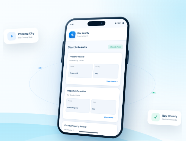
Quickly search for property records in Bay County, Florida, using a parcel ID, property address, owner name, city, or ZIP code. Apply advanced filters to refine your search and access detailed property reports in seconds.
Total Parcels
134,477
Data Source
Property Appraiser
Last update
2026 November
Important Bay County, FL Property Tools
Explore additional property resources from FL Parcel Point to find the Bay County, Florida, real estate information you need. Our free property tools help you access relevant records, explore property details, and find useful information, all in one convenient place.
Property Taxes
The FL Parcel Point property tax calculator for Bay County, Florida, is completely free to use and incorporates local tax district rates to help you estimate property taxes more accurately than a general calculator.
Doc Stamp Tax
Planning to buy or sell a property in Bay County? Use our transfer tax calculator to estimate documentary stamp taxes and explore important information about applicable rates and property transfers.
Property Guide
Explore our blog section for helpful guides covering common property-related questions, real estate information, and essential topics to help you better understand property records and related processes.
What Does the Bay County Property Search Tool Provide?
Our Bay County property search tool provides access to 120+ property data fields, organized into nine sections for easy navigation. Whether you’re a beginner or need help understanding specific details, explore our section-by-section guides to learn how to use each feature and find the property information you need.
- Completely Free Access: Search property records without creating an account or signing up.
- Bay County Property Appraiser Records: Explore available public property records and assessment information.
- PDF Download Option: Download property reports in PDF format for convenient access and future reference.
Ownership Records
This section provides property ownership details, including the primary and secondary owner's names, mailing address, city, and ZIP code, helping you identify the recorded owners of a property in Bay County.
Parcel Details
If you want to explore basic parcel information, check this section for essential property details and parcel identifiers to help you find and save the information you need.
Property Address
Inside the property address section, you can find the property's street number, street name, location, city, ZIP code, and other available address details to identify where the property is located.
Legal Records
FL Parcel Point also provides available legal descriptions and property status information for Bay County parcels, including short and long legal descriptions to help you understand the property's recorded legal details.
Building Characteristics
To explore a property's building details, check this section for available information about the number of floors, rooms, bathrooms, and other important structural characteristics recorded for the property.
Assessment
Check the assessment section to explore property valuation details, including assessed values and other available assessment information that can help you understand how the property is valued for tax purposes.
Property Codes
Use the property code section to review available property classification codes and related details that help explain how a parcel is categorized in Bay County's property records.
Property Sale History
Explore the property sale history section to review available past sales, transaction dates, recorded sale prices, and other relevant details that help you understand the property's transaction history.
GIS Map
Use the GIS map option to view the property's geographic location and explore available parcel boundaries and surrounding areas. This helps you better understand where the property is located within Bay County, Florida.
Bay County, Florida Communities and Real Estate Statistics
FL Parcel Point covers property parcels across Bay County, Florida, helping you explore local communities and understand the real estate market. Below, you can find community-level property statistics and real estate values to gain insights into local property trends and compare market conditions across different areas.
Counties Near Bay County, Florida
If your property search in Bay County has not turned up the right match, nearby counties may offer additional
choices. FL Parcel Point helps you access property records across surrounding Florida communities, making it
easier to explore real estate opportunities beyond Bay County.
Bay County Property Appraiser Office
Bay County Property Appraiser
The official office is the Bay County Property Appraiser’s Office, led by Dan Sowell, CFA. Sowell has served as Bay County Property Appraiser since winning election to the office in 2008. The position is an elected constitutional county office rather than an appointed county department.
The main office is located at 860 W. 11th Street, Panama City, FL 32401, and is open Monday through Friday from 8:00 a.m. to 4:30 p.m. Central Time. The office phone number is (850) 248-8401. A second office is located at 301 Richard Jackson Blvd, Panama City Beach, FL 32407, with a separate phone number of (850) 248-8470.
The office is organized into several specialized areas. Current department leadership includes a chief deputy, residential and commercial appraisal staff, exemptions and homestead compliance, GIS and mapping, quality assurance, technology and information systems, budget and finance, tax-roll administration, and tangible personal property. This structure allows the office to handle different types of taxpayer assistance and administrative responsibilities without placing all functions in one department.
Services and taxpayer assistance
Beyond maintaining the county’s appraisal operation, the Property Appraiser’s Office assists taxpayers with exemptions and homestead matters, tangible personal property requirements, valuation questions, forms, and other property-tax administration issues. The office also administers ad valorem exemptions and prepares and administers the tax rolls used by the Board of County Commissioners and Municipal Service Taxing Units.
Florida law gives the Property Appraiser responsibility for determining property values for taxation and carrying out related duties. Florida Statutes Chapter 193 establishes requirements for assessments, including the factors considered when determining just value. These include market evidence, legally permitted use, location, size, cost, condition, income, and relevant sale information.
Property Appraiser, Tax Collector, and Value Adjustment Board
The three offices have different responsibilities in Florida’s property-tax system. The Property Appraiser determines taxable values and administers applicable exemptions and classifications. The Tax Collector handles the collection and distribution of taxes after taxing authorities establish their millage rates. The Value Adjustment Board, or VAB, provides the administrative process for taxpayers who challenge certain assessments, exemptions, classifications, or related property-tax decisions.
Florida Statutes section 194.015 establishes a Value Adjustment Board in every county. The board includes members from the county governing body and school board along with two citizen members. Section 194.032 establishes the board’s hearing responsibilities, including petitions concerning assessments, exemptions, classifications, and certain other property-tax matters.
Bay County History and Local Government
Formation and early history
Bay County was established by the Florida Legislature on July 1, 1913, from portions of Washington, Calhoun, and Walton counties. Before its creation, representatives from five communities around the bay met in Panama City on February 12, 1913, to select a name for the proposed county. They chose the name Bay because it reflected the area’s geographic character and was acceptable to the participating communities.
The first county legislators met in July 1913, initially using rooms above the Bank of Panama City before county government had a permanent courthouse. Construction of the first courthouse began after the county was organized, with the cornerstone laid in December 1914 and the building dedicated in December 1915. A major fire on December 20, 1920, severely damaged the courthouse, although its exterior walls survived and the structure was rebuilt.
County government structure
Bay County operates under a commission-manager form of local government. The Board of County Commissioners is the county’s five-member governing board. It establishes policy and provides overall direction for county government, while the County Manager is responsible for carrying out board policies and overseeing day-to-day administration.
As of 2026, Joel Schubert serves as County Manager. The County Manager oversees senior county staff and departments responsible for areas such as Emergency Services, Human Services, Utilities, Public Works, Community Development, Budget, Information Technology, Public Information, Purchasing, and Risk Management.
The county’s administrative structure also includes constitutional offices and departments that perform specialized public functions. The County Attorney provides legal services to the Board of County Commissioners and other county boards, authorities, departments, and divisions. Other county operations include public works, utilities, community development, emergency services, code enforcement, parks and recreation, solid waste, and public safety.
Economic and institutional role
Bay County’s economy is supported by several major sectors rather than one single industry. County planning documents identify tourism, military activity, education, manufacturing, defense, and industrial development as important parts of the local economic base. Tyndall Air Force Base, Naval Support Activity Panama City, Northwest Florida Beaches International Airport, and Port Panama City are significant institutions within the broader regional economy.
The county’s economic-development strategy also focuses on maintaining suitable commercial and industrial land, supporting existing business areas, improving infrastructure and permitting, protecting employment opportunities, and attracting and retaining manufacturing and other targeted industries.
Official Bay County Zoning Codes and Classifications
County zoning applies primarily to unincorporated areas
Bay County’s Land Development Regulations establish zoning districts for implementing the county’s Comprehensive Plan. The county’s Planning and Zoning Division reviews development in unincorporated Bay County for consistency with these regulations. Incorporated municipalities may have their own zoning systems, so a county zoning classification should not automatically be treated as the zoning designation inside a city.
The county’s Official Zoning Map is maintained by the Planning and Zoning Division and is the controlling map for final zoning determinations. The county’s zoning regulations also distinguish zoning districts from Future Land Use designations; the two systems are related but are not interchangeable.
Residential zoning districts
| Code | Official classification | General purpose and typical use |
|---|---|---|
| R-1 | Single-Family | Primarily intended for single-family residential development. |
| R-2 | Single Family and Duplex Dwellings | Provides for single-family homes and duplex residential development. |
| R-3 | Duplex, Triplex and Quadraplex | Allows small-scale residential development with duplex, triplex, and quadraplex dwellings. |
| R-4 | Manufactured Housing/Mobile Home | Provides for manufactured housing and mobile-home residential uses. |
| R-5 | Multi-Family | Provides for multi-family residential development. |
| R-5A | Multi-Family Light | Provides for lighter-density or less intensive multi-family residential development. |
The county’s residential regulations are intended to protect existing residential neighborhoods, promote compatibility between residential uses, and reduce nuisances. The code also restricts activities such as ongoing commercial operations, outdoor storage associated with businesses, recreational vehicles used as residences, and activities creating continuing excessive noise, odor, glare, fumes, dust, or similar nuisances unless specifically allowed.
Commercial and mixed-use districts
| Code | Official classification | General purpose and typical use |
|---|---|---|
| C-1 | Neighborhood Commercial | Low-intensity businesses serving nearby residential areas, including smaller retail and service uses. |
| C-2 | Plaza Commercial | Commercial areas intended for plaza-style retail and service development. |
| C-3 | General Commercial | Broader commercial activity serving larger areas and a wider range of customers. |
| C-3A | General Commercial Low | Lower-intensity form of general commercial development. |
| C-4 | Research and Design | Commercial and employment activities associated with research, design, and related professional or technical uses. |
| MLU | Mixed Land Use | Combines compatible land-use activities within a mixed-use development pattern. |
The county specifically describes C-1 as a low-intensity commercial district serving surrounding residential areas. Examples of allowed C-1 uses include smaller retail centers, convenience stores, food-service establishments, pharmacies, laundromats, dry cleaners, day-care centers, florists, clothing or novelty shops, and auto-parts stores, subject to the detailed requirements of the regulations.
Agriculture and conservation districts
| Code | Official classification | General purpose and typical use |
|---|---|---|
| AG-1 | General Agriculture | Supports agricultural production, forestry-related activity, compatible outdoor recreation, conservation, public uses, and low-density rural residential development. |
| AG-2 | Agriculture/Timberland | Provides for agricultural and timberland uses and other development compatible with a rural setting. |
| CRES | Conservation Residential | Provides for residential use where conservation considerations are an important part of development regulation. |
| CSVP | Conservation Preservation | Intended for preservation-oriented areas where protection of natural resources is the primary consideration. |
| CSVR | Conservation Recreation | Provides for conservation areas where compatible recreational activities may occur. |
The county’s agriculture regulations are designed for customary agricultural production, including forestry, associated rural activities, low-density rural residential development, and compatible uses. AG-1 specifically allows agricultural activities, outdoor recreation, conservation uses, public/institutional uses, rural residential uses, communication towers, and public utilities, subject to the detailed restrictions in the Land Development Regulations.
Industrial and public-purpose districts
| Code | Official classification | General purpose and typical use |
|---|---|---|
| IND-1 | Light Industry | Accommodates lower-impact industrial activities that can operate with appropriate separation and site controls. |
| IND-2 | Industrial | Provides areas for more intensive industrial activities and related operations. |
| P/I | Public/Institutional | Provides locations for public and institutional buildings, facilities, educational uses, religious institutions, recreation, and similar community-serving activities. |
| A/IND | Airport/Industrial | Supports airport-related, aviation-dependent, industrial, warehouse, distribution, utility, and related activities while addressing aviation safety. |
The P/I district is intended for public and institutional facilities that support community health, education, religion, recreation, and other public needs. Allowable uses include government facilities, educational institutions, places of worship, civic centers, community recreation facilities, libraries, museums, parks, and playgrounds, with additional standards applying to development.
The A/IND district has additional aviation-related requirements. Allowable uses include airports and heliports, public utilities, aviation-related industrial activities, warehousing, distribution, and services supporting airport operations. Certain other commercial and communications uses may require conditional approval.
Sector plan and special-purpose classifications
Bay County also recognizes specialized zoning categories associated with the Bay-Walton Sector Plan. These include REC (Regional Employment Center), BC (Business Center), WBC (West Bay Center), VC (Village Center), LIR (Low Impact Residential), AT (Agriculture/Timberland), WBP (West Bay Preservation Area), LTC (Long-Term Conservation Area), ROS (Recreation/Open Space), and TC (Town Center). These classifications are tied to the sector-plan area and have their own development standards.
The county also uses Special Treatment Zones as overlay regulations. Current county regulations identify areas including the Airfield Installation Compatibility Use Zones, Coastal Planning Area, Beaches Area, Rural Communities, Sand Hills Rural Community, Ecosystem Management Areas, Bay Point, Deer Point Reservoir Protection Zone, Northwest Florida Beaches International Airport, and the Naval Support Activity Panama City Military Influence Overlay District. These overlays can add requirements to the underlying zoning district.
Bay County Development Review and Permitting
Planning and zoning review
For development in unincorporated Bay County, the Planning and Zoning Division reviews commercial and industrial projects, multifamily residential development, and subdivisions for compliance with the Land Development Regulations. Individual single-family homes are generally submitted through the Building Safety Division, although Planning and Zoning reviews the site plans associated with building permit applications.
For larger development proposals, the county recommends beginning with a pre-application conference. Applicants then submit the appropriate development-order application and supporting materials. Depending on the project, the review can involve site plans, surveys, proposed uses, utilities, stormwater controls, legal access, concurrency requirements, and permits from other agencies.
Bay County Planning and Zoning is located at 840 W. 11th Street, Panama City, FL 32401, and can be reached at (850) 248-8250. Regular office hours are Monday through Friday, 8:00 a.m. to 5:00 p.m.
ZIP Codes in Bay County, Florida
ZIP codes are assigned for postal delivery and do not necessarily follow county or municipal boundaries. Some ZIP codes associated with Bay County also extend into neighboring counties, so a ZIP code alone should not be treated as proof that an address is physically located within Bay County.
| ZIP Code | Postal city or community | Type | Bay County coverage |
|---|---|---|---|
| 32401 | Panama City | Standard | Primarily Bay County |
| 32402 | Panama City | PO Box | Bay County postal use |
| 32403 | Panama City / Tyndall AFB | Standard | Bay County |
| 32404 | Panama City / Callaway area | Standard | Primarily Bay County |
| 32405 | Panama City | Standard | Bay County |
| 32406 | Panama City | PO Box | Bay County postal use |
| 32407 | Panama City Beach | Standard | Primarily Bay County |
| 32408 | Panama City | Standard | Bay County |
| 32409 | Panama City / Southport area | Standard | Primarily Bay County |
| 32410 | Mexico Beach | PO Box | Bay County postal use |
| 32411 | Panama City | PO Box | Bay County postal use |
| 32412 | Panama City | PO Box | Bay County postal use |
| 32413 | Panama City Beach | Standard | Primarily Bay County |
| 32417 | Panama City | PO Box | Bay County postal use |
| 32437 | Ebro | Standard | Crosses into Bay and Washington counties |
| 32438 | Fountain | Standard | Primarily Bay County |
| 32444 | Lynn Haven | Standard | Primarily Bay County |
| 32456 | Port Saint Joe | Standard | Primarily Gulf County; extends into Bay County |
| 32462 | Vernon | Standard | Primarily Washington County; extends into Bay County |
| 32466 | Youngstown | Standard | Primarily Bay County |
The county’s GIS data identifies ZIP areas including 32401, 32403, 32404, 32405, 32407, 32408, 32409, 32413, 32437, 32438, 32444, 32456, and 32466. Broader ZIP boundary data also identifies the additional PO Box ZIPs used for Bay County, including 32402, 32406, 32410, 32411, 32412, and 32417.
Three ZIP codes require particular boundary caution. 32437 is primarily associated with Ebro and Washington County but extends into Bay County. 32456 is primarily a Gulf County ZIP associated with Port Saint Joe but includes portions of Bay County. 32462 is primarily associated with Vernon and Washington County and also extends into Bay County. These ZIP boundaries should not be used as substitutes for an actual county boundary determination.
- County seat: Panama City, Florida
- Regional setting: Florida Panhandle
- Time zone: Central Time
- Total area: 1466.7 square miles
- Land area: 758.6 square miles
- Water area: 708.1 square miles
- Natural setting: St. Andrews Bay, Gulf shoreline, pine flatwoods, and coastal wetlands influence land conditions in the county.
- Land-use context: Coastal parcels can be affected by flood zones, shoreline rules, and local zoning standards.
- Parcel-level verification: Use the county property appraiser, planning department, and official map layers to confirm details for a specific parcel.
Frequently Asked Questions
Are online parcel boundaries enough to settle a boundary question in Bay?
Do not select a result based on the owner’s name or street name alone. Compare the full address, parcel number,
property type, and mapped location. For properties in coastal parcels, waterfront locations, and properties in rapidly changing
urban areas, nearby parcels may have similar descriptions while differing in access, jurisdiction, or physical setting. Save the
parcel identifier so later checks refer to the same property.
How can I tell whether a property is inside a city limit or in an unincorporated part of Bay?
Compare the measurement method and date used by each source. Listings may round acreage or rely on older
marketing information, while GIS measurements are approximate and tax records may reflect a recorded parcel description.
For a transaction or boundary decision, review the legal description and obtain a current survey rather than choosing one online
figure. For Bay, this can be particularly relevant when comparing coastal parcels, waterfront locations, and properties in rapidly
changing urban areas.
How can I check whether a parcel in Bay has been split or combined with another lot?
Online property profiles may update after permits are issued, work is inspected, or assessment data is processed.
Some improvements may not be reflected immediately or may be recorded under a separate building feature. Check the local
building department’s permit records and ask the property appraiser how and when improvements are incorporated into the
assessment roll.
How can I research a commercial parcel differently from a home in Bay?
Treat the online profile as one source, not the complete file. Check the relevant clerk’s recorded instruments, permit
history, GIS layers, and planning or zoning information as needed. Different offices maintain different records, and updates may
occur on different schedules. If a key detail remains unclear, contact the office responsible for that record type.
How should I verify a recent deed or ownership change for a Bay property?
Use the appraiser’s transfer history as a starting point, then search the clerk’s official records for the deed or other
recorded instrument. Check the document’s recording details and legal description. A change may not appear immediately in
every online system, and a property profile should not replace review of the actual recorded document. For Bay, this can be
particularly relevant when comparing coastal parcels, waterfront locations, and properties in rapidly changing urban areas.
How do I check whether a Bay parcel has legal road access?
Try a map search, nearby road or intersection, owner name, or any partial address information available. Rural
parcels may use route descriptions or location references that do not behave like standard urban street addresses. Once you
find a likely match, verify its parcel number and legal description before using it for further research.
Why might the same property have different names or addresses across Bay records?
Begin with the parcel number if it is available, then compare the situs address and map position. Postal labels are
designed for mail delivery and do not always match municipal boundaries. If jurisdiction affects permits, zoning, or services, ask
the county or municipality to confirm which government has authority over that exact parcel.
Can a map search help locate a property when its street address is missing in Bay?
No. A property appraiser profile describes assessment information; it is not a building permit, zoning approval, or
development authorization. Confirm current zoning, future land-use designation, legal access, utilities, setbacks, environmental
limits, and any required permits with the applicable planning and building departments before making plans. For Bay, this can
be particularly relevant when comparing coastal parcels, waterfront locations, and properties in rapidly changing urban areas.
What is the best way to identify the correct parcel when a Bay search returns several matches?
No. GIS parcel lines are reference information and can be affected by mapping scale, data updates, and the source of the underlying geometry. They are helpful for locating neighboring parcels, but a licensed survey is the appropriate tool for establishing boundary locations, encroachments, or disputed lines.
What local approvals should I investigate before changing the use of a Bay parcel?
A property-use code is not a guarantee that a proposed activity is allowed. Review zoning, future land use,
development standards, access, utilities, and any applicable environmental rules with the government that has jurisdiction. Ask
for confirmation tied to the parcel number and proposed use, since general neighborhood descriptions may not establish what
is permitted.