
Liberty County Property Records Search
Look up Liberty County property records using an owner’s name, parcel ID, property address, city, or ZIP code. Refine
the search with the available options to locate the parcel that matches your information.
Total Parcels
6,368
Data Source
Property Appraiser
Last update
2026 November
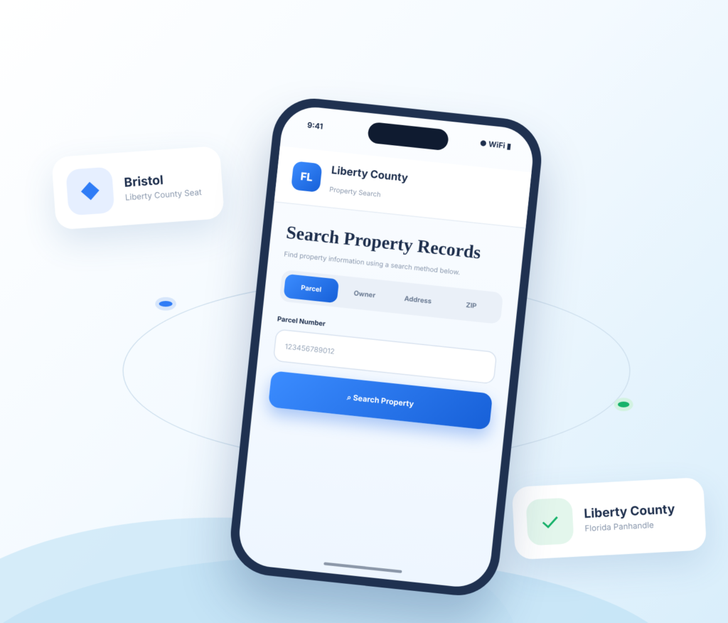
Discover Property Resources in Liberty County
Liberty County is one of Florida’s least-populated counties, with Bristol and extensive rural and forested areas. FL Parcel Point provides practical resources to help property researchers understand taxes, estimate transfer costs, explore parcel locations, and learn about property records.
Property Taxes
Learn about property tax assessments, find helpful payment information, and review key dates relevant to property owners
Doc Stamp Tax
Estimate documentary stamp taxes that may apply to a Florida property transfer and understand common transfer costs.
Property Guide
Find clear guides to property records, real estate terminology, and common questions about researching land or homes.
Liberty County Property Search Tool Features
A property record is made up of different kinds of information, and each field can answer a different question. FL Parcel Point
organizes access to 120+ publicly available property data fields for Liberty County, including ownership, parcel identifiers,
building details, assessments, and transaction information. Browse the categories to get a more complete view of the selected
parcel.
- Explore publicly available property appraiser and parcel information
- Use the property search tool free of charge.
- • Search without signing up or creating an account.
Ownership Records
Explore the ownership section for names and associated address details recorded for the parcel. It offers a useful starting point when you need to confirm how a property is listed in public records.
Parcel Details
Use parcel identifiers, recorded acreage, lot size, and other land measurements to distinguish the selected property. These details describe the parcel itself rather than the buildings that may sit on it
Property Address
Find the recorded location for the property, then check whether a separate mailing address is also listed. Address information can be useful when matching a search result to a particular parcel.
Legal Records
Use the legal record details to understand how the parcel is described in official property information. The section may show subdivision information, lot numbers, and other recorded identifiers.
Building Characteristics
Review the characteristics recorded for structures on the parcel. Depending on the available record, these may include construction type, year built, living area, bedroom and bathroom counts, and related building details.
Assessment
Review the property's available assessment values and note how just value, assessed value, and taxable value are presented. These figures help explain the valuation information recorded for the parcel.
Property Codes
Explore the designations attached to the parcel, including available property-use codes and land classifications. They help explain the category under which the property is recorded.
Property Sale History
Look through available transaction entries for recorded sale dates, reported prices, and transfer details. Historical information can provide context about previous sales associated with the selected parcel.
GIS Map
Use the map view to see where the selected parcel sits and how its boundaries relate to surrounding properties. The geographic display adds a visual reference to the written record details.
Explore Liberty County Towns and Rural Panhandle Property Areas
Liberty County is a lightly populated Panhandle county with Bristol as its county seat and principal incorporated community. Use the available local details to understand the county’s small-town setting and place property addresses in context, particularly when comparing municipal locations with surrounding rural parcels.
Counties Near Liberty County, Florida
If you need more property options around Liberty County, nearby Florida Panhandle counties can help expand
your search. FL Parcel Point provides access to property records across surrounding communities, making it
easier to compare locations and research additional real estate opportunities.
Liberty County Property Appraiser’s Office
The Liberty County Property Appraiser’s Office is an independent constitutional office responsible for carrying out duties established under Florida law. The Property Appraiser is elected by county voters rather than appointed by the Board of County Commissioners.
Chris Rudd took office on January 7, 2025. His current term runs through January 2029, with the next scheduled election in 2028. The office operates independently from the county commission, although it coordinates with other local and state agencies to meet statutory requirements.
Office Address and Contact Information
The Property Appraiser’s Office is located at the Liberty County Courthouse.
Liberty County Property Appraiser
10818 NW SR 20
Bristol, FL 32321
- Mailing address: P.O. Box 580, Bristol, FL 32321
- Phone: 850-643-2279
- Fax: 850-643-4193
- Office hours: Monday through Thursday, 8:00 a.m. to 4:30 p.m.; Friday, 8:00 a.m. to 4:00 p.m.
Chris Rudd serves as Property Appraiser, and Angel Phillips, Chief Deputy, is identified as the custodian of public records. Residents can contact the office for help with exemption applications, filing requirements, and other administrative questions. The office also provides assistance to people who have difficulty accessing information through its website.
Public Assistance and Office Responsibilities
The office provides several taxpayer support services beyond its routine statutory work. These include assistance with:
- Homestead exemption and related exemption applications.
- Senior citizen exemption applications.
- Disability and other qualifying exemption programs.
- Agricultural classification applications.
- Tangible personal property tax return requirements.
- Transfer of homestead exemption applications.
- Questions about filing deadlines and required supporting documents.
The office’s work is governed by several parts of Florida law. Chapters 192 and 193 address general property tax administration and assessment requirements, Chapter 195 covers property tax supervision and state oversight, and Chapter 196 establishes exemptions. Chapter 194 provides procedures for administrative review and appeals.
The Property Appraiser, Tax Collector, and Value Adjustment Board have separate responsibilities. Marie G. Goodman serves as Liberty County Tax Collector. Her office handles tax collection and other services assigned to the constitutional office. The Property Appraiser does not collect payments or establish local tax rates.
The Value Adjustment Board (VAB) provides an independent process for reviewing eligible challenges to decisions involving assessments, classifications, and exemptions. The Liberty County Clerk of Court serves as clerk to the VAB. Current board members include county commissioners, a school board member, and citizen appointees. The VAB clerk can be reached through the Clerk of Court at 850-643-2215.
For office details, taxpayer assistance, and application information, visit the Liberty County Property Appraiser.
Liberty County History, Government and Local Institutions
County Establishment and Historical Background
Liberty County was established on December 15, 1855, from the southern portion of Gadsden County. Its name reflects the American ideal of liberty. The area has a much longer history, however, with evidence of early Apalachee communities and archaeological sites dating back centuries.
Before the county was established, the Apalachicola River served as an important route for trade and transportation. In the early 19th century, British trader John Forbes operated trading posts in the region as part of the Forbes Grant. Settlers from Georgia and the Carolinas later moved into the area, drawn by opportunities for farming and trade.
The Civil War also left its mark on the county. Confederate forces established defensive positions along the Apalachicola River, while the surrounding river areas provided shelter for soldiers and deserters. These events are still reflected in local historical sites and preserved landmarks.
Historic Landmarks and Heritage Sites
One of the county’s most significant historical destinations is Torreya State Park, which preserves important Civil War and 19th-century history.
The park contains the historic Gregory House, a plantation-era home built around 1849 by Jason Gregory. Originally located across the Apalachicola River at Ocheesee Landing, the house was dismantled and relocated by the Civilian Conservation Corps in 1935. It is now a historic attraction where visitors can learn about the area’s plantation history and architecture.
Other historic features at Torreya include Confederate gun pits along Battery and Neal’s Bluff. These defensive positions were built to help protect the river during the Civil War. The park also preserves structures built by the Civilian Conservation Corps during the Great Depression.
County Government and Commissioners
Liberty County is governed by a five-member Board of County Commissioners. Each commissioner represents one district, and the board makes decisions affecting county administration, public services, local ordinances, and infrastructure.
The current commissioners listed by the county are:
- Dewayne Branch: Chairman, District 1
- Hannah Casseaux: District 2
- Jim Johnson: District 3
- Doyle Brown: Vice Chairman, District 4
- Derrick Arnold: District 5
The board generally holds its regular monthly meeting on the first Thursday following the first Monday of the month. Meetings take place in the Liberty County Courthouse courtroom and provide an opportunity for residents to follow public business and raise local concerns.
The Clerk of the Circuit Court and Comptroller also has an important role in county administration. Jace Ford serves as the elected Clerk. In addition to court-related responsibilities, the office acts as clerk to the county commission and handles financial oversight functions, including accounting, auditing, and custody of county funds.
County Departments and Community Services
Several county departments provide services that residents and businesses use throughout the year.
- Planning and Zoning: Coordinates development review, land-use applications, and planning-related approvals. The county uses the Apalachee Regional Planning Council to provide planning and zoning services.
- Building Department: Reviews construction plans, issues building permits, conducts inspections, and handles contractor registration.
- Roads and Bridges: Maintains county roads and bridges and provides services such as grading and culvert installation.
- Emergency Management: Coordinates preparedness, response, and recovery activities during emergencies and disasters.
- Ambulance Services: Provides emergency medical response and related services.
- Liberty County Transit: Offers transportation services, including programs and policies for people who need accessible transportation.
- 4-H Extension Services: Provides educational programs and practical resources for youth, families, and the local community.
- Parks and Recreation: Supports recreational programs and public facilities.
- Solid Waste and Transfer Station: Handles accepted construction debris, bulk items, and other designated waste materials.
These services are supported through county administration and the annual county budget.
Local Economy and Educational Resources
Government services, natural resource industries, construction, trade, education, and healthcare are important parts of the local economy. Florida’s 2024 county economic profile recorded 141 business establishments in Liberty County. Government represented a significant share of local employment, while natural resources and mining, construction, trade and transportation, and education and health services also contributed to economic activity.
Agriculture and forestry remain important to the county’s rural economy. Local activity includes crop and livestock operations, timber-related work, and services supporting land-based industries. Public institutions, including the Liberty County School District and county extension services, provide education and community support.
Liberty County Zoning Codes and Land Use Classifications
Liberty County regulates development in unincorporated areas through its Land Development Code (LDC) and Comprehensive Plan. Chapter 4 of the LDC establishes land use districts and development standards. The code uses named land use categories rather than a conventional system of short alphanumeric zoning codes such as R-1 or C-2. These official category names should not be mistaken for property use codes or separate municipal zoning labels.
Residential and Mixed-Use Classifications
Official Classification | Purpose and Typical Uses | Important Considerations |
Town Center | Combines residential development with offices, retail, lodging, restaurants, services, medical facilities, schools, and recreation. | Intended to recognize established town centers. Business development is generally limited to 65% land coverage. |
Rural Village | Supports suburban or exurban residential development with compatible neighborhood businesses, schools, churches, and recreational uses. | Residential density depends on available central water and sewer, with a maximum of four dwelling units per acre. |
Mixed Use – Rural Residential | Provides primarily rural residential development while allowing neighborhood-scale businesses, institutional uses, utilities, agriculture, and recreation. | Gross residential density is limited to one dwelling unit per acre. Nonresidential uses should not exceed 20% of the total area. |
Mixed Use – Suburban Residential | Provides residential development in areas near rural villages, with limited neighborhood commercial and public uses. | Residential density is generally limited to two dwelling units per acre. Commercial and public development is subject to additional land-coverage limits. |
These categories allow a combination of residential and compatible nonresidential activities, but the permitted mix and development intensity differ. For example, Town Center areas can accommodate a wider range of business activities than Mixed Use – Rural Residential areas.
Agricultural, Commercial and Industrial Classifications
Official Classification | Purpose and Typical Uses | Important Considerations |
Agriculture | Supports crop production, pastureland, orchards, nurseries, livestock operations, aquaculture, and silviculture. | Residential and institutional uses may be allowed subject to the applicable standards. The code generally limits density to one dwelling per 10 acres. |
Commercial Use | Provides areas for retail businesses, offices, restaurants, gas stations, mini-markets, hardware stores, feed stores, and similar services. | Commercial development is subject to location, compatibility, infrastructure, and land-coverage standards. |
Industrial | Accommodates manufacturing, processing, storage, distribution, and related industrial activities. | Industrial development should be directed away from residential areas. Hazardous waste disposal is restricted, subject to the code’s special-exception provisions. |
Mining | Covers surface mining, rock quarries, extraction activities, and related processing or transportation operations. | Mining activities are subject to applicable development and environmental requirements. |
The county code also identifies separate use types within its development standards. General commercial activities differ from high-intensity commercial activities, which may require conditional-use approval because of their potential effects on surrounding properties, traffic, noise, lighting, or operating hours.
Public and Conservation Classifications
Official Classification | Purpose and Typical Uses | Important Considerations |
Public Institutional | Provides for Liberty Correctional Institution and other public infrastructure or institutional facilities. | Uses are tied to public and institutional purposes. |
Public Resource Management | Covers publicly owned land managed for resource-related activities, including timber harvesting and hunting. | Development must remain consistent with the land’s public resource-management purpose. |
Public Preservation | Protects publicly owned land for preservation and passive recreation. | Outdoor recreation is limited to passive activities, with compatible public facilities allowed. |
Conservation | Protects areas with limited development potential because of environmental sensitivity, alluvial soils, or other protective considerations. | Compatible uses include silviculture subject to Best Management Practices and outdoor recreation consistent with conservation. |
The LDC does not establish a separate conventional alphanumeric Planned Unit Development zoning code in its published list of land use categories. It does, however, address planned unit developments in its subdivision and development provisions. A proposed project must be reviewed under the applicable code requirements rather than assuming a separate PUD classification applies.
County and Municipal Zoning Authority
The Liberty County Land Development Code generally applies to unincorporated areas. The City of Bristol has its own municipal government and administers development matters within its incorporated limits. The county code may also apply in other areas when authorized by law or an interlocal agreement.
The county’s Future Land Use Map identifies the broad land use categories used in its planning framework. These designations are connected to the development standards in Chapter 4, but they should not be described as separate alphanumeric zoning codes. Applicants should confirm the applicable category, permitted uses, and approval requirements with county planning staff before beginning a project.
Liberty County Building Permits and Development Approvals
Liberty County requires a Planning and Zoning Permit before an applicant proceeds with additional permits for many new structures. This requirement applies to projects such as new homes, mobile homes, sheds, and pole barns. The county’s Planning and Zoning Department is supported by the Apalachee Regional Planning Council.
Planning and Zoning Application Process
Applicants generally need to provide:
- A copy of the deed showing the applicant as the grantee.
- A site map outlining the property and showing existing and proposed structures or modifications.
- A completed Planning and Zoning application.
Applications can be submitted through the county’s online portal or delivered to the Building Department. Planning and zoning staff can provide guidance on application requirements and the applicable development standards.
Building Department and Inspections
The Building Services Division reviews construction plans, issues permits, conducts inspections, investigates building-code complaints, and oversees contractor registration and address numbering. Its services cover unincorporated areas, including communities such as Hosford, Lake Mystic, Telogia, Estiffanulga, and Sumatra.
The department is located at:
Liberty County Building Department
10818 NW SR 20
Bristol, FL 32321
Phone: 850-643-2215
Office hours: Monday through Friday, 8:00 a.m. to 4:00 p.m.
The county’s official government website provides access to planning applications, building permit information, department contacts, and local ordinances.
ZIP Codes in Liberty County, Florida
Four ZIP codes are commonly associated with Liberty County. They include standard delivery ZIP codes and PO Box ZIP codes. A postal community name does not always identify the exact county jurisdiction, particularly in rural areas where postal delivery boundaries and county lines do not follow the same boundaries.
ZIP Code | Postal Community | ZIP Code Type | Geographic Coverage and Notes |
32321 | Bristol | Standard | Serves Bristol and surrounding delivery areas in Liberty County. |
32334 | Hosford | Standard | Serves Hosford and nearby rural communities. |
32335 | Sumatra | PO Box | Primarily used for post office box delivery rather than a separate standard residential delivery area. |
32360 | Telogia | PO Box | Primarily associated with post office box service for the Telogia community. |
Standard ZIP codes serve regular street delivery routes, while PO Box ZIP codes are assigned primarily to post office box services. The Sumatra and Telogia ZIP codes should therefore not be treated as evidence of separate standard residential delivery areas.
ZIP code boundaries are established for postal delivery and do not necessarily match county jurisdictional lines. For planning, permitting, and local government purposes, the physical location of a site should be confirmed with the appropriate county or municipal office rather than relying only on its mailing city or ZIP code.
- County seat: Bristol, Florida
- Regional setting: Florida Panhandle
- Time zone: Eastern Time
- Total area: 843.2 square miles
- Land area: 835.6 square miles
- Water area: 7.6 square miles
- Natural setting: Large forest areas, river corridors, and proximity to the Apalachicola region define Liberty County.
- Land-use context: Check ownership boundaries, flood conditions, and any public-land adjacency before relying on parcel details.
- Parcel-level verification: Use the county property appraiser, planning department, and official map layers to confirm details for a specific parcel.
Frequently Asked Questions
Which documents should I compare when the legal description for a Liberty property is difficult to follow?
Read the legal description together with the parcel number and recorded plat, if one exists. Descriptions can refer to subdivision lots, metes and bounds, condominium units, or other legal arrangements. If the wording is unclear or affects a transaction, ask a title professional, surveyor, or real estate attorney to interpret the recorded documents.
How can I use nearby parcel information without confusing neighboring properties in Liberty?
Neighboring parcel records can help identify road patterns, subdivision names, or surrounding land uses, but they are not evidence that the same rights or restrictions apply to your parcel. Compare each parcel’s own legal description, zoning, access, and recorded documents. Avoid copying a neighbor’s acreage, tax status, or building details as if they applied to your property.
What can explain a difference between the acreage in a Liberty record and a real estate listing?
Different sources may use rounded acreage, marketing estimates, GIS calculations, or a legal description prepared at another time. An online parcel area is useful for preliminary research, but it is not a surveyed measurement. For a transaction, fence line, access issue, or development plan, compare the legal description and obtain a current survey from a licensed surveyor.
How can I find out whether a Liberty parcel has legal access from a public road?
A map or property profile may suggest where a parcel meets a road, but it does not prove a legally enforceable access right. Review the deed and recorded easements, and check whether the road is public or privately maintained. If access is essential to a purchase or project, have a title professional or attorney review the relevant documents.
What should I check if a Liberty parcel is close to a city boundary or crosses more than one local area?
A mailing city, neighborhood name, or nearby landmark may not identify the government responsible for a parcel. Check the parcel’s location against official municipal boundary information and ask the county or city to confirm jurisdiction. This is important where rural residential parcels, timberland, and land near rivers or public conservation areas spans several communities or includes both incorporated and unincorporated areas.
How can I verify whether a Liberty parcel's current use matches its zoning designation?
Compare the parcel’s current use with the zoning map and written land-development regulations. A property-use code in an assessment record is not a zoning determination and does not guarantee that an existing or proposed activity is permitted. Request written, parcel-specific guidance from the local planning authority before relying on an interpretation.
What should I investigate if a Liberty parcel appears vacant but nearby imagery shows a structure?
A property profile may not show every structure or recent improvement. Assessment records, permit files, aerial images, and inspection records can be updated on different schedules and serve different purposes. Check the building or permitting department’s records and contact the property appraiser if an improvement appears to be missing or incorrectly described.
Why might the property profile for a Liberty building show limited or outdated improvement details?
Building data can be incomplete because improvements were added recently, are recorded in another system, or have not yet flowed into the assessment record. It can also reflect the appraiser’s classification rather than every feature a buyer expects to see. Review permit history and ask the responsible office to explain the source and date of the displayed information.
What is the best way to investigate a parcel that may have been split or combined in Liberty?
Look for recorded plats, deeds, surveys, and clerk documents that describe the parcel’s history. A map may display a current parcel shape without explaining how it was created. If a split or combination affects ownership, access, taxes, or development rights, verify the legal description and status with the appraiser, clerk, and planning office.
How can I research a condominium unit separately from the larger building in Liberty?
A condominium unit and the land or building containing it may have related but distinct identifiers and records. Confirm the unit number, legal description, condominium name, and parcel identifier, then review the declaration and association documents. Building-wide information should not automatically be treated as a unit-specific fact.