
Leon County Property Records Lookup
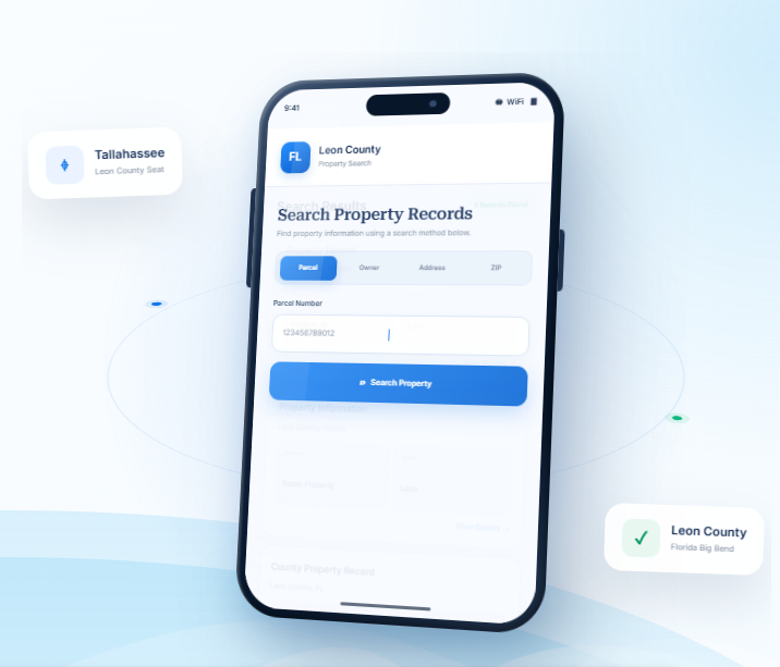
Find Leon County property records by entering an owner name, parcel number, street address, city, or ZIP code. Use additional search options to make the lookup more precise and identify the correct parcel.
Total Parcels
113,443
Data Source
Property Appraiser
Last update
2026 November
Find Property Resources for Leon County
Leon County is home to Tallahassee, state government offices, university communities, and residential areas extending into rural surroundings. FL Parcel Point offers useful resources to help you understand property taxes, estimate transfer costs, explore parcel geography, and research property records.
Property Taxes
Learn about property tax assessments, review payment guidance, and find useful information about dates that matter to property owners.
Doc Stamp Tax
Estimate documentary stamp taxes that may apply to a Florida real estate transfer and understand basic transaction costs
Property Guide
Browse practical guides to property records, real estate terminology, and common questions about researching or owning property
Leon County Property Search Tool Features
When you want to understand a Leon County property, it helps to separate the information that identifies the land from details
about its buildings and value. FL Parcel Point brings together 120+ publicly available property data fields in organized
categories, giving you a straightforward way to explore the selected parcel’s recorded information.
- Explore publicly available property appraiser and parcel information
- Use the property search tool free of charge.
- Search without signing up or creating an account
Ownership Records
Review the owner name or names shown in the available parcel record, along with related mailing details where provided. These entries help you see how ownership is represented in the county's public property information.
Parcel Details
Check the identifying number and available measurements attached to the land, such as lot dimensions or acreage. This information can help you compare parcels and make sure you are viewing the intended record.
Property Address
Check the address details associated with the selected record, including its physical location and available mailing information. This can help avoid confusion between properties with similar names or nearby locations.
Legal Records
Look at the formal description used to identify the land in public records. Available entries may include subdivision names, lot references, and other legal identifiers that distinguish one parcel from another.
Building Characteristics
Explore information about the property's buildings, such as their recorded age, construction, size, and room counts. The fields available can vary by property and by the information held in public records.
Assessment
Explore the assessment section to see the values assigned to the property. Where reported, just, assessed, and taxable values provide separate parts of the county's valuation record.
Property Codes
Check the codes and classifications used to describe the parcel in the property record. Available entries may relate to property use, land classification, or other official designations.
Property Sale History
Review the sales activity shown in the property record, including prior dates and amounts where available. These entries reflect recorded transactions and may help you follow the property's sales history.
GIS Map
Explore the mapped location of the property, including available parcel outlines and nearby land. This view can help you understand the parcel's position in relation to its surroundings.
Explore Leon County Cities and Tallahassee Property Locations
Leon County is centered on Tallahassee, Florida’s state capital. Much of the county outside the city is unincorporated, including communities such as Woodville. Use the municipality details to distinguish the City of Tallahassee from surrounding county areas when researching a property, parcel, or local jurisdiction.
Counties Near Leon County, Florida
If you are searching for property in Leon County but need more choices, nearby Florida counties may offer
additional communities to consider. FL Parcel Point helps you access property records across the surrounding
region and broaden your real estate search.
Leon County Property Appraiser’s Office
The Leon County Property Appraiser’s Office is an independently elected constitutional office responsible for carrying out duties established under Florida property tax law. The current Property Appraiser is Akin Akinyemi, PhD, RA, CFA, CMS. He was first elected in 2016 and reelected in 2020 and 2024. The position is elected by county voters for a four-year term, with the next scheduled election in 2028.
Office Location and Contact Information
The main office is located in the Leon County Government Annex.
Leon County Property Appraiser
315 South Calhoun Street, Third Floor
Tallahassee, FL 32301
- Phone: 850-606-6200
- Fax: 850-606-6201
- Mailing address: P.O. Box 1750, Tallahassee, FL 32302-1750
- Email: admin@leonpa.gov
- Office hours: Monday through Friday, 8:30 a.m. to 5:00 p.m.
The office provides in-person, telephone, and email assistance. Its contact system directs inquiries to the appropriate department, helping residents reach staff who handle exemptions, appraisal administration, customer service, and other office responsibilities. The office also cautions that written communications concerning official business may be subject to Florida public records laws.
Office Organization and Public Assistance
The Property Appraiser’s Office is organized into several departments that support its statutory responsibilities and public services. Its management structure includes an Assistant Property Appraiser, appraisal leadership, technology management, finance and human resources, exemptions, and public relations.
Major service areas include:
- Residential Appraisal: Handles appraisal administration for residential property types.
- Commercial Appraisal: Supports appraisal work involving commercial and other income-producing properties.
- Tangible Personal Property: Administers responsibilities involving business equipment, furnishings, and other taxable personal property.
- Exemptions and Customer Service: Assists with homestead, senior, disability, veteran, charitable, educational, and other qualifying exemption programs.
- Information Technology: Supports data systems, website services, and geographic information technology used by the office.
- Administration and Finance: Coordinates office operations, budgeting, payroll, and internal administrative functions.
- Public Relations: Manages community outreach, public information, and educational communication.
The office also provides guidance for people applying for exemptions under Florida law. Certain exemptions require an application and supporting documentation rather than being granted automatically. For example, religious, charitable, scientific, literary, and educational exemptions have specific eligibility requirements under Sections 196.196 and 196.198, Florida Statutes.
Legal Responsibilities and Related County Offices
The Property Appraiser’s duties are governed by several chapters of Florida law. Chapter 192, Florida Statutes, establishes general provisions for property taxation. Chapter 193 addresses assessment procedures, Chapter 195 covers state supervision and administration, and Chapter 196 establishes exemption requirements. Chapter 194 provides the legal framework for administrative review of certain property tax decisions.
Three separate offices are particularly important in the county’s property tax administration:
- Property Appraiser: Administers appraisal-related duties and determines eligibility for exemptions and classifications under state law.
- Tax Collector: Handles tax collection and other services assigned by Florida law. The current Leon County Tax Collector is Doris Maloy.
- Value Adjustment Board (VAB): Provides an independent administrative process for reviewing qualifying disputes involving assessments, exemptions, and certain other property tax matters.
The VAB is separate from the Property Appraiser’s Office. It operates under Chapter 194, Florida Statutes, and follows its own petition procedures and deadlines. Residents should distinguish between asking the Property Appraiser’s staff to review an issue and filing a formal VAB petition.
The Leon County Property Appraiser’s Office has also received the International Association of Assessing Officers’ Certificate of Excellence in Assessment Administration. The office reports receiving the recognition in 2012 and completing recertifications in 2018 and 2024.
Leon County History, Government and Local Institutions
Historical Establishment and the Origin of the County Name
Leon County was established on December 29, 1824, by the Florida Territorial Legislative Council. It was created from part of Gadsden County and named after Juan Ponce de León, the Spanish explorer associated with the early European exploration of Florida. The county’s creation followed the establishment of Tallahassee as the territorial capital earlier that year.
Before the establishment of the county government, the area had a long history of Indigenous communities and Spanish colonial activity. The Apalachee people maintained important settlements in the region, and Spanish missionaries established a chain of missions across North Florida. One of the most significant was San Luis de Talimali, which served as an important administrative and religious center for the Spanish mission system.
The mission was destroyed during raids in 1704, after which Spanish and Apalachee residents abandoned the settlement. The site is now preserved as the Mission San Luis, a historic archaeological and cultural destination that interprets the area’s Apalachee and Spanish colonial history.
Tallahassee developed as the center of territorial government, and the county grew alongside Florida’s political institutions. Florida became a state in 1845, further strengthening the area’s role in government and public administration. Historic government buildings, mission sites, and cultural institutions continue to reflect these early developments.
County Government and Home Rule Charter
Leon County operates under a Council-Manager form of government and is governed by a seven-member Board of County Commissioners. Five commissioners are elected from individual districts, while two are elected at large by voters throughout the county.
The county adopted its Home Rule Charter through a voter-approved referendum in 2002. The charter established the framework for local self-government and clarified the responsibilities of the elected commission and appointed administration. Chapter 125, Florida Statutes, provides the general statutory authority for county government.
The Board of County Commissioners is responsible for:
- Adopting county ordinances and resolutions.
- Approving the annual county budget.
- Establishing local policies and service priorities.
- Overseeing county departments and public programs.
- Appointing the County Administrator and County Attorney.
- Approving major contracts, public projects, and administrative policies.
- Appointing residents to advisory boards and committees.
The County Administrator manages daily county operations and coordinates the work of departments. The County Attorney provides legal advice to the commission and county administration. This structure separates policy decisions made by elected commissioners from the day-to-day management of county services.
Major County Departments and Public Services
Leon County government provides a range of administrative, public safety, infrastructure, and community services. Important departments and service areas include:
- Development Support and Environmental Management: Oversees development review, environmental permitting, building plans, inspections, and related regulatory services.
- Public Works: Manages county road operations, engineering, infrastructure maintenance, and stormwater-related responsibilities.
- Emergency Medical Services: Provides emergency medical response and related public safety services.
- Emergency Management: Coordinates disaster preparedness, emergency response, and recovery planning.
- Animal Control: Handles animal-related public services and enforcement responsibilities.
- Veterans Services: Helps eligible veterans and their families access available benefits and assistance.
- Human Services and Community Partnerships: Supports community programs and services for residents who need assistance.
- Public Library Services: Provides educational resources, reading programs, technology access, and community activities.
- Cooperative Extension: Offers agricultural education and practical information through its partnership with the University of Florida.
- Facilities Management: Maintains county buildings and public facilities.
The county also works with regional organizations and community partners in areas such as business development, workforce training, cultural programs, and neighborhood services.
Education, Research and Economic Activity
Education and government are central parts of the local economy. Leon County is home to Florida State University (FSU), Florida Agricultural and Mechanical University (FAMU), and Tallahassee State College. These institutions contribute to the regional workforce, research activity, healthcare partnerships, technology development, and cultural life.
The State of Florida is a major employer, alongside FSU, Tallahassee Memorial Healthcare, the Leon County School District, the City of Tallahassee, FAMU, and Tallahassee State College. The county’s economic activity also includes professional and business services, healthcare, construction, retail, transportation, hospitality, and financial services.
Research and technology-related activity is supported by institutions such as the National High Magnetic Field Laboratory and the Innovation Park of Tallahassee. These organizations connect university research with scientific development, technology commercialization, and private-sector innovation.
Leon County Zoning Codes and Classifications
Leon County administers zoning through Chapter 10, Article VI of the Leon County Code of Laws, which contains its zoning regulations and official zoning map provisions. The county zoning framework includes residential, commercial, industrial, rural, institutional, and special-purpose classifications. The Tallahassee-Leon County Planning Department publishes a district chart that distinguishes county zoning districts from classifications used only by the City of Tallahassee.
Residential and Rural Zoning Districts
Zoning Code | Official Classification | General Purpose |
R | Rural | Supports rural development patterns and compatible residential and agricultural activities. |
R-1 | Single-Family Detached Residential | Provides for detached single-family homes. |
R-2 | Single-Family Detached Residential | Supports lower-density detached housing in areas with an established suburban pattern. |
R-3 | Single-Family Detached, Attached Two-Family Residential | Accommodates single-family and two-family housing. |
R-4 | Single, Two-Family and Multi-Family Residential | Provides for a wider range of residential housing types. |
R-5 | Manufactured Home and Single-Family Detached | Allows manufactured homes and detached single-family residences. |
RA | Residential Acre | Provides for residential development on larger lots. |
MR-1 | Medium Density Residential | Supports medium-density residential development. |
MH | Manufactured Home Park | Provides for manufactured-home park development. |
RC | Rural Community | Recognizes designated rural community development patterns. |
RP | Residential Preservation | Supports preservation of established residential areas. |
The residential districts differ in the types of housing they accommodate and the development patterns they are intended to maintain. For example, R-1 and R-2 focus on detached single-family housing, while R-3 and R-4 allow additional housing types. The R-5 district recognizes manufactured homes alongside detached residences.
Commercial and Office-Related Zoning Districts
Zoning Code | Official Classification | General Purpose |
BC-1 | Bradfordville Commercial – 1 | Provides commercial services within designated Bradfordville areas. |
BC-2 | Bradfordville Commercial – 2 | Accommodates additional commercial activity in designated Bradfordville locations. |
BCS | Bradfordville Commercial Services | Supports commercial service uses in the Bradfordville area. |
BOR | Bradfordville Office Residential | Provides for office and compatible residential uses. |
C-1 | Neighborhood Commercial | Allows neighborhood-serving retail and service businesses. |
C-2 | General Commercial | Provides for a broader range of commercial activities. |
CM | Medical Arts Commercial | Supports medical offices and related healthcare services. |
CP | Commercial Parkway | Accommodates commercial development along designated transportation corridors. |
IC | Interchange Commercial | Provides for commercial uses associated with major transportation interchanges. |
OR-1 | Office Residential | Combines office uses with compatible residential development. |
OR-2 | Office Residential | Provides an additional office-residential classification. |
OR-3 | Office Residential District | Supports office and residential uses under district-specific standards. |
NBO | Neighborhood Boundary Office | Provides office-related uses near designated neighborhood boundaries. |
UP-1 | Urban Pedestrian District | Encourages pedestrian-oriented development and a connected urban pattern. |
UP-2 | Urban Pedestrian District | Provides another urban pedestrian-oriented development classification. |
WC | Woodville Commercial District | Supports commercial services in the Woodville community. |
Commercial and office classifications are designed to serve different areas and activity levels. Neighborhood commercial districts focus on services for nearby residents, while C-2 and interchange-related districts accommodate a wider range of businesses. Office-residential classifications provide for professional offices in locations where they can remain compatible with nearby housing.
Industrial and Special-Purpose Zoning Districts
Zoning Code | Official Classification | General Purpose |
I | Industrial Zoning | Provides for industrial activities and related employment uses. |
M-1 | Light Industrial | Accommodates light manufacturing, warehousing, and compatible industrial operations. |
M | Mining District | Provides for mining and mineral extraction activities under applicable requirements. |
GO | Government Operational | Accommodates designated government operations and public facilities. |
OS | Open Space | Provides for open-space uses and compatible recreational activities. |
LP | Lake Protection | Applies development controls intended to protect designated lake areas. |
LPN | Lake Protection Node | Provides a special planning classification for designated lake protection nodes. |
LT | Lake Talquin Recreational Urban Fringe Protection | Addresses development compatibility and recreational protection in the Lake Talquin area. |
OA-1 | Airport Vicinity | Regulates compatible development in designated airport vicinity areas. |
DRI | Development of Regional Impact | Recognizes development subject to applicable regional impact review provisions. |
These districts address activities that require standards beyond conventional residential or commercial zoning. Industrial and mining uses are subject to specific operating and development requirements. Government Operational districts accommodate public facilities, while airport vicinity and lake protection classifications address special planning considerations.
Planned Development and Mixed-Use Classifications
Zoning Code | Official Classification | General Purpose |
PD | Planned Development | Allows coordinated development under an approved project plan. |
PUD | Planned Unit Development | Provides a planned approach to development with project-specific standards. |
AC | High Intensity Urban Activity Center | Supports concentrated, mixed-use activity in designated urban centers. |
MCR | Mahan Corridor Ring | Establishes a development framework for the ring area of the Mahan corridor. |
MCN | Mahan Corridor Node | Supports concentrated development at designated Mahan corridor nodes. |
UF | Urban Fringe | Provides a transition framework between urban and less-developed areas. |
Planned development classifications allow the county to review a project as a coordinated plan rather than applying only the standard rules of a conventional district. Approval may establish project-specific conditions involving uses, site layout, access, and development standards.
County and Municipal Zoning Jurisdiction
The zoning classifications listed above are those identified for Leon County in the Tallahassee-Leon County zoning district chart. Some classifications are shared by the county and the City of Tallahassee, while others are identified as county-only districts. The City of Tallahassee administers its own Land Development Code within city limits, so county zoning provisions should not automatically be applied to property inside the municipality.
The county’s zoning regulations are also separate from future land use categories in the Comprehensive Plan. Future land use establishes broader planning policy, while zoning districts establish more detailed development standards and permitted activities. The official zoning map and applicable code provisions must be considered together when reviewing a proposed use or development.
Leon County Building Permits and Development Administration
The Development Support and Environmental Management (DSEM) department handles development-related permitting and regulatory services in unincorporated Leon County. Its Development Services Division reviews land development applications, interprets the Land Development Code, and administers zoning, site plan, subdivision, sign code, and concurrency requirements. Concurrency review considers whether public facilities can support proposed development.
Building Plan Review and Inspections
The Building Plans Review and Inspection Division reviews construction plans and inspects projects for compliance with the Florida Building Code. Its responsibilities include permit intake, plan review, inspections, and related administrative services.
The county uses an online permitting portal for building permit applications. Review times depend on the project type and whether the application includes all required documents. Some eligible single-trade permits may be issued immediately, while new residential and commercial projects generally require additional review.
The division is located at:
Building Plans Review and Inspection
Renaissance Center, 435 North Macomb Street, Second Floor
Tallahassee, FL 32301
Phone: 850-606-1333
Septic system permits are now issued by the Florida Department of Environmental Protection rather than the county. Applicants should account for this separate state approval when a proposed project requires an onsite sewage treatment and disposal system.
Floodplain Regulations and Development Permits
Leon County participates in the National Flood Insurance Program and enforces local floodplain standards through Section 10-8 of the Leon County Code of Laws. The county uses FEMA Flood Insurance Rate Maps to identify regulated flood hazard areas and applies the Florida Building Code to construction in unincorporated areas.
Development activity in unincorporated Leon County generally requires a county permit unless a specific exemption applies. This includes building construction, alterations, and certain changes to ground elevation. The county may require additional review to confirm compliance with floodplain standards before construction or other regulated work begins.
ZIP Codes in Leon County, Florida
Leon County is associated with 22 ZIP codes, including standard delivery ZIP codes, PO Box ZIP codes, and unique-use postal codes. Several postal areas extend beyond county boundaries, so a ZIP code or mailing city should not be treated as proof that an address is physically located within Leon County.
ZIP Code | Postal Community | ZIP Code Type | Geographic Coverage and Notes |
32301 | Tallahassee | Standard | Serves central Tallahassee and surrounding delivery areas. |
32302 | Tallahassee | PO Box | Primarily used for post office box delivery. |
32303 | Tallahassee | Standard | Serves residential and business areas in Tallahassee. |
32304 | Tallahassee | Standard | Includes areas associated with Florida State University and surrounding communities. |
32305 | Tallahassee | Standard | Serves southern Tallahassee and surrounding areas. |
32306 | Tallahassee | Unique | Assigned to Florida State University. |
32307 | Tallahassee | Unique | Assigned to Florida A&M University. |
32308 | Tallahassee | Standard | Serves northeastern and central Tallahassee delivery areas. |
32309 | Tallahassee | Standard | Serves northeastern Tallahassee and surrounding areas; delivery coverage extends toward the Jefferson County boundary. |
32310 | Tallahassee | Standard | Serves southwestern Tallahassee and surrounding rural areas; portions extend toward Gadsden County. |
32311 | Tallahassee | Standard | Serves southeastern Tallahassee and nearby communities. |
32312 | Tallahassee | Standard | Serves northern Tallahassee and surrounding areas. |
32313 | Tallahassee | Unique | Specialized postal use. |
32314 | Tallahassee | PO Box | Primarily used for post office box delivery. |
32315 | Tallahassee | PO Box | Primarily used for post office box delivery. |
32316 | Tallahassee | PO Box | Primarily used for post office box delivery. |
32317 | Tallahassee | Standard | Serves eastern Tallahassee and nearby areas; portions extend toward Jefferson County. |
32318 | Tallahassee | PO Box | Primarily used for post office box delivery. |
32327 | Crawfordville | Standard | Postal delivery area associated with Crawfordville; portions extend into the southern Leon County area. |
32351 | Quincy | Standard | Primarily associated with Quincy in Gadsden County, with boundary overlap in the broader county area. |
32362 | Woodville | PO Box | PO Box service associated with Woodville. |
32399 | Tallahassee | Unique | Specialized postal use rather than a standard residential delivery area. |
Standard ZIP codes serve regular postal delivery routes. PO Box ZIP codes are primarily used for post office box services, while unique-use ZIP codes are assigned to specific institutions or specialized postal purposes.
Postal boundaries do not follow county lines exactly. Some standard ZIP codes associated with Leon County extend into Gadsden, Jefferson, or Wakulla counties. Addresses using 32327 or 32351 may also have postal communities outside Leon County while serving areas near the county boundary. For local government and permitting purposes, the physical location of an address not simply its mailing city or ZIP code determines the appropriate jurisdiction.
- County seat: Tallahassee, FloridaCounty seat: Tallahassee, FloridaCounty seat: Tallahassee, Florida
- Regional setting: Florida Big Bend
- Time zone: Eastern Time
- Total area: 701.8 square miles
- Land area: 668.4 square miles
- Water area: 33.4 square miles
- Natural setting: Rolling hills, lakes, canopy roads, and extensive tree cover distinguish Leon County from much of Florida.
- Land-use context: Tree protection, stormwater, and municipal or county land-use controls may apply to a given property.
- Parcel-level verification: Use the county property appraiser, planning department, and official map layers to confirm details for a specific parcel.
Frequently Asked Questions
What records help me check whether a recent sale or transfer has been formally recorded in Leon?
Use the property appraiser’s transfer or sale information as an initial clue, then search the county clerk’s official records for the deed or other recorded instrument. The contract date, closing date, recording date, and date an online profile updates may differ. Read the recorded document when the parties, legal description, or transfer timing matters.
Can a property appraiser record tell me whether a Leon property has open permits or code violations?
Usually not. Property appraiser pages focus on valuation and assessment information, while permits, code enforcement, utilities, and association matters may be maintained by separate offices or organizations. Identify the question you need answered and check the relevant department’s records directly. Do not assume that the absence of a notice on one page means none exists.
Which documents should I compare when the legal description for a Leon property is difficult to follow?
Read the legal description together with the parcel number and recorded plat, if one exists. Descriptions can refer to subdivision lots, metes and bounds, condominium units, or other legal arrangements. If the wording is unclear or affects a transaction, ask a title professional, surveyor, or real estate attorney to interpret the recorded documents.
How can I use nearby parcel information without confusing neighboring properties in Leon?
Neighboring parcel records can help identify road patterns, subdivision names, or surrounding land uses, but they are not evidence that the same rights or restrictions apply to your parcel. Compare each parcel’s own legal description, zoning, access, and recorded documents. Avoid copying a neighbor’s acreage, tax status, or building details as if they applied to your property.
What can explain a difference between the acreage in a Leon record and a real estate listing?
Different sources may use rounded acreage, marketing estimates, GIS calculations, or a legal description prepared at another time. An online parcel area is useful for preliminary research, but it is not a surveyed measurement. For a transaction, fence line, access issue, or development plan, compare the legal description and obtain a current survey from a licensed surveyor.
How can I find out whether a Leon parcel has legal access from a public road?
A map or property profile may suggest where a parcel meets a road, but it does not prove a legally enforceable access right. Review the deed and recorded easements, and check whether the road is public or privately maintained. If access is essential to a purchase or project, have a title professional or attorney review the relevant documents.
What should I check if a Leon parcel is close to a city boundary or crosses more than one local area?
A mailing city, neighborhood name, or nearby landmark may not identify the government responsible for a parcel. Check the parcel’s location against official municipal boundary information and ask the county or city to confirm jurisdiction. This is important where city neighborhoods, university-area housing, historic properties, and rural parcels around the capital spans several communities or includes both incorporated and unincorporated areas.
How can I verify whether a Leon parcel's current use matches its zoning designation?
Compare the parcel’s current use with the zoning map and written land-development regulations. A property-use code in an assessment record is not a zoning determination and does not guarantee that an existing or proposed activity is permitted. Request written, parcel-specific guidance from the local planning authority before relying on an interpretation.
What should I investigate if a Leon parcel appears vacant but nearby imagery shows a structure?
A property profile may not show every structure or recent improvement. Assessment records, permit files, aerial images, and inspection records can be updated on different schedules and serve different purposes. Check the building or permitting department’s records and contact the property appraiser if an improvement appears to be missing or incorrectly described.
Why might the property profile for a Leon building show limited or outdated improvement details?
Building data can be incomplete because improvements were added recently, are recorded in another system, or have not yet flowed into the assessment record. It can also reflect the appraiser’s classification rather than every feature a buyer expects to see. Review permit history and ask the responsible office to explain the source and date of the displayed information.