
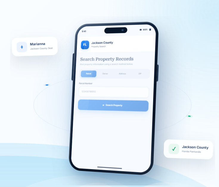
Jackson County Florida Property Search
Find Jackson County property records using a parcel number, owner name, property address, city, or ZIP code. Start with any known detail and apply available filters to focus on the parcel you need.
Total Parcels
43,206
Data Source
Property Appraiser
Last update
2026 November
Explore Property Resources in Jackson County
Jackson County sits in Florida’s Panhandle, with Marianna, smaller communities, and rural areas near the Alabama
border. FL Parcel Point brings together practical resources for understanding property taxes, estimating transfer costs,
exploring parcel locations, and learning about property records.
Property Taxes
Review property tax basics, learn how assessments relate to tax bills, and find useful guidance on payments and important dates.
Doc Stamp Tax
Estimate documentary stamp taxes that may apply to a Florida property transfer and understand common transaction-related costs.
Property Guide
Read practical guides about property records, real estate terms, and common questions when researching homes or land.
Jackson County Property Search Tool Features
When reviewing a Jackson County property, it can help to look at the parcel’s identifying information alongside its ownership, building, and valuation details. FL Parcel Point organizes access to 120+ publicly available property data fields into practical categories. Browse the sections to see what has been recorded for the selected property and use the field explanations when a term needs more context.
- Explore publicly available property appraiser and parcel information
- Use the property search tool free of charge.
- Search without signing up or creating an account.
Ownership Records
Check who is listed in connection with the selected property. The record may include owner names, mailing addresses, and other ownership-related entries that help you identify the parties associated with the parcel.
Parcel Details
Explore the land-related entries, including parcel number, lot size, and recorded area where available. Together, these details provide a basic description of the property being searched.
Property Address
Review the street address connected with the parcel and any mailing address information included in the record. These details help link the database entry to the location you have in mind.
Legal Records
Explore legal descriptions and recorded references such as subdivision, block, or lot details when available. These identifiers provide a more formal way to describe the parcel than its street address alone.
Building Characteristics
Check the structural details associated with the property, including building type, construction year, living space, and available bedroom or bathroom information. These entries describe improvements rather than the land itself.
Assessment
Compare the valuation figures shown for the parcel, which may include just value, assessed value, and taxable value. Each figure serves a different purpose in the property assessment record.
Property Codes
Review the property's recorded use codes and classifications to understand how it is categorized in the database. These labels add context to the parcel information but should be read alongside the full record.
Property Sale History
Explore past sale information connected with the parcel. The record may include transaction dates, reported sale prices, and other available details about earlier transfers.
GIS Map
View the parcel in its geographic setting using the available GIS map. You can examine its mapped position, parcel boundaries, and nearby land to better understand the property's location.
Jackson County Communities and Property Statistics
Jackson County includes Marianna, its county seat, along with towns such as Graceville, Cottondale, and Sneads. The local statistics provide context on the county’s dispersed communities and help users determine whether a property is within an incorporated municipality or in the surrounding rural area.
Counties Near Jackson County, Florida
If you need more property options beyond Jackson County, nearby Florida Panhandle counties can give you
additional areas to explore. FL Parcel Point helps you access property records across surrounding communities,
making it easier to compare locations and continue your real estate search.
About the Jackson County Property Appraiser’s Office
The Jackson County Property Appraiser’s Office is an elected constitutional office that operates independently from the Board of County Commissioners. Rebecca Morris-Haid, CFA, serves as the Jackson County Property Appraiser. The position is elected by county voters for a four-year term, and the office follows the requirements established by the Florida Constitution, Florida Statutes, and the Florida Department of Revenue.
Office Location and Contact Information
The Property Appraiser’s main office is located inside the Jackson County Courthouse. Residents can contact the office for assistance with exemption applications, agricultural classification, business personal property requirements, and other matters handled by the appraisal staff.
Office detail | Information |
Official office name | Jackson County Property Appraiser |
Property Appraiser | Rebecca Morris-Haid, CFA |
Street address | 4445 Lafayette Street, Room 106 |
City, State, ZIP | Marianna, Florida 32446 |
Telephone | (850) 482-9646 |
Fax | (850) 482-9036 |
Office hours | Monday–Friday, 8:00 a.m.–4:30 p.m. |
Mailing address | P.O. Box 1526, Marianna, FL 32447-1526 |
The office is generally closed on weekends and county-observed holidays. Calling ahead is helpful when an inquiry involves supporting documents or requires additional staff assistance.
Departments and Taxpayer Support Services
The office handles several specialized functions to support homeowners, businesses, agricultural landowners, and other taxpayers. Its responsibilities include:
- Exemptions: Assists with applications for homestead, senior, disability, veteran, widow or widower, and other exemptions authorized by Florida law.
- Agricultural Classification: Reviews applications and supporting information for land used primarily for bona fide agricultural purposes.
- Tangible Personal Property: Provides guidance to businesses regarding reporting requirements for equipment, furniture, machinery, and other taxable business assets.
- Residential and Commercial Appraisal: Handles valuation work for different property types and applies the relevant state appraisal standards.
- Mapping and Technical Support: Supports the office’s mapping and assessment administration functions.
- Public Records Assistance: Responds to requests for records maintained by the Property Appraiser’s Office.
The office also works with property owners when questions arise about exemption eligibility, agricultural use, assessment procedures, or required filing deadlines. Its public records custodian is identified as Angela Roberts, who can be contacted through the main office telephone number.
Florida Statutes Governing the Property Appraiser
The Property Appraiser’s duties are established through several parts of Florida law. These statutes provide statewide rules for assessment administration, exemptions, oversight, and taxpayer review procedures.
- Chapter 192: Establishes general provisions for property taxation and administration.
- Chapter 193: Covers property assessment requirements and valuation procedures.
- Chapter 195: Establishes state oversight and standards for property tax administration.
- Chapter 196: Governs homestead and other property tax exemptions.
- Chapter 194: Explains taxpayer rights and procedures for challenging assessments.
These laws help maintain consistent assessment practices across Florida and define the responsibilities of county property appraisers.
Property Appraiser, Tax Collector and Value Adjustment Board
The Property Appraiser, Tax Collector, and Value Adjustment Board have separate responsibilities within the county’s property tax system.
The Property Appraiser administers qualifying exemptions and prepares the assessment roll. The Tax Collector handles tax billing, payment collection, and distribution of revenue to the appropriate taxing authorities. Mary Carol Murdock serves as Jackson County Tax Collector.
The Value Adjustment Board (VAB) provides an independent process for reviewing eligible disputes involving property assessments, exemptions, and certain classification decisions. Property owners who disagree with an assessment may file a petition under the applicable procedures and deadlines. The VAB is not part of the Property Appraiser’s Office and does not make the original assessment decision.
Jackson County History, Government and Local Information
Jackson County was established on August 12, 1822, by the First Session of the Territorial Legislative Council. It was named in honor of Andrew Jackson, the seventh president of the United States. Its early government developed during Florida’s territorial period, before Florida became a state in 1845.
Historical Development and Important Landmarks
The county’s history is closely connected to agriculture, trade, transportation, and the development of communities in the Florida Panhandle. Marianna was founded in 1827 by Scottish entrepreneur Robert Beveridge and grew into an important center for farming and commerce. The arrival of the Pensacola and Atlantic Railroad in the 1880s strengthened its role as a regional transportation and trade community.
One of the most significant events in local history was the Battle of Marianna, fought on September 27, 1864, during the Civil War. The battle was one of the major Civil War engagements fought in Florida. Historic markers and memorials near the courthouse and Confederate Park commemorate the event.
Other important heritage locations include:
- Marianna Historic District: Recognized for its historic homes, churches, and commercial buildings, including structures dating to the 19th century.
- Greenwood Historic District: Preserves buildings and sites associated with the community’s early development.
- Florida Caverns State Park: A landmark developed in part by Civilian Conservation Corps workers during the 1930s and early 1940s. Its guided cave tours and historic park structures remain important regional attractions.
- Battle of Marianna Memorials: Markers and monuments that preserve the history of the 1864 battle and honor those connected to the event.
Main Street Marianna also supports downtown preservation and local business activity. In June 2026, the Florida Department of State recognized it as the Florida Main Street Program of the Month.
County Government Structure
Jackson County operates under a five-member Board of County Commissioners. Commissioners are elected to represent the county’s geographical districts and serve staggered four-year terms. The Board is responsible for adopting county ordinances and resolutions, approving the annual budget, establishing policies, and overseeing county services.
The county’s constitutional officers operate separately from the Board. These elected offices include the Clerk of the Circuit Court, Sheriff, Property Appraiser, Tax Collector, and Supervisor of Elections. Each has responsibilities established by Florida law.
Regular Board of County Commissioners meetings are generally held on the second and fourth Tuesdays of each month. Meetings take place at the county commission chamber, 2864 Madison Street, Marianna. The meeting schedule may change because of holidays or other official commitments.
County Departments and Public Services
County departments handle the daily services needed to maintain public facilities, support residents, and administer local programs. Major service areas include:
- Community Development: Planning, building services, affordable housing programs, and code enforcement.
- Road and Bridge: County road maintenance, drainage-related work, and transportation infrastructure.
- Public Works: Maintenance of county facilities and public infrastructure.
- Fire Rescue and Emergency Management: Fire response, emergency planning, disaster coordination, and recovery support.
- Utilities: County utility services and related infrastructure.
- Parks and Recreation: Public recreational facilities and community activities.
- Veterans Services: Assistance with veterans’ benefits and related support.
- Agriculture Center: Agricultural education, extension programs, and assistance for local producers.
- Public Library: Library services, educational resources, and community learning opportunities.
These departments work alongside state agencies, municipalities, and independent constitutional offices to provide services throughout the county.
Major Economic Activities and Educational Institutions
Agriculture, forestry, timber production, construction, retail trade, transportation, manufacturing, and public services contribute to the local economy. Farming and timber remain important parts of the county’s economic history, while healthcare, education, tourism, and small businesses support employment and commercial activity.
Jackson County also has several important educational institutions. Chipola College provides academic programs, workforce training, and continuing education opportunities. The Baptist College of Florida offers religious and ministry-focused higher education. The Jackson County School District supports public education and career preparation for local students.
Jackson County Land Use Categories and Development Classifications
Jackson County does not use traditional zoning districts in its unincorporated areas. The county’s Planning Division specifically states that it does not have conventional zoning districts. Instead, development is guided by the adopted Comprehensive Plan, Future Land Use Element, Future Land Use Map, and performance-based requirements in the Land Development Code.
This distinction is important when researching land in the county. The classifications below are official Future Land Use categories, not conventional zoning codes. They guide the general type, density, and intensity of development that may be considered.
Official Future Land Use Classifications
Official code | Full classification name | General purpose and development considerations |
CON | Conservation | Protects environmentally sensitive land. Allows compatible conservation and passive recreation activities, with residential density generally limited to one dwelling per 40 acres. |
AG-1 | Agricultural-1 | Supports large-scale agriculture and forestry, including timber production, crops, pasture, orchards, and related farm activities. Residential development is generally limited to one dwelling per 20 acres. |
AG-2 | Agricultural-2 | Supports smaller-scale farming, pasture, timber production, and compatible agricultural-related activities. Residential density may reach one dwelling per acre, subject to applicable policies. |
R | Residential | Provides for residential development and compatible neighborhood commercial uses. The plan identifies a maximum residential density of four dwelling units per acre. |
COM | Commercial | Provides areas for retail, business, and service activities serving residents and the traveling public. |
I-1 | Industrial-1 | Supports light industrial and light manufacturing uses, including research, laboratories, and production activities with limited off-site impacts. |
I-2 | Industrial-2 | Accommodates heavy industrial and manufacturing activities that may depend on transportation access and larger volumes of raw materials. Additional buffering and performance standards apply. |
MUUT | Mixed Use Urban Transitional | Provides a transition between urban service areas and more intensive uses such as industrial parks, airports, and municipalities. It allows a compatible mix of residential, commercial, agricultural, office, and certain light industrial uses. |
P | Public | Provides land for public facilities and services, including government centers, educational facilities, institutions, and other public uses. |
REC | Recreation | Supports active and passive recreational facilities, with development intensity controlled by the plan and applicable regulations. |
The Comprehensive Plan also identifies maximum impervious surface ratios for several categories. These ratios control how much of a site may be covered by buildings, pavement, and other surfaces that prevent water from soaking into the ground. The listed maximums include 60% for AG-1, AG-2, and R; 90% for COM; 85% for I-1, I-2, and MUUT; 80% for P; and 50% for REC.
Official Overlay Classifications
The county Comprehensive Plan also identifies overlays that add location-specific development considerations to the underlying Future Land Use category.
Overlay code | Full name | Purpose |
RMHP | Rural Mobile Home Park | Allows consideration of rural mobile home park development in designated AG-2 areas, subject to an amendment and density requirements. |
USA | Urban Service Area | Identifies areas served, or planned to be served, by public water, sewer, and suitable road infrastructure. |
RV | Rural Villages Overlay | Recognizes traditional rural settlement areas where growth is generally directed toward infill and limited expansion. |
G | Greenways Overlay | Identifies greenway corridors and supports conservation and compatible recreational connections. |
Overlay designations do not automatically replace the underlying Future Land Use category. For example, the Greenways Overlay continues to follow the development standards of the underlying category.
County and Municipal Land Use Jurisdiction
The county’s Future Land Use Map and Land Development Code apply to unincorporated areas under county jurisdiction. Incorporated municipalities, including Marianna and Graceville, maintain their own planning and land development regulations within their boundaries.
A postal address using a municipality’s name does not necessarily mean the property is inside that municipality. The responsible government should be confirmed before submitting a development application or relying on a particular land-use designation.
Planning, Building Permits and Development Administration
Jackson County’s Community Development Department oversees planning, development review, building services, housing assistance, and code enforcement. Its work is intended to ensure that new construction and land development follow the county’s Comprehensive Plan, Land Development Code, and applicable state requirements.
Planning and Development Review
The Planning Division reviews residential, commercial, and other development proposals. A residential project generally begins with a Residential Development Order application. Once approved, the application is coordinated with other departments, which may include Building Services, Road and Bridge, E-911 addressing, and the Property Appraiser.
Commercial and nonresidential proposals may require a pre-application meeting and a General Development Order application with supporting plans. County staff review the submission for completeness and consistency with the Comprehensive Plan. Projects requiring Board approval may also go before the Planning Commission for a recommendation and a public hearing before the Board of County Commissioners.
The county publishes review timelines for these applications. Residential development orders generally receive an initial review within ten business days. For commercial development orders, staff generally determine application completeness within ten calendar days and review complete plans within 30 days. Actual processing times can vary depending on the application and whether revisions or additional approvals are needed.
Building Permits and Construction Inspections
After the required development approval is obtained, applicants may proceed with building permit applications. Building Services reviews construction plans, issues permits, and performs inspections to verify compliance with the Florida Building Code.
The department also maintains contractor licensing information and coordinates inspections for regulated construction work. Depending on the project, applicants may need separate approvals for building, electrical, plumbing, mechanical, or other regulated work.
Community Development Contact Information
Department | Address | Telephone |
Community Development | 4979 Healthy Way, Suite B, Marianna, FL 32446 | (850) 482-9637 |
Planning Division | 4979 Healthy Way, Suite B, Marianna, FL 32446 | (850) 482-9637 |
Building Services | 4979 Healthy Way, Suite B, Marianna, FL 32446 | (850) 482-9805 |
Code Enforcement | 4979 Healthy Way, Suite B, Marianna, FL 32446 | (850) 482-9087 |
Housing Assistance | 4979 Healthy Way, Suite B, Marianna, FL 32446 | (850) 482-9083 |
The county also administers housing assistance programs, including funding through Florida’s State Housing Initiatives Partnership program, to support eligible households and affordable housing activities.
ZIP Codes Within Jackson County, Florida
Jackson County is associated with standard ZIP codes serving its communities as well as postal codes used for PO Box delivery. Some standard ZIP code areas extend into neighboring counties, so the postal community name does not always indicate the government jurisdiction responsible for a particular location.
Standard ZIP Codes
ZIP Code | Postal community | Geographic coverage and boundary notes |
32420 | Alford | Serves Alford and surrounding areas in Jackson County. |
32421 | Altha | Primarily serves Calhoun County, with a portion extending into Jackson County. |
32423 | Bascom | Serves Bascom and surrounding areas in Jackson County. |
32426 | Campbellton | Serves Campbellton and nearby areas in Jackson County. |
32428 | Chipley | Primarily serves Washington County, with a portion extending into Jackson County. |
32431 | Cottondale | Serves Cottondale and nearby areas in Jackson County. |
32440 | Graceville | Serves Graceville and surrounding areas; the ZIP area extends beyond the county boundary. |
32442 | Grand Ridge | Serves Grand Ridge and nearby areas in Jackson County. |
32443 | Greenwood | Serves Greenwood and surrounding areas in Jackson County. |
32445 | Malone | Serves Malone and surrounding areas in Jackson County. |
32446 | Marianna | Serves Marianna and surrounding areas in Jackson County. |
32448 | Marianna | Serves additional Marianna-area delivery routes and surrounding communities. |
32460 | Sneads | Serves Sneads and surrounding areas in Jackson County. |
PO Box ZIP Codes
ZIP Code | Postal community | ZIP code type |
32432 | Cypress | PO Box |
32447 | Marianna | PO Box |
The ZIP code list includes 13 standard codes and two PO Box codes associated with Jackson County. ZIP code 32421 is primarily associated with Altha in Calhoun County, while 32428 is primarily associated with Chipley in Washington County. Both include portions within Jackson County.
ZIP Code Boundary Considerations
ZIP code boundaries are established for postal delivery and do not follow county or municipal boundaries in every location. A mailing address may use a community name outside the county even when the physical location falls within Jackson County.
For legal, permitting, and development purposes, the responsible jurisdiction should be determined from the actual location rather than the ZIP code alone.
Official Jackson County Government Resources
The following official resources provide additional information about county administration, property appraisal, planning, and development requirements:
- Jackson County Property Appraiser : Official office information and taxpayer assistance.
- Jackson County Planning Division : Comprehensive Plan, Future Land Use Map, development applications, and planning procedures.
- County seat: Marianna, Florida
- Regional setting: Florida Panhandle
- Time zone: Central Time
- Total area: 954.5 square miles
- Land area: 918.2 square miles
- Water area: 36.3 square miles
- Natural setting: The Chipola River, caves and karst features, farmland, and forests are notable in Jackson County.
- Land-use context: Confirm floodplain, groundwater, and rural service details when evaluating land away from incorporated areas.
- Parcel-level verification: Use the county property appraiser, planning department, and official map layers to confirm details for a specific parcel.
Frequently Asked Questions
How can I confirm that a Jackson property is in the municipality named in its listing?
Start with the parcel identification number and compare it with the property’s physical location on an official map. A postal city or listing description may not establish municipal jurisdiction. If city limits affect permits, services, or land-use rules, ask the relevant county or municipality to confirm the jurisdiction for that specific parcel.
What should I verify before assuming a parcel in Jackson can be used for a particular project?
A property appraiser classification is not a development approval. Check zoning, future land use, legal access, setbacks, utilities, permits, and any environmental or special-area requirements with the authority that has jurisdiction. Because rural homesites, agricultural acreage, and parcels near rivers or state-border routes can include varied property conditions, obtain parcel-specific confirmation before making plans or spending money.
How can I tell whether a Jackson property is affected by a homeowners' association or condominium association?
An appraiser record may not list every private covenant, association rule, fee, or assessment. Review the deed restrictions, recorded declarations, condominium documents, estoppel information, and association records where applicable. Ask the seller or association for current documents and confirm whether the property is actually subject to the community’s rules.
What should I do if a Jackson tax record and property appraiser profile show different information?
Different offices maintain different datasets and update them on different timelines. First identify which detail differs, the date attached to each record, and the purpose of the record. Then contact the office responsible for that information. For a tax balance, use the tax collector; for valuation details, contact the property appraiser; for recorded instruments, check the clerk.
Where can I confirm historic property or district restrictions that may affect a Jackson building?
Start by identifying whether the property is individually designated, located within a historic district, or subject to another preservation review. Check local planning or historic-preservation records and review recorded restrictions. A property’s age or appearance alone does not establish a formal designation, and requirements can differ by municipality.
What records help me check whether a recent sale or transfer has been formally recorded in Jackson?
Use the property appraiser’s transfer or sale information as an initial clue, then search the county clerk’s official records for the deed or other recorded instrument. The contract date, closing date, recording date, and date an online profile updates may differ. Read the recorded document when the parties, legal description, or transfer timing matters.
Can a property appraiser record tell me whether a Jackson property has open permits or code violations?
Usually not. Property appraiser pages focus on valuation and assessment information, while permits, code enforcement, utilities, and association matters may be maintained by separate offices or organizations. Identify the question you need answered and check the relevant department’s records directly. Do not assume that the absence of a notice on one page means none exists.
Which documents should I compare when the legal description for a Jackson property is difficult to follow?
Read the legal description together with the parcel number and recorded plat, if one exists. Descriptions can refer to subdivision lots, metes and bounds, condominium units, or other legal arrangements. If the wording is unclear or affects a transaction, ask a title professional, surveyor, or real estate attorney to interpret the recorded documents.
How can I use nearby parcel information without confusing neighboring properties in Jackson?
Neighboring parcel records can help identify road patterns, subdivision names, or surrounding land uses, but they are not evidence that the same rights or restrictions apply to your parcel. Compare each parcel’s own legal description, zoning, access, and recorded documents. Avoid copying a neighbor’s acreage, tax status, or building details as if they applied to your property.
What can explain a difference between the acreage in a Jackson record and a real estate listing?
Different sources may use rounded acreage, marketing estimates, GIS calculations, or a legal description prepared at another time. An online parcel area is useful for preliminary research, but it is not a surveyed measurement. For a transaction, fence line, access issue, or development plan, compare the legal description and obtain a current survey from a licensed surveyor.