
Union County Property Records Lookup
Explore Union County property records with an owner’s name, parcel number, property address, city, or ZIP code. Use advanced search options to refine the results and identify the parcel that matches your details.
Total Parcels
7,406
Data Source
Property Appraiser
Last update
2026 November
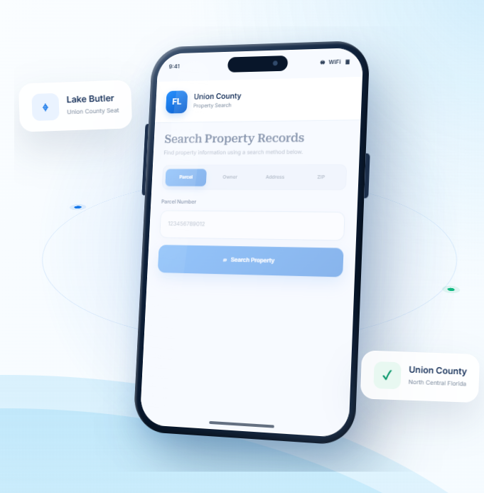
Explore Property Resources Across Union County
Union County is a small North Florida county centered on Lake Butler, with rural communities and land beyond the town. FL Parcel Point offers useful starting points for understanding property taxes, estimating transfer costs, exploring parcel locations, and learning about real estate records.
Property Taxes
Learn about property tax assessments, find payment guidance, and review important dates that may affect property owners.
Doc Stamp Tax
Estimate documentary stamp taxes for a Florida property transfer and learn about common transaction-related costs.
Property Guide
Browse clear guides to property records, real estate terms, and common questions about researching homes or land.
Union County Property Search Tool Features
A property’s public record can include a range of details that help describe the parcel and its improvements. FL Parcel Point
brings access to 120+ property data fields together for Union County searches, grouping ownership, parcel, building,
assessment, and sale information into categories that are easier to browse.
- Explore publicly available property appraiser and parcel information.
- Use the property search tool free of charge.
- Search without signing up or creating an account
Ownership Records
Review the owner name or names shown in the available parcel record, along with related mailing details where provided. These entries help you see how ownership is represented in the county's public property information.
Parcel Details
Check the identifying number and available measurements attached to the land, such as lot dimensions or acreage. This information can help you compare parcels and make sure you are viewing the intended record.
Property Address
Check the address details associated with the selected record, including its physical location and available mailing information. This can help avoid confusion between properties with similar names or nearby locations.
Legal Records
Look at the formal description used to identify the land in public records. Available entries may include subdivision names, lot references, and other legal identifiers that distinguish one parcel from another.
Building Characteristics
Look at the formal description used to identify the land in public records. Available entries may include subdivision names, lot references, and other legal identifiers that distinguish one parcel from another.
Assessment
Explore information about the property's buildings, such as their recorded age, construction, size, and room counts. The fields available can vary by property and by the information held in public records.
Property Codes
Check the codes and classifications used to describe the parcel in the property record. Available entries may relate to property use, land classification, or other official designations.
Property Sale History
Review the sales activity shown in the property record, including prior dates and amounts where available. These entries reflect recorded transactions and may help you follow the property's sales history.
GIS Map
Explore the mapped location of the property, including available parcel outlines and nearby land. This view can help you understand the parcel's position in relation to its surroundings.
Explore Union County Towns and Rural North Florida Communities
Union County includes Lake Butler, Raiford, and Worthington Springs, set within a compact and largely rural part of North Florida. Reviewing the municipality information helps property researchers understand the county’s small-town geography and identify whether an address is within an incorporated town or outside municipal limits.
Counties Near Union County, Florida
If you have not found the right property in Union County, nearby North Florida counties may offer more options to
explore. FL Parcel Point provides access to property records across surrounding communities, helping you
compare locations and continue researching real estate opportunities.
Union County Property Appraiser and Local Property Information
The Union County Property Appraiser’s Office is responsible for assessing real estate and qualifying tangible personal property for property tax purposes. Its work includes determining property values, administering eligible tax exemptions, reviewing agricultural classifications, and preparing the annual assessment roll used by local taxing authorities.
Located in North Central Florida, Union County is one of the state’s smallest counties by land area. Lake Butler is the county seat and the center of local government, while Raiford and Worthington Springs are among its other recognized communities. The county’s property landscape includes agricultural acreage, timberland, rural homesites, residential neighborhoods, and properties connected to local businesses and public institutions.
Understanding the Property Appraiser’s responsibilities, county government, zoning regulations, and development requirements can help property owners and prospective buyers make informed decisions.
Union County Property Appraiser Office
The Union County Property Appraiser is an elected constitutional officer responsible for determining the value of taxable property within the county. The office operates independently from the Board of County Commissioners and the Tax Collector.
Bruce D. Dukes serves as Union County Property Appraiser. The office assesses property for taxation purposes, administers qualifying exemptions, reviews agricultural classification applications, and maintains the assessment information used in the annual property tax process.
Office Location and Contact Information
Property owners can contact the Property Appraiser’s Office for assistance with assessment questions, exemption applications, agricultural classifications, tangible personal property, and public records requests.
Office detail | Information |
Office name | Union County Property Appraiser |
Property Appraiser | Bruce D. Dukes |
Street address | 55 W. Main Street, Room 109, Lake Butler, FL 32054 |
Phone | 386-496-3431 |
Office hours | Monday–Friday, 8:00 a.m.–5:00 p.m., except holidays |
Public records contact | Benita Griffis |
Public records email | benita@unionflpa.gov |
The office is located in the Union County Courthouse at 55 West Main Street in Lake Butler. Property owners who need help with a specific application or assessment issue can call ahead to confirm the appropriate staff contact.
Property Appraiser Services and Responsibilities
The Property Appraiser’s Office performs several functions that support the county’s property tax assessment system.
- Property valuation: Determines the just value of real estate and taxable tangible personal property for ad valorem taxation.
- Exemption administration: Reviews applications for qualifying exemptions, including homestead and other exemptions authorized under Florida law.
- Agricultural classification: Evaluates whether land is used primarily for bona fide commercial agricultural purposes and qualifies for agricultural assessment.
- Conservation assessment: Processes eligible applications involving land used for conservation purposes.
- Tangible personal property: Handles assessment matters involving qualifying business equipment, machinery, furniture, supplies, and other taxable assets.
- Assessment administration: Prepares and certifies the annual assessment roll for local taxing authorities.
- Public records assistance: Provides access to records maintained by the office, subject to applicable public records laws.
Agricultural classification is particularly relevant in Union County because farming, timber production, and other rural land uses are important parts of the local economy. Property owners should understand that agricultural zoning does not automatically qualify land for agricultural assessment. The office evaluates the property’s actual use and applicable statutory requirements.
Important Property Tax Application Deadlines
Property owners should pay attention to filing deadlines for exemptions and special classifications.
- March 1: General deadline for qualifying exemption applications and agricultural classification applications.
- April 1: Deadline listed by the office for tangible personal property returns.
- January 1: Statutory assessment date used to determine property status and qualifying use for the assessment year.
For agricultural classification, the land must be used primarily for bona fide agricultural purposes, and the application must be submitted by the applicable deadline. A new application is required when ownership changes because agricultural classification does not automatically transfer to a new owner.
Understanding the Property Appraiser’s Role in County Taxes
The Property Appraiser does not set the final property tax bill. The office determines property values and processes applicable exemptions, while local taxing authorities establish their respective millage rates.
The Union County Tax Collector, Lisa B. Johnson, has a separate responsibility for collecting property taxes. The Value Adjustment Board provides a formal process through which eligible property owners can challenge certain assessment decisions.
Florida property assessment and exemption procedures are primarily governed by Chapters 192 through 197 of the Florida Statutes. These laws establish the framework for property valuation, exemptions, assessment administration, and related tax matters.
Union County History and Local Government
Union County was officially established on October 1, 1921, after being separated from Bradford County. It became Florida’s 61st county and originally covered approximately 246 square miles.
Before its creation, the area passed through several county jurisdictions. It was originally part of St. Johns County, later became part of Duval and Alachua counties, and was eventually included in Columbia County. In 1858, the area became part of New River County, which was renamed Bradford County in 1861.
The name Union was selected to represent unity after years of disagreements and division over county boundaries and the location of the county seat. Lake Butler became the county seat when the new county was established.
Raiford and the Development of the County
Raiford has played an important role in Union County’s history because of its connection to Florida’s correctional system. A state prison farm was established in the area in 1913, before Union County was created. The presence of correctional facilities later became a significant part of the county’s employment base and economic development.
The original prison farm eventually became associated with Union Correctional Institution. Additional correctional facilities and state operations contributed to the region’s employment and public infrastructure.
Agriculture, timber, and transportation also shaped the county’s development. Farming and forestry remain important land uses, while trucking and related services support the movement of agricultural and industrial products.
County Commission and Administration
The Union County Board of County Commissioners serves as the county’s primary legislative and policy-making body. It consists of five commissioners representing separate districts. The board is responsible for county policies, budgets, public services, infrastructure, and administrative oversight.
The commissioners currently listed on the county’s official website are:
- District 1: Donna Jackson
- District 2: Channing Dobbs
- District 3: Melissa McNeal
- District 4: Mac Johns
- District 5: Willie Croft
Channing Dobbs serves as Board Chair.
Union County Board of County Commissioners+1
James Williams serves as County Coordinator. He reports to the five-member commission and oversees the county’s day-to-day operations, coordinates county resources, and works with the board on economic development opportunities and public services.
The County Coordinator’s office is located at 15 NE 1st Street, Lake Butler, Florida 32054. The main contact number is 386-496-4241.
The board’s regular meetings are scheduled for the first Monday of each month at 4:30 p.m. and the third Monday at 6:00 p.m. Meetings are held in the Board Meeting Room at the Union County Courthouse, 55 West Main Street, Lake Butler. Residents should check official public notices for changes or special meeting announcements.
County Departments and Public Services
Union County provides public services through several departments and administrative offices. These departments support residents, businesses, property owners, and visitors.
Important service areas include:
- Building Department: Handles building permit applications and related construction requirements.
- Planning and Development: Reviews land-use applications, zoning matters, development proposals, and subdivision requests.
- Road Department: Supports county road maintenance and transportation infrastructure.
- Emergency Management: Coordinates disaster preparedness and emergency response planning.
- Emergency Medical Services: Provides emergency medical response and related services.
- Agriculture Extension: Offers agricultural education and technical assistance.
- Solid Waste: Coordinates waste management and related public services.
- Economic Development: Supports business recruitment, investment opportunities, and local economic initiatives.
- Public Library: Provides educational resources and community services.
The county’s administrative structure also includes finance, human resources, grants, animal control, and other public-service functions.
Local Economy and Major Industries
Union County has a rural economy supported by agriculture, timber, trucking, and correctional institutions operated by the Florida Department of Corrections.
Agricultural operations and forestry contribute to the county’s land-based economy. Timber production supports related transportation and processing activities, while trucking provides connections between local businesses and regional markets.
Correctional institutions are also a major source of employment. Union Correctional Institution and other Florida Department of Corrections operations in the Raiford area have influenced the county’s economic development for decades.
Other important local services include education, healthcare, retail, public administration, and construction. The county’s economic development efforts focus on supporting existing businesses and attracting suitable new investment.
Union County Zoning Districts and Land Use Regulations
Zoning regulations determine how land can be used and what types of development may be allowed on a property. Union County administers land-use planning through its Comprehensive Plan, Land Development Regulations, zoning regulations, and official zoning atlas.
The county’s Land Development Regulations identify agricultural, rural residential, residential, commercial, industrial, conservation, and planned development districts. They also establish standards for subdivisions, stormwater management, flood protection, permits, and development review.
Agricultural and Conservation Zoning Districts
Agricultural and conservation classifications are important in Union County because of the county’s extensive rural land and forestry activities.
- A – Agricultural: Intended primarily for agricultural activities and compatible rural uses, including farming, forestry, and related operations.
- CSV – Conservation: Designed to protect conservation areas and natural resources while limiting development that may conflict with environmental objectives.
- ESA – Environmentally Sensitive Areas: Applies to environmentally sensitive land where additional protections and development limitations may be necessary.
Agricultural and conservation districts are particularly relevant when evaluating large rural tracts, timberland, and properties near natural resource areas. Permitted activities depend on the applicable district standards and any additional environmental requirements.
Rural Residential and Residential Districts
Union County’s Land Development Regulations include several residential categories intended for different housing types and development patterns.
- RR – Rural Residential: Intended for low-intensity residential development in rural settings, with standards designed to maintain the area’s rural character.
- RSF – Residential, Single Family: Provides for conventional single-family housing and related residential uses.
- RSF/MH – Residential, Mixed Single Family/Mobile Home: Allows qualifying single-family and mobile-home residential uses under applicable district requirements.
- RMH – Residential, Mobile Home: Provides for mobile-home residential development.
- RMH-P – Residential, Mobile Home Park: Intended for qualifying mobile-home park development.
- RMF – Residential Multiple Family: Provides for multifamily housing and qualifying residential developments with multiple dwelling units.
The specific density, lot dimensions, setbacks, and permitted housing types depend on the applicable district regulations. Property owners should verify the current zoning designation before planning a new residence or changing an existing property’s use.
Commercial Zoning Districts
Commercial zoning categories provide locations for businesses, retail services, and other commercial activities.
- CN – Commercial Neighborhood: Intended for smaller-scale commercial services that serve nearby residential areas.
- CG – Commercial General: Provides for a broader range of retail, service, and general business activities.
- CI – Commercial Intensive: Intended for more intensive commercial uses that may generate higher traffic or require larger sites.
The permitted uses and development standards vary by district. Businesses considering a location in Union County should confirm whether their proposed operations are permitted before purchasing or leasing property.
Industrial and Planned Development Districts
Industrial and planned development classifications support employment-generating uses and coordinated development.
- ILW – Industrial, Light and Warehousing: Intended for qualifying light industrial, storage, and warehousing activities.
- I – Industrial: Provides for industrial operations and related uses subject to county development standards.
- PRD – Planned Residential Development: Allows coordinated residential development under an approved development plan.
- PRRD – Planned Rural Residential Development: Provides a planned framework for qualifying rural residential projects.
Planned development approvals may include site-specific conditions involving access, infrastructure, density, drainage, and the arrangement of buildings or lots.
County Zoning and Municipal Land Use
Union County’s Land Development Regulations apply to the unincorporated area of the county. The regulations identify the county’s jurisdiction separately from the planning authority of incorporated municipalities.
This distinction matters when a property is located near Lake Butler or another community. Its physical location determines which government agency has land-use authority.
Zoning should also be distinguished from Future Land Use. Future Land Use provides broad planning direction for the type and intensity of development anticipated in an area, while zoning establishes more specific rules for permitted uses and development standards.
Property owners can consult the county’s official zoning atlas and contact Planning and Development to confirm a parcel’s current classification.
Union County ZIP Codes
ZIP codes help identify mailing destinations and communities throughout Union County. The county’s postal coverage includes Lake Butler, Raiford, Lawtey, and Worthington Springs, although some postal areas extend into neighboring counties.
The following ZIP codes are identified within or partly within Union County:
ZIP code | Common postal city | ZIP type |
32054 | Lake Butler | Standard |
32058 | Lawtey | Standard |
32083 | Raiford | Standard |
32697 | Worthington Springs | PO Box |
ZIP code 32054 is associated with Lake Butler, the county seat. ZIP code 32083 serves the Raiford area, while 32058 has coverage that extends from neighboring Bradford County into parts of the Union County area. Worthington Springs uses ZIP code 32697 as a PO Box postal designation.
ZIP Code Boundaries and Property Locations
Postal ZIP codes are designed for mail delivery and do not establish official county or municipal boundaries. A mailing address may use a city name associated with a neighboring county even when a property is located elsewhere.
For property assessments, zoning questions, permit applications, and real estate transactions, the physical property location is more important than the postal city or ZIP code. Property owners should confirm the county jurisdiction before relying on mailing information.
Building Permits, Development Review, and Property Requirements
Property owners planning construction, land improvements, or changes in land use should review county requirements before starting a project. Development approval may depend on zoning, property access, lot dimensions, flood conditions, drainage, utilities, and the proposed use.
Planning and Development Department
Union County’s Planning and Development services review land-use applications and development proposals for consistency with the Comprehensive Plan and Land Development Regulations.
The department handles matters such as:
- Comprehensive Plan and Future Land Use Map amendments.
- Rezoning applications.
- Variance requests.
- Special use permits and special exceptions.
- Planned Unit Development applications.
- Subdivision plats and related development reviews.
The county provides applications for subdivision plats, plan amendments, and special exceptions through its official Planning and Development resources.
Building Department Contact Information
Property owners and contractors can contact the county’s Building Department for information about permits and construction requirements.
Department detail | Information |
Department | Union County Building Department |
Address | 15 NE 1st Street, Lake Butler, Florida |
Phone | 386-496-2676 |
building department contact listed on the county website |
Permit requirements can differ depending on whether a project involves a new building, an addition, a mobile home, a swimming pool, electrical work, plumbing, mechanical systems, or roofing. Applicants should confirm the current forms and supporting documents required for their specific project.
Floodplain and Stormwater Management
Flood protection is an important part of development planning in Union County. The county’s Land Development Regulations include a dedicated Flood Damage Prevention article covering floodplain administration, development permits, construction documents, inspections, variances, and flood-resistant construction.
The regulations also include separate provisions for stormwater management, subdivision drainage, and flood protection. These requirements help address runoff, drainage impacts, and development in areas exposed to flooding.
Property owners should verify flood-zone information and applicable construction standards before building or making substantial improvements. Additional surveys, elevation information, engineering documents, or permits may be necessary depending on the location and type of project.
Subdivision and Land Development Requirements
Dividing rural acreage into smaller lots may require more than recording a new legal description. Union County’s subdivision regulations address preliminary plats, construction plans, final plats, road improvements, stormwater management, water supply, sanitary sewer, utilities, and other infrastructure considerations.
The county may also require development proposals to demonstrate consistency with the Comprehensive Plan and applicable level-of-service standards. Property owners considering a subdivision should contact Planning and Development before dividing or marketing individual portions of a larger tract.
Official Union County Resources
Property owners, buyers, and businesses can consult the following official resources for current information and assistance:
- Union County Property Appraiser — Property assessment, exemptions, agricultural classifications, tangible personal property, and office contact information.
- Union County Board of County Commissioners — County departments, Planning and Development, building permits, public meetings, and administrative information.
These offices provide essential assistance for understanding property assessments, local land-use requirements, development procedures, and county government services.
- County seat: Lake Butler, Florida
- Regional setting: North Central Florida
- Time zone: Eastern Time
- Total area: 249.8 square miles
- Land area: 243.6 square miles
- Water area: 6.2 square miles
- Natural setting: Pine forests, lakes, farmland, and a small-town rural setting characterize Union County.
- Land-use context: Check rural access, agricultural classifications, and any wetland or floodplain mapping before relying on details.
- Parcel-level verification: Use the county property appraiser, planning department, and official map layers to confirm details for a specific parcel.
Frequently Asked Questions
How can I tell whether a Union property is affected by a homeowners' association or condominium association?
An appraiser record may not list every private covenant, association rule, fee, or assessment. Review the deed restrictions, recorded declarations, condominium documents, estoppel information, and association records where applicable. Ask the seller or association for current documents and confirm whether the property is actually subject to the community’s rules.
What should I do if a Union tax record and property appraiser profile show different information?
: Different offices maintain different datasets and update them on different timelines. First identify which detail differs, the date attached to each record, and the purpose of the record. Then contact the office responsible for that information. For a tax balance, use the tax collector; for valuation details, contact the property appraiser; for recorded instruments, check the clerk.
Where can I confirm historic property or district restrictions that may affect a Union building?
Start by identifying whether the property is individually designated, located within a historic district, or subject to another preservation review. Check local planning or historic-preservation records and review recorded restrictions. A property’s age or appearance alone does not establish a formal designation, and requirements can differ by municipality.
What records help me check whether a recent sale or transfer has been formally recorded in Union?
Use the property appraiser’s transfer or sale information as an initial clue, then search the county clerk’s official records for the deed or other recorded instrument. The contract date, closing date, recording date, and date an online profile updates may differ. Read the recorded document when the parties, legal description, or transfer timing matters.
. Can a property appraiser record tell me whether a Union property has open permits or code violations?
: Usually not. Property appraiser pages focus on valuation and assessment information, while permits, code enforcement, utilities, and association matters may be maintained by separate offices or organizations. Identify the question you need answered and check the relevant department’s records directly. Do not assume that the absence of a notice on one page means none exists
Which documents should I compare when the legal description for a Union property is difficult to follow?
: Read the legal description together with the parcel number and recorded plat, if one exists. Descriptions can refer to subdivision lots, metes and bounds, condominium units, or other legal arrangements. If the wording is unclear or affects a transaction, ask a title professional, surveyor, or real estate attorney to interpret the recorded documents.
How can I use nearby parcel information without confusing neighboring properties in Union?
: Neighboring parcel records can help identify road patterns, subdivision names, or surrounding land uses, but they are not evidence that the same rights or restrictions apply to your parcel. Compare each parcel’s own legal description, zoning, access, and recorded documents. Avoid copying a neighbor’s acreage, tax status, or building details as if they applied to your property.
What can explain a difference between the acreage in a Union record and a real estate listing?
Different sources may use rounded acreage, marketing estimates, GIS calculations, or a legal description prepared at another time. An online parcel area is useful for preliminary research, but it is not a surveyed measurement. For a transaction, fence line, access issue, or development plan, compare the legal description and obtain a current survey from a licensed surveyor.
How can I find out whether a Union parcel has legal access from a public road?
: A map or property profile may suggest where a parcel meets a road, but it does not prove a legally enforceable access right. Review the deed and recorded easements, and check whether the road is public or privately maintained. If access is essential to a purchase or project, have a title professional or attorney review the relevant documents.
What should I check if a Union parcel is close to a city boundary or crosses more than one local area?
A mailing city, neighborhood name, or nearby landmark may not identify the government responsible for a parcel. Check the parcel’s location against official municipal boundary information and ask the county or city to confirm jurisdiction. This is important where small-town parcels, agricultural land, and rural properties outside incorporated areas spans several communities or includes both incorporated and unincorporated areas.