
Osceola County Property Records Search
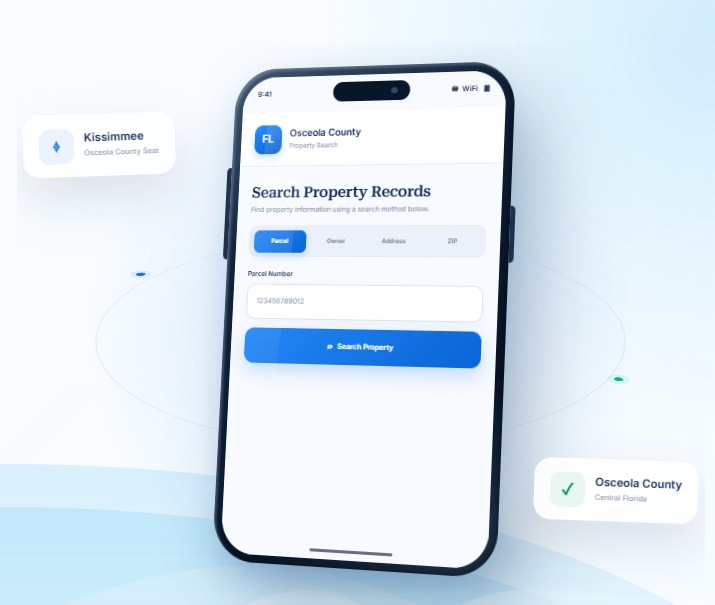
Search Osceola County property information by parcel number, owner’s name, property address, city, or ZIP code. Use advanced filters to narrow the list and locate the record that corresponds to the property.
Total Parcels
215,714
Data Source
Property Appraiser
Last update
2026 November
Explore Property Resources in Osceola County
Osceola County includes Kissimmee, St. Cloud, resort areas, and growing residential communities south of Orlando. FL
Parcel Point provides resources for understanding property taxes, estimating transfer expenses, exploring parcel maps, and learning about property records.
Property Taxes
Understand property tax assessments, find payment information, and review helpful guidance about important dates for property owners.
Doc Stamp Tax
Estimate documentary stamp taxes related to a Florida property transfer and learn about common transaction costs
Property Guide
Browse clear guides about property records, real estate terms, and common questions about researching or purchasing property.
Osceola County Property Search Tool Features
Whether you are checking a parcel number or looking into a property’s recorded details, a well-organized search can save
time. FL Parcel Point provides access to 120+ property data fields for Osceola County, grouped into categories covering
ownership, parcel information, legal descriptions, buildings, assessments, and past sales
- Explore publicly available property appraiser and parcel information.
- Use the property search tool free of charge.
- Search without signing up or creating an account
Ownership Records
Check who is listed in connection with the selected property. The record may include owner names, mailing addresses, and other ownership-related entries that help you identify the parties associated with the parcel.
Parcel Details
Explore the land-related entries, including parcel number, lot size, and recorded area where available. Together, these details provide a basic description of the property being searched.
Property Address
Review the street address connected with the parcel and any mailing address information included in the record. These details help link the database entry to the location you have in mind.
Legal Records
Explore legal descriptions and recorded references such as subdivision, block, or lot details when available. These identifiers provide a more formal way to describe the parcel than its street address alone.
Building Characteristics
Check the structural details associated with the property, including building type, construction year, living space, and available bedroom or bathroom information. These entries describe improvements rather than the land itself.
Assessment
Compare the valuation figures shown for the parcel, which may include just value, assessed value, and taxable value. Each figure serves a different purpose in the property assessment record.
Property Codes
Review the property's recorded use codes and classifications to understand how it is categorized in the database. These labels add context to the parcel information but should be read alongside the full record.
Property Sale History
Explore past sale information connected with the parcel. The record may include transaction dates, reported sale prices, and other available details about earlier transfers.
GIS Map
View the parcel in its geographic setting using the available GIS map. You can examine its mapped position, parcel boundaries, and nearby land to better understand the property's location.
Explore Osceola County Cities and Central Florida Communities
Osceola County includes Kissimmee and St. Cloud, alongside fast-growing residential communities and areas near the region’s major tourism corridors. Compare the local statistics to understand where population is concentrated and verify whether a property is inside a municipality or within unincorporated Osceola County.
Counties Near Osceola County, Florida
If you have not found the right property in Osceola County, nearby Central Florida counties may offer additional
areas to explore. FL Parcel Point helps you access property records across surrounding communities, so you can
compare locations and broaden your real estate search.
Osceola County Property Appraiser’s Office
The Osceola County Property Appraiser’s Office is an independently elected constitutional office responsible for carrying out property appraisal and exemption duties under Florida law. The current Property Appraiser is Katrina S. Scarborough, CFA, CCF, MCF. She leads the office and oversees its work in accordance with state requirements. The position is elected by county voters and operates independently of the Board of County Commissioners.
Office Location, Hours, and Contact Information
The Property Appraiser’s Office is located along East Irlo Bronson Memorial Highway in Kissimmee.
Office Detail | Information |
Official Name | Osceola County Property Appraiser |
Property Appraiser | Katrina S. Scarborough, CFA, CCF, MCF |
Address | 2505 E. Irlo Bronson Memorial Highway, Kissimmee, FL 34744 |
Main Phone | 407-742-5000 |
Fax | 407-742-4900 |
info@property-appraiser.org | |
Office Hours | Monday through Friday, 8:00 a.m. to 5:00 p.m., excluding county holidays |
Residents can contact the office by telephone, email, or in person. Customer service staff can direct inquiries to the appropriate department, including exemption services, agricultural classification, and tangible personal property.
Official office information is available through the Osceola County Property Appraiser.
Departments and Taxpayer Assistance
The Property Appraiser’s Office has several specialized departments that handle different parts of its statutory responsibilities. These include:
- Agriculture: Reviews applications for agricultural classification and helps applicants understand the requirements for qualifying agricultural land.
- Commercial and Tangible Personal Property: Handles commercial appraisal responsibilities and business tangible personal property requirements.
- Customer Service and Exemptions: Assists residents with homestead exemptions and other available property tax benefits.
- Information Technology: Supports the office’s technology systems and internal information services.
- Land Records and GIS: Provides technical mapping and land information support for the office.
- Residential: Handles residential appraisal responsibilities.
- Tax Roll: Coordinates work associated with the preparation and administration of the annual tax roll.
The office also provides guidance on exemptions for eligible senior citizens, veterans, people with disabilities, and qualifying nonprofit organizations. Homeowners may receive assistance with homestead exemption applications and the portability provisions of Florida’s Save Our Homes program.
Florida Statutes Governing the Office
The Property Appraiser’s authority comes from the Florida Constitution and state statutes. Several legal provisions are especially important:
- Article VII, Section 4, Florida Constitution: Establishes constitutional requirements for property valuation.
- Article VIII, Section 1(d), Florida Constitution: Provides for the election of county property appraisers.
- Chapter 192, Florida Statutes: Covers general provisions governing property taxation.
- Chapter 193, Florida Statutes: Addresses property assessments and appraisal requirements.
- Chapter 194, Florida Statutes: Covers administrative and judicial review of property tax assessments.
- Chapter 195, Florida Statutes: Establishes state administration and oversight of property taxation.
- Chapter 196, Florida Statutes: Covers property tax exemptions.
- Chapter 197, Florida Statutes: Addresses tax collection and enforcement.
These laws establish the framework for appraisal administration, exemption eligibility, state oversight, and the review of qualifying disputes.
Property Appraiser, Tax Collector, and Value Adjustment Board
The Property Appraiser, Tax Collector, and Value Adjustment Board have separate responsibilities within Florida’s property tax system.
The Property Appraiser administers appraisal duties, reviews exemption applications, and prepares the annual tax roll under state requirements.
The Tax Collector collects taxes after the tax roll has been certified. Osceola County Tax Collector Bruce Vickers operates a separate elected constitutional office. The Tax Collector also provides services involving vehicle registrations, titles, driver’s licenses, and other state-authorized transactions.
The Value Adjustment Board (VAB) provides an independent process for reviewing qualifying disputes involving property assessments, exemptions, and classifications. Property owners may file petitions when they disagree with certain decisions made by the Property Appraiser.
The Clerk of the Circuit Court provides administrative support for the VAB and its hearing process. The Property Appraiser may present information during a hearing, but the board is responsible for deciding the appeal.
Osceola County History and Local Government
County Establishment and Name Origin
Osceola County was established on May 12, 1887, from portions of Orange and Brevard counties. It became Florida’s 40th county and was named after Osceola, the well-known Seminole leader who resisted U.S. military efforts during the Seminole Wars.
Osceola was born Billy Powell in Alabama in 1804. He later became known by the name Osceola and emerged as an important leader during the conflicts of the 1830s. The county’s name and official heritage symbols recognize his historical significance.
Early Economic and Historical Development
During the late nineteenth century, the area developed as an important transportation and agricultural region. Riverboats and railroads connected inland settlements with markets elsewhere in Florida and beyond. Cattle ranching, sugar production, and lumber became important parts of the local economy.
The cattle industry has a particularly strong connection to the area’s history. Ranching traditions continue through agricultural businesses, cattle organizations, and community events such as the Silver Spurs Rodeo.
The development of St. Cloud also reflects an unusual part of local history. The community was founded in 1909 and attracted Union Army veterans who settled in the area after the Civil War. This connection helped establish its nickname, “Soldier City.”
Historic Places and Cultural Heritage
Several sites help preserve the county’s history and provide educational opportunities.
- Historic Osceola County Courthouse: Built in the Romanesque Revival style, the courthouse has been in continuous use since 1890. It was added to the National Register of Historic Places in 1977.
Florida Division of Historical Resources - Osceola County Welcome Center and History Museum: Features exhibits and information about local history, early settlement, agriculture, and community development.
- Pioneer Village at Shingle Creek: Preserves historic buildings and provides a look at rural life in early Central Florida.
- Osceola History Museum: Maintains collections and educational programs focused on the county’s cultural and historical development.
- Narcoossee Historic District: Reflects the area’s early settlement and the influence of British immigrants who helped introduce polo to the region.
These institutions and historic locations provide context for the county’s development, from its agricultural beginnings to its more recent growth in tourism and technology.
Board of County Commissioners
Osceola County operates under a commission-manager form of government. The Board of County Commissioners (BCC) consists of five elected members, each representing a single-member district. The board establishes county policies, adopts ordinances, approves budgets, and oversees public services and infrastructure.
The commissioners listed on the county’s official website for 2026 are:
- Peggy Choudhry – District 1
- Viviana Janer – District 2
- Brandon Arrington – District 3
- Cheryl L. Grieb – District 4
- Ricky Booth – District 5
Brandon Arrington serves as chairman, and Cheryl L. Grieb serves as vice chairwoman.
County Administration and Major Departments
The County Manager oversees day-to-day county operations and works with department directors to carry out policies approved by the Board of County Commissioners. Donald S. Fisher serves as County Manager. The County Manager’s Office coordinates administrative functions and supports the delivery of county services.
Major departments and service areas include:
Department | Main Responsibilities |
Community Development | Building, permitting, zoning, planning, development review, and code enforcement |
Public Works | Roads, transportation infrastructure, and related maintenance |
Fire and EMS | Fire protection, emergency medical response, and public safety services |
Emergency Management | Disaster planning, preparedness, response, and recovery coordination |
Animal Services | Animal care, shelter operations, and animal-related enforcement |
Housing and Community Services | Housing assistance and community support programs |
Corrections | County detention operations and related services |
Economic Development | Business recruitment, investment, and local economic growth |
Transportation and Transit | Transportation planning and public transit services |
Environment and Public Lands | Environmental programs and management of public lands |
Extension Services | Agricultural education and community-based educational programs |
Parks and Recreation | Public recreation facilities, parks, and community programs |
The county also provides financial administration, procurement, information technology, sustainability, library services, and tourism development programs.
Major Industries and Educational Institutions
Tourism and hospitality are important parts of the local economy. The county benefits from its location near major Central Florida attractions, hotels, entertainment venues, and visitor destinations. Restaurants, lodging businesses, transportation providers, and recreation services support this industry.
Agriculture remains important, particularly cattle ranching and related agricultural services. Osceola County is also working to expand employment in manufacturing, technology, life sciences, and research and development. NeoCity, a technology and innovation district, is a central part of this economic diversification strategy.
Valencia College and Osceola Technical College provide educational and workforce training opportunities. Their programs support career development in healthcare, business, technology, skilled trades, and other fields. The educational and research presence of nearby institutions also supports the county’s efforts to attract technology-based employers.
Osceola County Zoning Codes and Classifications
Osceola County administers zoning through its Land Development Code (LDC), which implements the county’s Comprehensive Plan. Chapter 3 contains the main zoning district descriptions, development standards, use regulations, planned development requirements, and special-purpose district provisions.
The county’s official zoning designation list includes agricultural, residential, commercial, industrial, mixed-use, employment, institutional, and planned-development districts. The following classifications are identified in the county’s zoning reference materials.
Agricultural and Estate Residential Districts
Zoning Code | Official Classification | General Purpose and Typical Uses |
AC | Agricultural Development and Conservation | Supports agricultural activities and conservation-oriented development. |
ARE | Agricultural Rural Estate | Provides for rural estate properties and compatible agricultural uses. |
E-1 | Estate Development | Allows estate-style residential development under the district’s standards. |
E-1A | Estate Development | Provides an additional estate residential classification with its own development requirements. |
E-2 | Estate Development | Supports lower-density estate development. |
E-2A | Estate Development | Provides an alternative estate development classification. |
E-5 | Estate Development | Allows estate-style residential development subject to its specific standards. |
Agricultural and estate districts are intended to accommodate rural living and compatible agricultural activities. Permitted uses and development intensity depend on the individual district and applicable standards.
Residential Zoning Districts
Zoning Code | Official Classification | General Purpose and Typical Uses |
HDR | High Density Residential | Provides for higher-density residential development, including multifamily housing where permitted. |
LDR | Low Density Residential | Supports lower-density residential development. |
MDR | Medium Density Residential | Accommodates residential development at medium densities. |
MDR-M | Medium Density Residential – Manufactured Product | Provides for medium-density residential development involving manufactured housing products. |
R-1 | Rural Development One Acre | Provides for rural residential development with a one-acre standard. |
R-2 | Rural Development Two Acres | Provides for rural residential development with a two-acre standard. |
R-1M | Rural Development One Acre Manufactured Home | Allows manufactured homes in the one-acre rural development district. |
R-2M | Rural Development Two Acres Manufactured Home | Allows manufactured homes in the two-acre rural development district. |
RM-1 | Residential Multi-Family One | Provides for multifamily residential development under district-specific standards. |
RM-2 | Residential Multi-Family Two | Accommodates multifamily housing at a different development intensity. |
RM-3 | Residential Multi-Family Three | Provides for multifamily residential development under its applicable standards. |
RMH | Residential Manufactured Housing | Provides for manufactured housing development. |
RMH-1 | Residential Manufactured Housing | Provides an additional manufactured housing classification. |
RMH-1A | Residential Manufactured Housing | Allows manufactured housing under a separate set of district requirements. |
RS | Rural Settlement | Supports residential development within designated rural settlement areas. |
RS-1 | Residential Single Family | Intended primarily for detached single-family homes. |
RS-1A | Residential Single Family | Provides for single-family development under additional district standards. |
RS-1C | Residential Single Family | Provides a separate single-family residential classification. |
RS-2 | Residential Single Family | Allows single-family residential development under its specific requirements. |
RS-3 | Residential Single Family | Provides another single-family residential classification with separate development standards. |
US | Urban Settlement | Supports residential and compatible development within designated urban settlement areas. |
US-M | Urban Settlement Manufactured Product | Provides for manufactured housing within designated urban settlement areas. |
Residential zoning districts differ in their permitted housing types, density, minimum lot dimensions, setbacks, and building requirements. A manufactured housing classification does not automatically allow every type of mobile or manufactured home; the applicable district standards and state requirements still apply.
Commercial, Employment, and Industrial Zoning Districts
Zoning Code | Official Classification | General Purpose and Typical Uses |
CG | Commercial General | Accommodates a broad range of commercial businesses and services. |
CN | Commercial Neighborhood | Provides smaller-scale businesses and services for nearby residential areas. |
CO | Commercial Office | Supports office-based businesses and professional services. |
CR | Commercial Restricted | Allows selected commercial uses subject to additional restrictions. |
CT | Commercial Tourist | Supports businesses and services serving visitors and tourism-related activity. |
EC | Employment Commercial | Provides for commercial and employment-oriented uses. |
ECC | Employment Center Core | Supports central employment and business activities within designated employment areas. |
ECP | Employment Center Perimeter | Provides compatible development around employment center core areas. |
IB | Industrial Business | Accommodates industrial and business-related activities. |
IG | Industrial General | Provides for general industrial operations. |
IM | Industrial Manufacturing | Supports manufacturing and production activities. |
IR | Industrial Restricted | Allows selected industrial uses subject to additional restrictions. |
Commercial districts vary in the intensity and type of business activity they allow. Neighborhood commercial areas are intended for smaller-scale services, while general commercial and tourist districts provide for a wider range of businesses. Industrial districts are intended for production, manufacturing, and other employment-related operations.
Mixed-Use, Community Center, and Planned Development Districts
Zoning Code | Official Classification | General Purpose and Typical Uses |
CCC | Community Center Core | Provides for the central uses and activities within designated community centers. |
CCP | Community Center Perimeter | Supports compatible development around community center core areas. |
MXD | Mixed Use District | Allows a coordinated combination of residential and non-residential uses. |
NCC | Neighborhood Center Commercial | Provides commercial services intended to serve nearby neighborhoods. |
NCM | Neighborhood Center Mixed | Allows a mix of neighborhood commercial and compatible uses. |
PD | Planned Development | Allows coordinated development under an approved development plan. |
PMUD | Planned Mixed Use Development | Provides for planned projects combining different types of land uses. |
STRPD | Short Term Rental Planned Development | Provides for approved planned developments involving short-term rental uses. |
UCC | Urban Center Core | Supports the central uses and activities within designated urban centers. |
UCP | Urban Center Perimeter | Provides compatible development around urban center core areas. |
RPB | Residential Professional Business | Allows residential and professional business uses under the applicable district standards. |
Planned development districts allow the county to review a project as a coordinated plan. Approval may include specific conditions for permitted uses, site layout, infrastructure, access, building design, and other development requirements.
Institutional and Special-Purpose Districts
Zoning Code | Official Classification | General Purpose |
IN | Institutional | Provides for institutional and public-serving uses, subject to the applicable district standards. |
INCORP | Incorporated into the City | Identifies areas incorporated into a municipality rather than regulated under the county’s standard zoning districts. |
RCID | Reedy Creek Improvement District | Identifies the Reedy Creek Improvement District, a special-purpose governmental district. |
TTP | Travel Trailer Park | Provides for travel trailer park uses under applicable development requirements. |
The INCORP designation is a jurisdictional classification, not a conventional residential or commercial zoning district. RCID identifies a special-purpose district with its own governmental and development framework.
County Zoning and Municipal Zoning
The county’s Land Development Code generally applies to unincorporated areas under Osceola County jurisdiction. The City of Kissimmee and City of St. Cloud administer their own zoning regulations and development approval procedures within their municipal boundaries.
A county zoning classification should not automatically be assumed to apply inside an incorporated city. The responsible planning authority depends on the location and jurisdiction of the proposed development.
Zoning districts must also be distinguished from future land-use designations. Future land use is part of the county’s Comprehensive Plan and provides a broader framework for planned development. Zoning establishes more specific rules about permitted uses, building standards, and development intensity.
Some uses are allowed without a public hearing when they meet the applicable code requirements. Other uses are classified as conditional uses and require public hearing approval. The county may also require site development plans, building permits, or other approvals.
The current Osceola County Land Development Code provides the official district descriptions and development standards. Applicants should check the latest regulations because zoning requirements and permitted uses may change through ordinance amendments.
ZIP Codes Within Osceola County
Osceola County is associated with standard delivery ZIP codes and PO Box ZIP codes. Some postal service areas extend beyond county boundaries, so a ZIP code or postal city name should not be treated as an exact indicator of local government jurisdiction.
ZIP Code | Postal Community | ZIP Code Type | Geographic Notes |
33848 | Intercession City | PO Box | Primarily used for post office box delivery. |
33896 | Davenport | Standard | Serves the Four Corners and ChampionsGate area; the postal area extends across county boundaries. |
34739 | Kenansville | Standard | Serves the rural Kenansville area. |
34741 | Kissimmee | Standard | Serves central Kissimmee-area addresses. |
34742 | Kissimmee | PO Box | Primarily used for post office box delivery. |
34743 | Kissimmee | Standard | Includes the Buenaventura Lakes area. |
34744 | Kissimmee | Standard | Serves Kissimmee and parts of the St. Cloud postal area. |
34745 | Kissimmee | PO Box | Primarily used for post office box delivery. |
34746 | Kissimmee | Standard | Serves southern Kissimmee-area addresses, including Campbell. |
34747 | Kissimmee | Standard | Serves the Celebration and Four Corners areas. |
34758 | Kissimmee | Standard | Serves Poinciana and nearby communities. |
34759 | Kissimmee | Standard | Serves parts of the Poinciana area and extends toward Polk County. |
34769 | Saint Cloud | Standard | Serves central St. Cloud-area addresses. |
34770 | Saint Cloud | PO Box | Primarily used for post office box delivery. |
34771 | Saint Cloud | Standard | Serves eastern St. Cloud-area addresses. |
34772 | Saint Cloud | Standard | Serves southern St. Cloud-area addresses. |
34773 | Saint Cloud | Standard | Serves the rural eastern and southeastern part of the county. |
ZIP Code Boundary Considerations
ZIP codes are designed for mail delivery and do not necessarily follow county or municipal boundaries. The 33896 and 34759 service areas are examples where postal coverage extends toward neighboring counties. The 34747 postal area also includes communities near the Four Corners area, where county boundaries meet.
PO Box ZIP codes, including 33848, 34742, 34745, and 34770, are primarily intended for post office box delivery rather than broad residential street-address coverage.
A postal community name does not establish which county or municipality provides local services. For development, permitting, and other government matters, the actual jurisdiction should be confirmed separately from the mailing ZIP code.
Development Review and Building Permits
Osceola County’s Community Development Department oversees building, permitting, code enforcement, development review, planning and design, and zoning services. The department coordinates these functions to ensure that development follows the county’s Land Development Code and Comprehensive Plan.
The department includes several offices:
- Building and Permits: Handles building permit applications, plan reviews, and construction-related approvals.
- Code Enforcement: Addresses violations of county codes, land-use regulations, and applicable statutes.
- Development Review: Coordinates review of development proposals and supporting technical requirements.
- Zoning and Land Use: Administers zoning regulations and reviews permitted and conditional uses.
- Planning and Design: Maintains the Comprehensive Plan and reviews proposed land-use and zoning changes.
- Impact and Mobility Fees: Administers applicable fees associated with development and infrastructure needs.
The Community Development Department is located at 1 Courthouse Square, Suite 1400, Kissimmee, FL 34741. Its main phone number is 407-742-0200.
Some development proposals require additional approvals, including conditional-use hearings, zoning map amendments, or planned development review. Building permits may also require site plans, construction drawings, inspections, and approvals from other agencies.
Projects inside Kissimmee or St. Cloud generally follow the respective city’s permitting and development procedures. Applicants should confirm the correct reviewing authority before starting construction, renovation, or a change in land use.
- County seat: Kissimmee, Florida
- Regional setting: Central Florida
- Time zone: Eastern Time
- Total area: 1506 square miles
- Land area: 1327.5 square miles
- Water area: 178.5 square miles
- Natural setting: Lakes, wetlands, pastureland, and rapidly growing communities create contrasting property settings in Osceola County.
- Land-use context: Growth-area zoning, floodplains, and conservation lands can materially affect parcel-level use.
- Parcel-level verification: Use the county property appraiser, planning department, and official map layers to confirm details for a specific parcel.
Frequently Asked Questions
How can I research a Osceola property when its address is incomplete or uses a rural route?
: Try a map-based search, nearby road or intersection, owner name, or any partial location details you have. Rural properties may use route descriptions or community names rather than a conventional street address. Once a likely result appears, compare the parcel number and legal description before treating it as the correct property.
What should I review when a Osceola parcel is described as waterfront or water-access property?
: Waterfront wording in a listing can refer to direct frontage, a canal, a view, nearby public access, or a shared facility. Check the parcel’s actual location, legal description, access rights, shoreline or riparian issues, and any applicable environmental rules. A map or marketing label alone does not establish private water access or ownership to the water’s edge.
How can I check whether a Osceola parcel may have drainage, wetland, shoreline, or flood-related constraints?
: Property appraiser and GIS information may not contain complete flood, wetland, drainage, shoreline, or conservation determinations. Check the relevant flood maps and environmental or water-management agency records, then seek parcel-specific guidance where needed. In planned subdivisions, tourism-area properties, rural land, and parcels near lakes or conservation areas, the physical setting may make these checks particularly important, but no general location label settles the question.
4. What should I know when researching a property in a planned or master-planned community in Osceola?
: Planned communities may have recorded plats, design standards, association declarations, common areas, and phased development records. Review the specific lot’s legal description and the governing documents, then confirm current development status with the association or local planning office. A community name alone does not establish the rules that apply to an individual parcel.
Can the online property map establish the exact boundary of a Osceola lot?
: No. A GIS outline is a reference layer and may not show a legally surveyed boundary. Mapping scale, data updates, and older parcel geometry can affect how a line appears. If the exact location of a boundary, encroachment, easement, or setback matters, review the recorded description and use a qualified surveyor.
. What should I check if the owner name in a Osceola property profile does not match the occupant?
: Occupancy, management, mailing details, and recorded ownership are not necessarily the same. A property may be rented, managed by an agent, held by a trust or company, or involved in a recent transfer. For legal ownership, review the recorded deed and clerk’s official records rather than relying only on the appraiser’s owner field.
. Can a Osceola property record confirm whether a driveway, fence, or addition is legally permitted?
A property record does not by itself establish that a fence, driveway, addition, or other improvement complies with local rules or private restrictions. Check permits, zoning requirements, easements, setbacks, and any association documents. For a disputed structure or boundary, consult the responsible building office and a qualified surveyor or attorney as appropriate.
What is worth checking when a Osceola property has a trust, estate, or company listed as its owner?
A trust, estate, or company name may appear because the property is held or administered through that entity. The appraiser’s display name does not explain the authority of an individual to sell or manage the property. Review recorded instruments and, where relevant, probate or entity documents with a title professional or attorney.
How do I distinguish the correct parcel when a Osceola search returns properties with similar names or addresses?
: Do not rely on a matching owner name or street name alone. Compare the full situs address, parcel number, property type, and map location. In planned subdivisions, tourism-area properties, rural land, and parcels near lakes or conservation areas, similar descriptions can refer to different parcels or property settings. Keep the parcel identifier with your notes so later document searches stay tied to the same land.
Which checks are useful when comparing two adjoining properties in Osceola?
: Compare each parcel’s identification number, legal description, dimensions, access, and mapped position. Adjacent lots may have different zoning, recorded easements, drainage patterns, or local jurisdiction. For planned subdivisions, tourism-area properties, rural land, and parcels near lakes or conservation areas, also consider whether the surrounding land or water features affect access or permitted use. Confirm important differences through official records.