
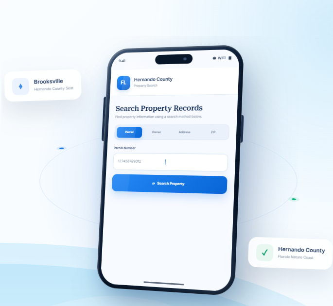
Hernando County Property Records Search
Look up Hernando County property appraiser records using a parcel number, owner name, property address, city, or ZIP code. Choose the search method that fits the information you have and refine results as needed.
Total Parcels
120,890
Data Source
Property Appraiser
Last update
2026 November
Explore Property Tools and Guides in Hernando County
Hernando County blends growing residential communities around Brooksville and Spring Hill with rural land and natural
areas. FL Parcel Point offers useful resources for understanding property taxes, estimating transfer costs, exploring
parcel maps, and learning about property records.
Property Taxes
Find property tax information, understand assessment basics, and review helpful guidance about payments and important tax dates.
Doc Stamp Tax
Estimate documentary stamp taxes connected with a property transfer and learn more about Florida’s real estate transaction costs.
Property Guide
Browse practical guides to property records, real estate language, and common questions about researching, buying, or owning property.
Hernando County Property Search Tool Features
A Hernando County property lookup may involve checking its owner record, land characteristics, building details, and assessed values. FL Parcel Point groups access to 120+ property data fields into clear categories so you can review each type of information in context. Explore the available entries and use the field descriptions to clarify unfamiliar terms
- Explore publicly available property appraiser and parcel information.
- Use the property search tool free of charge.
- Search without signing up or creating an account.
Ownership Records
Check who is listed in connection with the selected property. The record may include owner names, mailing addresses, and other ownership-related entries that help you identify the parties associated with the parcel.
Parcel Details
Explore the land-related entries, including parcel number, lot size, and recorded area where available. Together, these details provide a basic description of the property being searched.
Property Address
Review the street address connected with the parcel and any mailing address information included in the record. These details help link the database entry to the location you have in mind.
Legal Records
Explore legal descriptions and recorded references such as subdivision, block, or lot details when available. These identifiers provide a more formal way to describe the parcel than its street address alone.
Building Characteristics
Check the structural details associated with the property, including building type, construction year, living space, and available bedroom or bathroom information. These entries describe improvements rather than the land itself.
Assessment
Compare the valuation figures shown for the parcel, which may include just value, assessed value, and taxable value. Each figure serves a different purpose in the property assessment record.
Property Codes
Review the property's recorded use codes and classifications to understand how it is categorized in the database. These labels add context to the parcel information but should be read alongside the full record.
Property Sale History
Explore past sale information connected with the parcel. The record may include transaction dates, reported sale prices, and other available details about earlier transfers.
GIS Map
View the parcel in its geographic setting using the available GIS map. You can examine its mapped position, parcel boundaries, and nearby land to better understand the property's location.
Explore Hernando County Cities and Nature Coast Communities
Hernando County includes Brooksville and the City of Weeki Wachee, alongside many well-known unincorporated communities. Reviewing the municipality information helps users separate formal municipal jurisdictions from census-designated or neighborhood names when locating a property and interpreting local parcel information.
Counties Near Hernando County, Florida
If you have not found the right property in Hernando County, nearby counties along Florida’s Nature Coast and
Tampa Bay region may offer alternatives. FL Parcel Point helps you access property records across surrounding
communities and broaden your search with more locations to explore.
About the Hernando County Property Appraiser’s Office
The Hernando County Property Appraiser’s Office is responsible for carrying out property appraisal duties and administering applicable property tax exemptions under Florida law. The office currently identifies Randy Mazourek as the Hernando County Property Appraiser. The position is a constitutional county office established under Florida law and is separate from the Board of County Commissioners.
The office provides assistance to homeowners, businesses, agricultural property owners, and other taxpayers. Its work also includes maintaining official addressing information and supporting the county’s geographic information services.
Office Locations and Contact Information
The main Property Appraiser’s Office is located in Brooksville. Residents can also visit the Westside Office in Spring Hill for assistance with services offered at that location.
Office detail | Information |
Main office | 201 Howell Avenue, Suite 300, Brooksville, FL 34601 |
Main phone | (352) 754-4190 |
Fax | (352) 754-4198 |
pa@co.hernando.fl.us | |
Main office hours | Monday–Friday, 8:00 a.m.–4:45 p.m. |
Westside office | 7525 Forest Oaks Boulevard, Spring Hill, FL 34606 |
Addressing office | 7509 Forest Oaks Boulevard, Spring Hill, FL 34606 |
The office recommends contacting staff before visiting the Westside or Addressing Office to confirm which services are available at each location. The Hernando County Property Appraiser’s official website provides current contact information and office updates.
Main Services and Office Responsibilities
The Property Appraiser’s Office handles several responsibilities beyond maintaining information used for local property taxation. Its service areas include:
- Exemptions: Provides information and assistance with homestead, senior, portability, and other property tax exemption programs.
- Agricultural Classification: Handles applications and questions involving agricultural land classification, including qualifying citrus, crop, nursery, pasture, and timber operations.
- Tangible Personal Property: Assists businesses with reporting requirements for taxable business equipment, furniture, machinery, and other qualifying assets.
- Addressing Services: Maintains addressing information and processes certain address-related requests to support consistent property identification and emergency response.
- Central GIS Support: Provides geographic information services used by county departments and the public.
- Public Records Administration: Responds to public-records requests for records maintained by the office, subject to Florida’s applicable confidentiality laws.
These services are particularly useful for business owners, agricultural operators, and residents applying for property tax benefits.
Florida Statutes Governing the Office
The Property Appraiser’s authority and responsibilities are established through several sections of Florida law.
- Florida Statute 192.011: Requires the Property Appraiser to assess property located within the county, subject to statutory exceptions.
- Florida Statute 193.023: Establishes requirements for determining property assessments.
- Florida Statute 195.027: Addresses the Department of Revenue’s authority and the collection of information needed for property assessment administration.
- Florida Statute 196.011: Establishes application requirements for certain property tax exemptions.
- Florida Statute 194.011: Provides procedures for taxpayers who wish to challenge an assessment or exemption decision.
- Florida Statute 194.015: Establishes a Value Adjustment Board in each county.
Together, these laws provide the legal framework for the office’s work and establish procedures for taxpayers who need to question an official decision.
Property Appraiser, Tax Collector and Value Adjustment Board
Florida separates property appraisal, tax collection, and administrative review into different responsibilities.
The Property Appraiser handles property assessments and applicable exemptions or classifications. The Tax Collector collects property taxes and distributes the money to the appropriate taxing authorities. The Value Adjustment Board (VAB) provides an administrative process for reviewing certain disputes involving property assessments, exemptions, and classifications.
The VAB is separate from the Property Appraiser’s appraisal staff. Taxpayers who disagree with an assessment or an exemption decision may have the right to request an informal discussion or file a petition under the procedures and deadlines established by Florida law.
Hernando County History, Government and Local Information
Establishment and Origin of the County’s Name
Hernando County was established on February 27, 1843, before Florida became a state. Its original boundaries covered a much larger region than the county does today. The territory included areas that later became part of Citrus and Pasco counties.
The county was named after Hernando de Soto, the Spanish explorer whose expedition traveled through the region during the 16th century. In 1887, the Florida Legislature divided the original county into three separate counties: Hernando, Citrus, and Pasco. The present county boundaries date from that division.
Historic Places and Local Heritage
Hernando County has several historic sites that help explain its settlement and development.
Chinsegut Hill Historic Site is one of the county’s best-known historic properties. The site includes the historic Chinsegut Hill Manor House, which is listed on the National Register of Historic Places. The property has served different purposes over time, including as a private residence, educational setting, and retreat facility. Hernando County manages the grounds and retreat facilities under an agreement with the Florida Department of Environmental Protection, while the Tampa Bay History Center manages the historic building.
The Brooksville Commercial Historic District also reflects the county’s early development. Its historic buildings show how the local business center grew through the late 19th and early 20th centuries. Historic properties can be subject to additional preservation considerations when owners plan major exterior changes, rehabilitation, or redevelopment.
These sites are valuable community resources and provide context for understanding the county’s architectural and cultural history.
County Government Structure
Hernando County operates under a five-member Board of County Commissioners (BOCC). Each commissioner represents a geographic district and serves a four-year term. The commissioners are elected by county voters, and the board selects its chair and vice chair.
The BOCC is the county’s main legislative and policy-making body. Its responsibilities include:
- Adopting the county budget and approving public spending.
- Passing county ordinances and resolutions.
- Establishing policies for county departments and services.
- Reviewing land-use and development matters that require board approval.
- Overseeing county infrastructure and public facilities.
- Supporting public safety, transportation, and community services.
The board also serves as the governing body of the Hernando County Water and Sewer District, which provides water and wastewater services in areas under its jurisdiction.
County Administration and Major Departments
The County Administrator manages the day-to-day operations of departments that report to the BOCC. The administrator coordinates department activities, oversees county employees, and helps prepare the annual operating budget for board review.
Major county service areas include:
- Development Services: Coordinates planning, zoning, building, and development review functions.
- Public Works: Handles roadway maintenance, infrastructure operations, and related public services.
- Public Safety: Coordinates emergency management, fire rescue, and other county safety functions.
- Engineering: Supports infrastructure planning, technical reviews, and construction projects.
- Economic Development: Works to attract businesses, support local employers, and encourage investment.
- Housing and Supportive Services: Connects eligible residents with housing assistance and community support programs.
- Airport Operations: Oversees county airport-related activities and facilities.
The county also maintains public services through its libraries, parks and recreation programs, transit system, and UF/IFAS Extension office.
Local Economy and Major Industries
Hernando County has a diverse economy supported by healthcare, retail, construction, manufacturing, professional services, transportation, and tourism. Healthcare and social assistance are important employment sectors, while retail trade and professional services support a large number of local businesses.
The 2024 Florida Economic Development Research county profile reported 4,659 business establishments across all industries. Professional and business services, trade and transportation, construction, and education and health services represented major parts of the local business base.
The county’s economic development efforts also focus on attracting new employers and supporting existing businesses. The Brooksville-Tampa Bay Regional Airport contributes to the county’s business and transportation infrastructure, while local tourism and recreation businesses benefit from the area’s historic attractions and outdoor destinations.
Hernando County Zoning Codes and Classifications
Hernando County regulates land use in its unincorporated areas through Appendix A, the Zoning section of the county Code of Ordinances. The code establishes residential, agricultural, commercial, industrial, conservation, mining, and special-purpose districts.
Each district has its own permitted uses, setbacks, lot dimensions, and development standards. The following classifications are identified in the county’s zoning ordinance.
Residential Zoning Districts
Zoning code | Official classification | General purpose |
R-1A | Residential District | Supports established residential areas with a mixture of conventional single-family homes and mobile homes. |
R-1B | Residential District | Provides for medium-density single-family development, particularly in urbanizing areas. |
R-1C | Residential District | Encourages and protects low-density single-family development. |
R-2.5 | Residential District | Allows low-density single-family development at a maximum density of 2.5 dwelling units per acre. |
RM | Residential Mobile Home District | Provides for low-density mobile home subdivisions. |
R-2 | Residential District | Allows medium-density residential development, including single-family and two-family dwellings. |
R-3 | Residential District | Allows higher-density residential development with single-family and multifamily dwellings. |
R-4 | Residential District | Provides for higher-density single-family and multifamily residential development. |
R-1-MH | Residential Single-Family Manufactured Housing District | Provides for low-density development using manufactured or modular housing. |
Agricultural and Agricultural/Residential Districts
Zoning code | Official classification | General purpose |
A/R | Agricultural/Residential District | Allows single-family homes while maintaining the open character of rural land. |
A/R-1 | Agricultural/Residential District | Allows single-family mobile homes in rural areas while preserving open land. |
A/R-2 | Agricultural/Residential District | Supports established low-density neighborhoods with a mixture of conventional homes and mobile homes. It is not intended for future development. |
County 2.5 | County 2.5 District | Provides for low-density residential use and limited agricultural activities in a semirural setting. |
AG | Agricultural District | Protects productive agricultural land and areas intended to retain a rural, open character. |
Commercial and Office Zoning Districts
Zoning code | Official classification | General purpose |
C-1 | General Commercial District | Provides for general retail shopping, convenience goods, shopping goods, personal services, and limited institutional uses. |
C-2 | Highway Commercial District | Accommodates highway-oriented businesses and automobile-related services, generally in planned commercial groupings. |
C-3 | Neighborhood Commercial District | Supports smaller commercial areas serving nearby residential communities. |
C-4 | Heavy Highway Commercial District | Provides for heavier commercial uses along major highways, preferably in organized commercial groupings. |
A-C | Agricultural Commercial District | Allows limited commercial activities that serve nearby rural and agricultural areas. |
OP | Office-Professional District | Provides for administrative, professional, and related low-profile office uses. |
R-C | Recreational Commercial District | Allows recreational vehicle and travel-trailer parks with temporary or seasonal occupancy, subject to the district’s time limits. |
Industrial, Marine and Special-Purpose Districts
Zoning code | Official classification | General purpose |
I-1 | Industrial District | Supports light industrial development, distribution, research, processing, storage, and related commercial activities. |
I-2 | Heavy Industrial District | Accommodates heavier manufacturing, processing, production, assembly, warehousing, and distribution activities. |
CM-1 | Marine Commercial District | Provides for commercial marinas and waterfront-dependent activities serving recreational boating and fishing. |
CM-2 | Heavy Marine Commercial District | Allows more intensive marine uses, including commercial fishing facilities, boat maintenance, and seafood handling. |
CV | Conservation District | Protects designated public and quasi-public conservation lands and important natural resources. |
M | Mining District | Provides for the extraction of natural resources in areas where those resources are found. |
PDP | Planned Development Project District | Allows customized development under an approved master plan, including specific permitted uses and project standards. |
Overlay Districts
The county also recognizes overlay zoning designations. These are added to an underlying zoning district and do not replace its basic classification.
Zoning code | Official classification | General purpose |
PSF | Public Service Facility Overlay District | Allows qualifying governmental and public service uses or structures on designated property. |
Resort Overlay District | Resort Overlay District | Allows resort residential uses on qualifying residential, rural, or conservation-zoned property, subject to approval. |
A Planned Development Project (PDP) is different from a standard zoning district because its permitted uses and development standards are customized through an approved master plan. A property with PDP zoning must follow the conditions and permitted uses in its specific approval rather than relying only on the general rules for a conventional district.
County Zoning Versus Municipal Zoning
The county’s zoning ordinance applies to unincorporated areas within Hernando County’s jurisdiction. The City of Brooksville has its own planning and zoning authority within city limits. A property located inside the city may therefore follow municipal regulations rather than the county’s zoning classifications.
The county Planning and Zoning Division reviews rezoning requests, master plans, special exceptions, conditional uses, and other development matters under county jurisdiction. Its staff also reviews site plans and provides information about applicable zoning requirements.
The Hernando County Planning and Zoning Department provides access to zoning resources, application information, and development regulations. Contacting the department is important when a project involves a PDP district, overlay designation, or use that may require additional approval.
ZIP Codes Within Hernando County, Florida
Hernando County is served by standard ZIP codes and several PO Box ZIP codes. Some postal ZIP code areas also extend beyond the county boundary. The postal community name does not always identify the county where an address is physically located.
The following table separates ZIP codes associated with addresses in Hernando County from ZIP codes that only partially extend into the county.
Standard ZIP Codes
ZIP code | Postal community | ZIP code type | Geographic notes |
34601 | Brooksville | Standard | Serves Brooksville and surrounding areas. |
34602 | Brooksville | Standard | Covers additional Brooksville-area addresses. |
34604 | Brooksville | Standard | Serves residential and business addresses in the Brooksville area. |
34606 | Spring Hill | Standard | Serves the Spring Hill area. |
34607 | Spring Hill | Standard | Covers addresses in the Spring Hill postal area. |
34608 | Spring Hill | Standard | Serves residential and commercial addresses in Spring Hill. |
34609 | Spring Hill | Standard | Covers a large part of the Spring Hill postal area. |
34613 | Brooksville | Standard | Serves addresses in the northern Brooksville postal area. |
34614 | Brooksville | Standard | Covers additional addresses in the Brooksville postal area. |
PO Box ZIP Codes
ZIP code | Postal community | ZIP code type | Notes |
34603 | Brooksville | PO Box | Used for post office box delivery. |
34605 | Brooksville | PO Box | Used for post office box delivery. |
34611 | Spring Hill | PO Box | Used for post office box delivery. |
34636 | Istachatta | PO Box | Associated with post office box delivery. |
34661 | Nobleton | PO Box | Associated with post office box delivery. |
ZIP Codes That Partially Extend Into Hernando County
ZIP code | Postal community | ZIP code type | Boundary clarification |
33523 | Dade City | Standard | Most of the ZIP code is associated with Pasco County, but part of its postal area extends into Hernando County. |
33597 | Webster | Standard | Primarily associated with Sumter County, with a portion extending into Hernando County. |
The two partial ZIP code areas should not be treated as entirely within Hernando County. A 2022 regional needs assessment found that approximately 17.3% of ZIP code 33523 addresses and 16.8% of ZIP code 33597 addresses were located in Hernando County.
ZIP codes are postal delivery areas rather than official government boundaries. For legal, permitting, or jurisdictional matters, the physical location of an address determines whether county or municipal rules apply. PO Box ZIP codes should also be distinguished from standard ZIP codes used for street delivery.
Planning, Building Permits and Development Administration
Hernando County’s Development Services functions help manage construction and land development under the county’s adopted regulations. Planning and Zoning reviews land-use matters, while the Building Division handles building permits and construction-related requirements.
A development proposal may need several separate approvals. Depending on the project, these can include zoning approval, site plan review, a special exception or conditional use, building permits, and required inspections.
Planning and Zoning Review
The Planning Department manages the county’s Comprehensive Plan and Land Development Regulations. Its responsibilities include reviewing rezoning applications, development master plans, special exceptions, conditional uses, and concurrency matters. Concurrency review considers whether public facilities and services can support proposed development.
The Zoning Division administers the county zoning code and reviews site plans for residential and commercial projects. It also handles certain permits and requests involving fences, tree removal, temporary uses, and easement matters.
Building Permits and Construction Requirements
The Building Division administers construction permitting and inspections. Property owners and contractors may need permits before starting new construction, additions, structural alterations, or other regulated work.
The county’s Civic Access system provides online access to permitting and licensing services. Building-related inquiries can be directed to (352) 754-4050, while Planning and Zoning inquiries can be directed to (352) 754-4057.
Development Approval for Planned Projects
Projects with PDP zoning require particular attention because their permitted uses and development standards are tied to an approved master plan and associated conditions. A proposed change that differs from the approved plan may require additional county review or an amendment.
Before purchasing land for a specific business, residential project, or industrial operation, developers should confirm the zoning district and review any applicable master plan, overlay designation, and approval conditions with the county’s Development Services staff.
- County seat: Brooksville, Florida
- Regional setting: Florida Nature Coast
- Time zone: Eastern Time
- Total area: 715.4 square miles
- Land area: 473 square miles
- Water area: 242.4 square miles
- Natural setting: Springs, karst terrain, Gulf coast wetlands, and forested uplands produce varied land conditions.
- Land-use context: Sinkhole risk, flood mapping, and wetland presence are useful items to check before making land decisions.
- Parcel-level verification: Use the county property appraiser, planning department, and official map layers to confirm details for a specific parcel.
Frequently Asked Questions
Can a property record show whether a detached structure is officially recognized in Hernando?
Compare the measurement method and date used by each source. Listings may round acreage or rely on older marketing information, while GIS measurements are approximate and tax records may reflect a recorded parcel description. For a transaction or boundary decision, review the legal description and obtain a current survey rather than choosing one online figure.
How can I check whether a Hernando property is affected by a conservation or land-use restriction?
Online property profiles may update after permits are issued, work is inspected, or assessment data is processed. Some improvements may not be reflected immediately or may be recorded under a separate building feature. Check the local building department’s permit records and ask the property appraiser how and when improvements are incorporated into the assessment roll. A useful next step is to compare the parcel’s exact location with the relevant local map and official record.
Where should I turn when a property appraiser record does not answer my legal question in Hernando?
Treat the online profile as one source, not the complete file. Check the relevant clerk’s recorded instruments, permit history, GIS layers, and planning or zoning information as needed. Different offices maintain different records, and updates may occur on different schedules. If a key detail remains unclear, contact the office responsible for that record type.
Are online parcel boundaries enough to settle a boundary question in Hernando?
Use the appraiser’s transfer history as a starting point, then search the clerk’s official records for the deed or other recorded instrument. Check the document’s recording details and legal description. A change may not appear immediately in every online system, and a property profile should not replace review of the actual recorded document.
How can I tell whether a property is inside a city limit or in an unincorporated part of Hernando?
Try a map search, nearby road or intersection, owner name, or any partial address information available. Rural parcels may use route descriptions or location references that do not behave like standard urban street addresses. Once you find a likely match, verify its parcel number and legal description before using it for further research. A useful next step is to compare the parcel’s exact location with the relevant local map and official record.
How can I check whether a parcel in Hernando has been split or combined with another lot?
Begin with the parcel number if it is available, then compare the situs address and map position. Postal labels are designed for mail delivery and do not always match municipal boundaries. If jurisdiction affects permits, zoning, or services, ask the county or municipality to confirm which government has authority over that exact parcel.
How can I research a commercial parcel differently from a home in Hernando?
No. A property appraiser profile describes assessment information; it is not a building permit, zoning approval, or development authorization. Confirm current zoning, future land-use designation, legal access, utilities, setbacks, environmental limits, and any required permits with the applicable planning and building departments before making plans.
How should I verify a recent deed or ownership change for a Hernando property?
No. GIS parcel lines are reference information and can be affected by mapping scale, data updates, and the source of the underlying geometry. They are helpful for locating neighboring parcels, but a licensed survey is the appropriate tool for establishing boundary locations, encroachments, or disputed lines. A useful next step is to compare the parcel’s exact location with the relevant local map and official record.
How do I check whether a Hernando parcel has legal road access?
A property-use code is not a guarantee that a proposed activity is allowed. Review zoning, future land use, development standards, access, utilities, and any applicable environmental rules with the government that has jurisdiction. Ask for confirmation tied to the parcel number and proposed use, since general neighborhood descriptions may not establish what is permitted.
Why might the same property have different names or addresses across Hernando records?
Do not select a result based on the owner’s name or street name alone. Compare the full address, parcel number, property type, and mapped location. For properties in suburban subdivisions, wooded parcels, and properties near springs or conservation land, nearby parcels may have similar descriptions while differing in access, jurisdiction, or physical setting. Save the parcel identifier so later checks refer to the same property.