
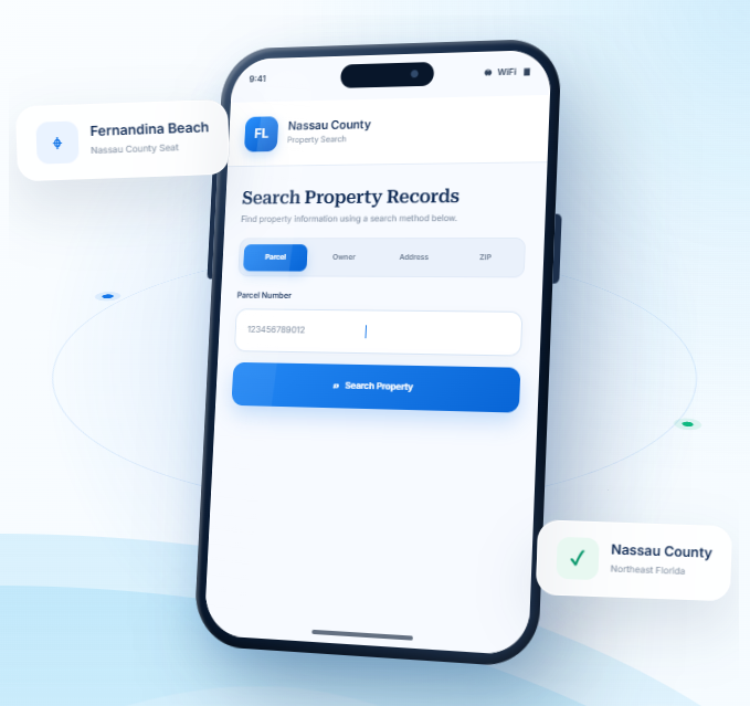
Nassau County Property Records Search
Explore Nassau County property records using an owner’s name, parcel ID, street address, city, or ZIP code. Apply
advanced search filters to narrow the matches and find the record associated with the property.
Total Parcels
60,784
Data Source
Property Appraiser
Last update
2026 November
Explore Property Research Tools for Nassau County
Nassau County includes Fernandina Beach, Yulee, smaller communities, and rural areas near Florida’s northeastern border. FL Parcel Point brings together practical resources to help you understand property taxes, estimate transfer
costs, explore parcel geography, and learn about property records.
Property Taxes
Review property tax basics, understand assessment information, and find guidance on payments and important dates for local owners.
Doc Stamp Tax
Estimate documentary stamp taxes related to a Florida property transfer and learn which details can influence the cost.
Property Guide
Browse useful guides about property records, real estate terminology, and common questions when researching homes or land
Nassau County Property Search Tool Features
A property search is more useful when the record details are easy to follow. FL Parcel Point provides access to 120+ publicly available property data fields for Nassau County, arranged by category so you can review ownership, parcel measurements,
legal descriptions, building information, and assessment values separately. The field explanations can help clarify unfamiliar
record terms.
- Explore publicly available property appraiser and parcel information
- Use the property search tool free of charge.
- Search without signing up or creating an account.
Ownership Records
Review the owner name or names shown in the available parcel record, along with related mailing details where provided. These entries help you see how ownership is represented in the county's public property information.
Parcel Details
Check the identifying number and available measurements attached to the land, such as lot dimensions or acreage. This information can help you compare parcels and make sure you are viewing the intended record.
Property Address
Check the address details associated with the selected record, including its physical location and available mailing information. This can help avoid confusion between properties with similar names or nearby locations.
Legal Records
Look at the formal description used to identify the land in public records. Available entries may include subdivision names, lot references, and other legal identifiers that distinguish one parcel from another.
Building Characteristics
Explore information about the property's buildings, such as their recorded age, construction, size, and room counts. The fields available can vary by property and by the information held in public records.
Assessment
Explore the assessment section to see the values assigned to the property. Where reported, just, assessed, and taxable values provide separate parts of the county's valuation record.
Property Codes
Check the codes and classifications used to describe the parcel in the property record. Available entries may relate to property use, land classification, or other official designations.
Property Sale History
Review the sales activity shown in the property record, including prior dates and amounts where available. These entries reflect recorded transactions and may help you follow the property's sales history.
GIS Map
Explore the mapped location of the property, including available parcel outlines and nearby land. This view can help you understand the parcel's position in relation to its surroundings.
Explore Nassau County Cities and Northeast Florida Communities
Nassau County includes Fernandina Beach, Callahan, and Hilliard, with coastal, suburban, and rural communities near the Georgia border. Reviewing the municipality information helps users compare local centers and identify whether a property is governed by a municipality or by Nassau County in an unincorporated area.
Counties Near Nassau County, Florida
If you are searching in Nassau County and need more options, nearby Northeast Florida counties can help you
explore additional communities. FL Parcel Point makes property records easier to access across surrounding
areas so you can compare locations and continue your real estate search.
Nassau County Property Appraiser’s Office
The Nassau County Property Appraiser’s Office is an independently elected constitutional office responsible for carrying out property appraisal duties and administering tax exemptions under Florida law. The current Property Appraiser is Kevin J. Lilly, A.S.A., C.F.A. He was elected in August 2024 and began serving in January 2025 after previously working as the office’s Chief Deputy. The position is elected by county voters rather than appointed by the Board of County Commissioners.
The office serves homeowners, businesses, agricultural operators, nonprofit organizations, and other taxpayers. Its responsibilities include preparing the annual tax roll, administering qualifying exemptions and classifications, maintaining compliance with state requirements, and providing assistance with property tax-related programs.
Office Locations and Contact Information
The Property Appraiser maintains three public service locations in Nassau County.
Office | Address | Operating hours |
Main Office – James S. Page Government Complex | 96135 Nassau Place, Suite 4, Yulee, FL 32097 | Monday–Friday, 8:00 a.m.–5:00 p.m. |
Callahan Office – Walter “Junior” Boatright Building | 45401 Mickler Street, Callahan, FL 32011 | Monday–Friday, 7:30 a.m.–4:30 p.m.; closed for lunch from 1:00–2:00 p.m. |
Fernandina Beach Office – Historic Courthouse | 416 Centre Street, Fernandina Beach, FL 32034 | Wednesday only, 8:30 a.m.–4:30 p.m.; closed for lunch from 1:00–2:00 p.m. |
Main phone: 904-491-7300
Florida toll-free phone: 1-888-615-4398
Fax: 904-491-3629
General email: info@ncpafl.com
The Yulee location is the primary office. The Callahan and Fernandina Beach locations provide additional access for residents who need in-person assistance. Office hours may change for holidays or special circumstances.
Departments and Taxpayer Assistance
The office has several specialized service areas to handle different taxpayer needs. Its organizational structure includes:
- Customer Service and Exemptions: Helps residents with homestead, senior, disability, veteran-related, and other qualifying exemption programs.
- Appraisal Services: Coordinates residential, commercial, condominium, and agricultural appraisal work.
- Tangible Personal Property: Handles business equipment and other taxable personal property matters.
- Geographic Information Systems: Supports the office’s mapping and geographic information responsibilities.
- Finance and Administrative Services: Manages office administration, financial operations, and internal support functions.
- 911 Mapping and Addressing: Supports the county’s addressing and mapping coordination responsibilities.
The office also assists eligible agricultural landowners with agricultural classification applications. Businesses can receive guidance about tangible personal property filing requirements, while qualifying religious and charitable organizations can request information about exemption eligibility.
Florida Statutes Governing the Office
The Property Appraiser operates under Florida’s constitutional and statutory property tax framework. Important legal provisions include:
- Florida Constitution, Article VII, Section 4: Establishes constitutional requirements related to property assessments.
- Florida Constitution, Article VIII, Section 1(d): Provides for constitutional county officers, including the Property Appraiser.
- Chapter 192, Florida Statutes: Covers general provisions governing property taxation.
- Chapter 193: Establishes assessment requirements and related procedures.
- Chapter 194: Addresses administrative and judicial review of property tax matters.
- Chapter 195: Covers state administration and oversight of property taxation.
- Chapter 196: Establishes property tax exemptions and eligibility requirements.
- Chapter 197: Governs tax collection and related procedures.
These laws provide the standards the office must follow when carrying out its responsibilities and serving taxpayers.
Property Appraiser, Tax Collector, and Value Adjustment Board
The Property Appraiser, Tax Collector, and Value Adjustment Board have separate responsibilities within the county’s property tax system.
The Property Appraiser administers appraisal duties, maintains the annual tax roll, and determines eligibility for applicable exemptions and classifications. The office does not collect property tax payments or establish local tax rates.
The Nassau County Tax Collector is responsible for collecting property taxes and distributing the revenue to the appropriate taxing authorities. The office also handles services involving vehicle and vessel registrations, titles, and other state and local transactions.
The Value Adjustment Board (VAB) provides an independent administrative process for taxpayers who dispute certain appraisal or exemption decisions. It is separate from the Property Appraiser’s Office. The Clerk of the Circuit Court and Comptroller provides administrative support for VAB proceedings.
This separation helps ensure that appraisal decisions, tax collection, and formal appeals are handled through different public offices.
Nassau County History, Government and Local Information
Establishment and Origin of the County’s Name
Nassau County was established on December 29, 1824, by the Florida Territorial Legislature. It was created from territory associated with Duval County and became one of the earliest counties established in the Florida Territory.
County historical material identifies the name as a reference to the Duchy of Nassau in Germany. The county’s early development was closely connected to maritime trade, agriculture, timber operations, and transportation. Its location near the Atlantic coast and the Georgia state line also made it an important area for early settlement and commerce.
Important Historical Developments
Several periods and events helped shape the county’s history:
- Early European settlement: French explorers arrived on present-day Amelia Island in 1562. Spanish, English, and American control followed during different periods, leaving a varied cultural and architectural history.
- Colonial and military activity: The region experienced military activity during the Revolutionary War and Civil War periods. Its coastal location made it strategically important for maritime transportation and defense.
- Agriculture and timber: Farming, forestry, and timber-related businesses supported settlement and employment in the county’s inland communities.
- Railroad expansion: Rail transportation helped connect local industries with regional and national markets. It also supported the movement of timber, agricultural products, and other commercial goods.
- Industrial development: Paper and forest-product manufacturing became important parts of the county’s economy, particularly around Fernandina Beach.
- American Beach: Established in 1935 by the Afro-American Life Insurance Company, this historic community provided African American families with a beach destination during segregation. It became an important part of Florida’s civil rights and cultural history.
Historic Places and Cultural Resources
Nassau County contains several historic locations that preserve its colonial, maritime, industrial, and cultural heritage.
- American Beach: This historic African American beach community on Amelia Island is listed on the National Register of Historic Places. Its history reflects the importance of Black-owned businesses, recreation, and community life during segregation.
- Fort Clinch State Park: The historic military fort preserves nineteenth-century coastal defense structures and offers educational programs about the area’s military history.
- Amelia Island Lighthouse: This historic lighthouse reflects the importance of maritime navigation along Florida’s Atlantic coast.
- Fernandina Beach Historic District: The district contains historic commercial buildings, homes, and architectural features that reflect the area’s development during the nineteenth and early twentieth centuries.
- Old Town Fernandina: This area preserves the location and history of earlier Spanish and English colonial settlements.
- Historic cemeteries throughout the county: These sites document the lives of early settlers, local families, and communities that contributed to the county’s development.
The county also works with historic preservation organizations to document archaeological sites and cemeteries. The Gullah Geechee Cultural Heritage Corridor recognizes the cultural contributions of African American communities along the southeastern coast, including those in Nassau County.
County Government Structure
Nassau County operates as a non-charter county under the Florida Constitution and state law. Its governing authority is the Board of County Commissioners (BOCC), which consists of five elected members representing commission districts. Commissioners are elected at large for staggered four-year terms.
The board is responsible for adopting county ordinances and resolutions, approving the annual budget, authorizing public spending, establishing policies, and providing services that support public health, safety, and general welfare. Regular meetings are held at the James S. Page Governmental Complex in Yulee, and members of the public may attend and participate under established meeting rules.
The county also has a County Manager, an appointed administrator who oversees day-to-day operations of departments under the BOCC. The manager works with department directors to carry out board policies, manage county programs, and coordinate public services.
Constitutional officers operate independently of the county manager. These include the Clerk of the Circuit Court and Comptroller, Property Appraiser, Sheriff, Tax Collector, and Supervisor of Elections.
Major County Departments and Public Services
County departments handle a range of administrative, public safety, infrastructure, and community responsibilities.
- Planning Department: Oversees comprehensive planning, land development regulations, and planning-related reviews in areas under county jurisdiction.
- Development Services: Coordinates development review, construction-related services, and transportation-related development requirements.
- Building Department: Administers building permit requirements, plan reviews, inspections, and applicable construction regulations.
- Code Enforcement: Responds to reported violations of county ordinances and works to support compliance with local regulations.
- Public Works and Engineering: Supports county infrastructure, engineering projects, road maintenance, and related public improvements.
- Animal Services: Handles animal control responsibilities and related public safety services.
- Emergency Management: Coordinates disaster preparedness, emergency planning, public information, and response activities.
- Parks and Recreation: Maintains county recreational facilities and provides public programs.
- Capital Projects: Coordinates planning and implementation of major county infrastructure and facility improvements.
The county also provides library services, community programs, and public information resources. Its online permitting system, Accela, supports applications, payments, inspection scheduling, and permit status updates.
Major Industries and Educational Institutions
Nassau County’s economy includes agriculture, forestry, manufacturing, logistics, tourism, retail, and professional services. Agricultural and timber-related activities remain important in western and central parts of the county, while commercial and industrial development is more concentrated in established transportation and employment corridors.
The Port of Fernandina, overseen by the Ocean Highway and Port Authority, supports maritime commerce and regional freight movement. Its cargo operations include forest products, paper products, steel, aluminum, machinery, and other goods. Rail and trucking connections help link the port with inland markets.
Other important economic activities include:
- Paper and forest-product manufacturing.
- Timber production and forestry services.
- Agriculture and related businesses.
- Tourism and hospitality, particularly around Amelia Island.
- Transportation, warehousing, and logistics.
- Construction, retail, healthcare, and professional services.
Florida State College at Jacksonville’s Nassau Center in Yulee provides higher education, workforce training, and academic programs for local students. The center also supports outdoor education and community partnerships. Nassau County’s public school system provides K–12 education through district schools and related educational programs.
Nassau County Zoning Codes and Classifications
Nassau County regulates land use in unincorporated areas through its Land Development Code (LDC), Ordinance 97-19, as amended. Article 7 establishes conventional zoning districts, while later articles provide district-specific rules for permitted uses, development standards, and restrictions.
The county also uses a transect-based zoning system in designated planning areas. This system organizes development from natural and rural settings to more compact urban centers. The official zoning atlas identifies the districts used in unincorporated Nassau County.
Residential Zoning Districts
Zoning code | Official classification | General purpose and typical uses |
RS-E | Residential, Single-Family Estate | Provides for low-density single-family homes on larger lots. |
RS-1 | Residential, Single-Family 1 | Supports single-family residential development under the district’s lot and building standards. |
RS-2 | Residential, Single-Family 2 | Provides for single-family housing at a different density and lot standard from RS-1. |
RS-2AB | Residential, Single-Family 2 – American Beach | Applies single-family residential standards specifically tailored to designated areas of American Beach. |
RM | Residential, Mixed | Allows a range of residential housing types under applicable development standards. |
RT | Residential, Townhouses | Provides for attached townhouse-style residential development. |
RG-1 | Residential, General 1 | Allows general residential development, including qualifying multifamily uses. |
RG-1AB | Residential, General 1 – American Beach | Applies a specialized general residential classification in designated American Beach areas. |
RG-2 | Residential, General 2 | Provides for a broader or more intensive range of residential development under district regulations. |
RMH | Residential, Mobile Homes | Accommodates qualifying mobile home and manufactured housing uses. |
Residential districts differ in permitted housing types, density, minimum lot dimensions, setbacks, and building requirements. The American Beach classifications are location-specific and should not be treated as countywide residential categories.
Commercial Zoning Districts
Zoning code | Official classification | General purpose and typical uses |
CN | Commercial, Neighborhood | Supports smaller businesses and services intended to serve nearby residential areas. |
CN-AB | Commercial, Neighborhood – American Beach | Provides neighborhood-oriented commercial uses under special American Beach district standards. |
CG | Commercial, General | Accommodates a wider range of retail, service, and general business activities. |
CG-AB | Commercial, General – American Beach | Applies general commercial regulations adapted for designated American Beach areas. |
CI | Commercial, Intensive | Allows more intensive commercial activities subject to specific operational and development requirements. |
CHT | Commercial, Highway and Tourist | Supports businesses serving highway travelers and visitors, including qualifying lodging and service uses. |
CPO | Commercial, Professional and Office | Provides for professional, medical, financial, and business office activities. |
The commercial districts are not interchangeable. For example, neighborhood commercial areas are intended for more limited local services, while intensive and highway-oriented districts can accommodate different business activities subject to their respective restrictions.
Industrial, Agricultural, and Public-Use Districts
Zoning code | Official classification | General purpose and typical uses |
IW | Industrial, Warehouse | Provides for warehousing, storage, distribution, and compatible industrial activities. |
IH | Industrial, Heavy | Accommodates heavier industrial operations subject to applicable performance and development standards. |
IP | Industrial Park | Supports planned industrial and employment uses, including compatible manufacturing and business operations. |
OR | Open Rural | Provides for rural uses, including qualifying agricultural activities, low-intensity development, and other uses allowed by the district. |
GPU | Government/Public Use | Applies to qualifying government facilities and public-service uses. |
ROS | Recreation and Open Space | Provides for public or approved recreational facilities and open-space uses. |
Industrial uses may be subject to additional requirements involving access, buffering, site design, and operating conditions. The Open Rural district is a conventional zoning classification and should not be confused with a future land-use designation.
Planned Development and Special Zoning Districts
Zoning code | Official classification | General purpose and typical uses |
PUD | Planned Unit Development | Allows coordinated development through an approved plan that establishes uses, layout, infrastructure, and project-specific standards. |
PD-ENCPA | Planned Development – East Nassau Community Planning Area | Applies planned development regulations within designated areas of the East Nassau Community Planning Area. |
Planned development districts allow the county to review a project as a coordinated plan rather than applying only standard lot-by-lot development rules. Approval may include conditions involving infrastructure, public facilities, site design, and permitted uses.
Transect-Based Zoning Districts
Article 44 of the Land Development Code establishes Transect-Based Zoning (TBZ) for designated Community-Based Design Overlay areas. Transects guide the form, density, and character of development as it moves from natural areas toward urban centers.
Zoning code | Official classification | General purpose |
T-1 | Natural Zone | Protects natural areas where development is generally prohibited, except for limited water-dependent recreation and similar approved uses. |
T-1.5 | Agriculture and Open Space Zone | Supports agricultural activity and open-space uses with very low residential density. |
T-2 | Rural Zone | Provides for rural development, agricultural activities, and low-density residential uses. |
T-2.5 | Rural Transitional Zone | Creates a transition between rural areas and more developed suburban settings. |
T-3 | Suburban Zone | Supports suburban neighborhoods with residential development and compatible local uses. |
T-3.5 | Urban Transitional Zone | Provides a transition toward higher-density and more mixed-use development. |
T-4 | Urban Edge/Urban General Zone | Supports more compact neighborhoods with residential and compatible nonresidential uses. |
T-4.5 | Urban Corridor Zone | Guides development along designated urban corridors, including a mix of uses where permitted. |
T-5 | Urban Center Zone | Supports higher-intensity, walkable centers with a greater mix of residential and commercial activities. |
T-7 | Special District Zone | Provides a framework for designated special-purpose development areas that do not fit the standard transect pattern. |
The county’s zoning map also identifies special T-7 subdistricts, including T-7.1 ENCPA, T-7.2 Institutional, T-7.3 Industrial Park, T-7.4 Flying M Acres, and T-7.5 CNEC. These classifications apply only in designated areas and are governed by their applicable planning and development provisions.
County Zoning and Municipal Zoning Are Different
Nassau County’s conventional zoning regulations generally apply to unincorporated areas. Incorporated municipalities, including Fernandina Beach, Callahan, and Hilliard, administer their own local land-use and zoning regulations.
A county zoning district should not automatically be applied to property within a municipality. The local government with jurisdiction determines which zoning ordinance and development standards apply.
The county’s Future Land Use Map also contains planning designations that guide long-term development policy. These designations are not zoning districts and should not be confused with the classifications listed above.
The official Nassau County Land Development Code provides access to the county’s zoning regulations, amendments, and related development requirements.
ZIP Codes Within Nassau County, Florida
Nassau County is served by standard street-delivery ZIP codes and separate PO Box ZIP codes. Postal community names identify the mailing city associated with a ZIP code, but they do not always match municipal boundaries.
County ZIP code directories identify six standard ZIP codes and two PO Box ZIP codes associated with Nassau County. One standard ZIP code, 32234, extends beyond the county into neighboring counties.
Standard ZIP Codes
ZIP code | Postal community | General geographical coverage |
32009 | Bryceville | Bryceville and surrounding western Nassau County communities. |
32011 | Callahan | Callahan and nearby central-western areas. |
32034 | Fernandina Beach | Fernandina Beach and surrounding Amelia Island delivery areas. |
32046 | Hilliard | Hilliard and nearby northern and northwestern communities. |
32097 | Yulee | Yulee and surrounding eastern-central Nassau County areas. |
32234 | Jacksonville | Portions of western Nassau County served through the Jacksonville postal designation; also extends into other counties. |
ZIP code 32234 crosses county boundaries. Although it serves part of Nassau County, it is also associated with areas in Baker, Clay, and Duval counties. The Jacksonville postal designation does not mean every address in this ZIP code is physically located within Jacksonville or Duval County.
PO Box ZIP Codes
PO Box ZIP codes are assigned to post office box customers and should not be treated as standard residential delivery areas.
ZIP code | Postal community | Postal use |
32035 | Fernandina Beach | Post office box service. |
32041 | Yulee | Post office box service. |
These codes identify postal facilities or box services rather than ordinary street-delivery neighborhoods.
ZIP Code Boundary Considerations
ZIP code boundaries are designed for mail delivery and do not necessarily follow county, city, or municipal boundaries. A mailing address may use a postal community name that differs from the actual local government jurisdiction.
This distinction is particularly important for ZIP code 32234, which extends into multiple counties. PO Box codes also do not represent separate geographic residential areas.
For official mailing purposes, the ZIP code should be confirmed through the United States Postal Service using the complete address. For permitting, development, and other local government matters, the physical location and responsible jurisdiction should be confirmed separately.
- County seat: Fernandina Beach, FloridaCounty seat: Fernandina Beach, FloridaCounty seat: Fernandina Beach, FloridaCounty seat: Fernandina Beach, Florida
- Regional setting: Northeast FloridaRegional setting: Northeast Florida
- Time zone Eastern Time
- Total area: 725.9 square miles
- Land area: 648.7 square miles
- Water area: 77.2 square miles
- Natural setting: Amelia Island, Atlantic beaches, tidal marshes, and the St. Marys River create diverse settings in Nassau County.
- Land-use context: Verify flood, shoreline, wetland, and municipal requirements based on the parcel’s exact location.
- Parcel-level verification: Use the county property appraiser, planning department, and official map layers to confirm details for a specific parcel.
Frequently Asked Questions
Why might the property profile for a Nassau building show limited or outdated improvement details?
Building data can be incomplete because improvements were added recently, are recorded in another system, or have not yet flowed into the assessment record. It can also reflect the appraiser’s classification rather than every feature a buyer expects to see. Review permit history and ask the responsible office to explain the source and date of the displayed information.
What is the best way to investigate a parcel that may have been split or combined in Nassau?
Look for recorded plats, deeds, surveys, and clerk documents that describe the parcel’s history. A map may display a current parcel shape without explaining how it was created. If a split or combination affects ownership, access, taxes, or development rights, verify the legal description and status with the appraiser, clerk, and planning office.
How can I research a condominium unit separately from the larger building in Nassau
A condominium unit and the land or building containing it may have related but distinct identifiers and records. Confirm the unit number, legal description, condominium name, and parcel identifier, then review the declaration and association documents. Building-wide information should not automatically be treated as a unit-specific fact.
How should I investigate a Nassau parcel before relying on it for a purchase, loan, or development decision?
For a consequential decision, combine the appraiser profile with recorded deeds, tax information, permits, zoning, maps, association documents, and a current survey where appropriate. The relevant sources depend on the question. Property search results are a research starting point, not a title opinion, survey, permit approval, or guarantee of development potential.
How can I research a Nassau property when its address is incomplete or uses a rural route?
Try a map-based search, nearby road or intersection, owner name, or any partial location details you have. Rural properties may use route descriptions or community names rather than a conventional street address. Once a likely result appears, compare the parcel number and legal description before treating it as the correct property.
What should I review when a Nassau parcel is described as waterfront or water-access property?
Waterfront wording in a listing can refer to direct frontage, a canal, a view, nearby public access, or a shared facility. Check the parcel’s actual location, legal description, access rights, shoreline or riparian issues, and any applicable environmental rules. A map or marketing label alone does not establish private water access or ownership to the water’s edge.
How can I check whether a Nassau parcel may have drainage, wetland, shoreline, or flood-related constraints?
Property appraiser and GIS information may not contain complete flood, wetland, drainage, shoreline, or conservation determinations. Check the relevant flood maps and environmental or water-management agency records, then seek parcel-specific guidance where needed. In coastal and island properties, suburban growth areas, and rural acreage, the physical setting may make these checks particularly important, but no general location label settles the question.
What should I know when researching a property in a planned or master-planned community in Nassau?
Planned communities may have recorded plats, design standards, association declarations, common areas, and phased development records. Review the specific lot’s legal description and the governing documents, then confirm current development status with the association or local planning office. A community name alone does not establish the rules that apply to an individual parcel.
Can the online property map establish the exact boundary of a Nassau lot?
No. A GIS outline is a reference layer and may not show a legally surveyed boundary. Mapping scale, data updates, and older parcel geometry can affect how a line appears. If the exact location of a boundary, encroachment, easement, or setback matters, review the recorded description and use a qualified surveyor.
What should I check if the owner name in a Nassau property profile does not match the occupant?
Occupancy, management, mailing details, and recorded ownership are not necessarily the same. A property may be rented, managed by an agent, held by a trust or company, or involved in a recent transfer. For legal ownership, review the recorded